Philly closes out ‘another warm winter’
Philly winters have been trending warmer. El Niño made this winter one of the city’s warmest and wettest on record.
Listen 0:52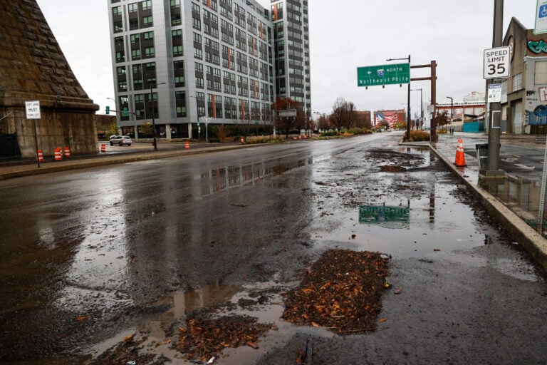
File photo: Debris sits on a closed Columbus Blvd. in Philadelphia after a storm brought heavy rain to the region and the Delaware River overflowed onto the road on December 18, 2023. (Kimberly Paynter/WHYY)
This story is part of the WHYY News Climate Desk, bringing you news and solutions for our changing region.
From the Poconos to the Jersey Shore to the mouth of the Delaware Bay, what do you want to know about climate change? What would you like us to cover? Get in touch.
As Philadelphia comes off a string of unseasonably warm February days, the city is closing out one of its warmest — and wettest — winters on record.
Despite Leap Day’s chilly winds, the period from the beginning of December through the end of February, known as meteorological winter, is on track to rank ninth warmest and fifth wettest since records began in the late 1800s. The Philadelphia region saw daily average temperatures of over 40 degrees Fahrenheit and a total of more than 15 inches of precipitation through Wednesday night.
“It’s another warm winter, when we’ve had several warm winters over the past decade or so,” said Eric Hoeflich, a meteorologist with the National Weather Service forecast office in Mt. Holly, New Jersey.
Winter is the fastest-warming season in Pennsylvania and the eastern half of the country. Human-caused climate change is bringing warmer temperatures and more intense precipitation to the Philly region. The development of more heat-trapping surfaces over time also contributes to higher temperatures.
This winter’s weather was largely driven by El Niño, a periodic warming of the Pacific Ocean surface that changes wind patterns, exacerbating the effects of climate change and often bringing warm and wet winters, Hoeflich said.
“You get warm air coming in from the Pacific and across the lower 48,” he said.
Rain storms in December and January prompted evacuations in Southeastern Pennsylvania, closed roads, and flooded sites like historic Fort Mifflin in South Philadelphia.
Philly broke a nearly two-year “snow drought” this winter, getting more than 11 inches of snow over the season. But that snowfall total is still below normal.
Warm winters with little snow have become common in Philly. Five of Philly’s last six winters have brought less than the normal amount of snowfall, and nine out of the last 10 have had warmer-than-normal temperatures, Hoeflich said.
“So that’s certainly a trend that’s concerning I guess, with the warming climate,” he said. “But climate’s also on a time scale of many, many years — not necessarily just a decade.”
The last week of February, Philly saw daily highs above 60 degrees. While these temperatures fell short of breaking records, they were well above normal — caused by warm air blowing up from the Gulf of Mexico, Hoeflich said.
“It’s kind of rare we see 60s in February — but it’s not completely on the question,” he said.
Meteorologists with the National Oceanic and Atmospheric Administration are predicting the Philly area could experience a warmer than normal spring, with the precipitation outlook leaning above normal as well. The effects of El Niño are expected to fade, then transition to La Niña in the summer and fall, which could mean an active Atlantic hurricane season this year.

Subscribe to PlanPhilly
WHYY is your source for fact-based, in-depth journalism and information. As a nonprofit organization, we rely on financial support from readers like you. Please give today.


