

Arctic temps are returning to Philly. When will the snow finally melt?
Snow and ice still cover some street corners in Philly. Single-digit temperatures this weekend won’t help.


Palmer Cemetery in Philadelphia’s Fishtown neighborhood is still nearly pristine with snow on Feb. 6, 2026. (Kimberly Paynter/WHYY)
Extreme cold and lingering snow
- Get or give help: Here are extreme cold resources across the Delaware Valley, and here’s how you can help your unhoused neighbors amid frigid temps.
- Be prepared: Take these steps to protect yourself (and your pets) from winter weather dangers; and here’s how to keep your pipes from freezing in cold weather.
- Climate connection: The tie between global warming and heavy snow in the Philadelphia region may surprise you.
- Winter wonderland: See how the storm and its aftermath have unfolded, in photos.
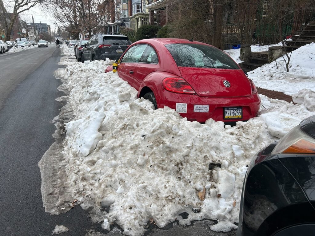
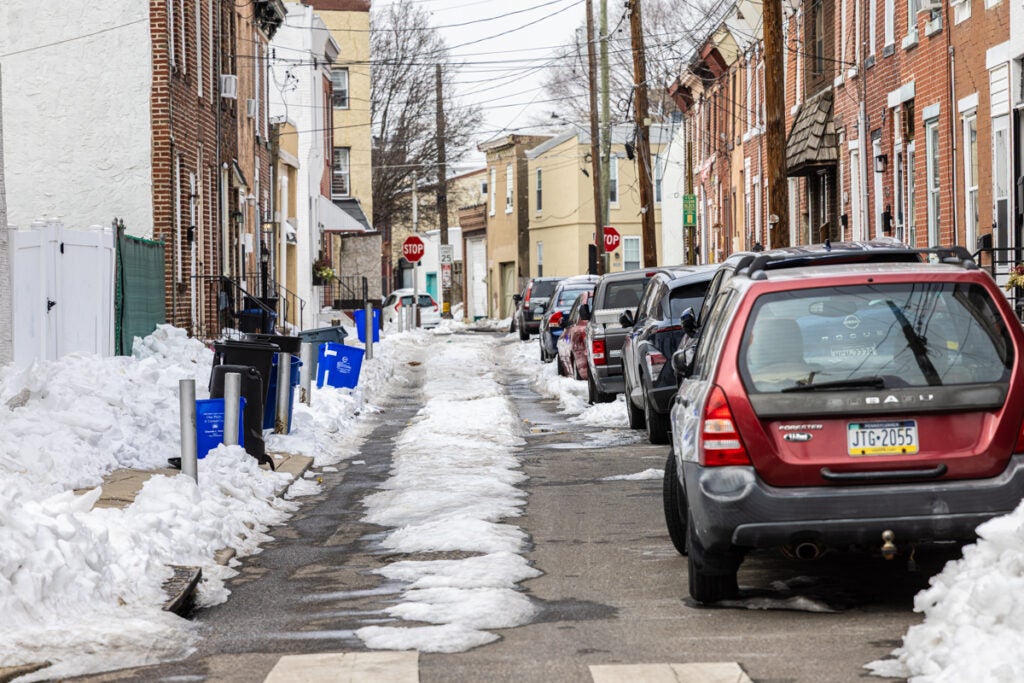
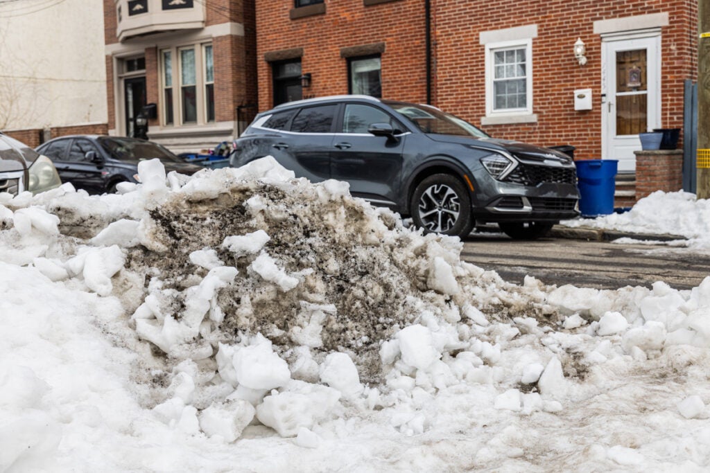
Snow, ice and slush are still blocking parking spaces and making some street corners and transit stops treacherous in Philadelphia, nearly two weeks after a winter storm dumped more snow than the city had seen in a decade.
For a week following the snowstorm, temperatures did not rise above freezing in Philadelphia. Temperatures peaked in the mid-30s during the first few days of February, but average daily temperatures have remained below normal.
Making the snow extra stubborn is a layer of ice on top, said National Weather Service meteorologist Nick Guzzo.
“We had the snow initially with that last system, and then it changed over to sleet,” Guzzo said. “There’s a lot more water content in that sleet than just the snow, so that’s making it slower to melt.”
A blast of Arctic air this weekend means the snow will likely stick around at least until next week.
Extreme cold warning and dangerous winds coming to Philadelphia region this weekend
An area of low pressure in the atmosphere is moving over the Philadelphia region, dragging a cold front that’ll bring a gust of Arctic air, Guzzo said.
Related Content

Ice cream shops around town are getting inventive, testing new, limited-time, breakfast-themed flavors for the whimsical holiday.
1 month ago
Meteorologists have issued a wind advisory or high wind warning Saturday and an extreme cold warning from Saturday morning through Sunday afternoon for areas of South Jersey, southeast Pennsylvania and Delaware.
They’re predicting dangerously cold wind chill, with gusts of up to 60 miles per hour, making the temperature feel as cold as 15 degrees below zero. Saturday’s overnight low is forecast to dip to 5 degrees.
Without precautions, the wind chill could lead to hypothermia or frostbite, according to the weather service. Wind gusts could also lead to “widespread power outages,” in Delaware and parts of South Jersey, forecasters said.
“Try to limit time outdoors, make sure you have layers protecting your skin, gloves, things along those lines,” Guzzo said. “And of course, don’t forget your pets.”
When will the snow finally melt?
The weather service predicts that Philadelphia will see temperatures peaking in the mid-30s Tuesday and upper-30s Wednesday of next week, which should help the snow start to melt, Guzzo said. Rain is also possible Wednesday, which would further melt the snow.
Overnight lows will continue to dip below freezing, meaning snow melt will only occur for part of the day, and any rain or runoff from melting snow could freeze again on roads and sidewalks.
Guzzo said he can’t predict when all the snow will be gone.
“That’s tricky, because it will depend on specific areas of how much snow they still have,” he said. “[There will be] at least more gradual melting those days, but I can’t say for certain that it will be all gone by, like, Wednesday.”
Get daily updates from WHYY News!
WHYY is your source for fact-based, in-depth journalism and information. As a nonprofit organization, we rely on financial support from readers like you. Please give today.

Snowfall breaks daily records in Pa., Del. and N.J.
But meteorologists say records for total snowfall during a single snowstorm or winter are unlikely to fall.
2 weeks ago

Philly’s snow emergency continues as the city digs itself out of slush and a deep freeze
After its biggest snowstorm in a decade, Philadelphia remains under a snow emergency with bitter cold expected to last all week.
1 month ago
Listen 1:04
The surprising tie between global warming and heavy snow in the Philly region
Winter is still the fastest-warming season on the East Coast. “You're always going to see variable weather patterns,” one expert said.
1 month ago
Listen 0:52