Debby brings threat of tornadoes and flooding to the Philadelphia region
Episodes of heavy rain and damaging wind are possible Friday. Sunny skies should return Saturday.

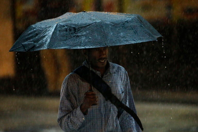
A man walks under an umbrella during a rain storm, Tuesday, July 15, 2014, in Philadelphia. (AP Photo/Matt Slocum)
This story is part of the WHYY News Climate Desk, bringing you news and solutions for our changing region.
From the Poconos to the Jersey Shore to the mouth of the Delaware Bay, what do you want to know about climate change? What would you like us to cover? Get in touch.
Debby, the deadly storm that made landfall as a hurricane in Florida Monday, has weakened to a post-tropical cyclone as it moves up the East Coast.
Forecasters expect it to cause heavy rain in parts of Pennsylvania, New Jersey and Delaware at times throughout the day — bringing the potential of flash flooding.
Delaware, eastern Pennsylvania and most of New Jersey are also under a Tornado Watch Friday morning into the afternoon.
“That is the biggest concern on our plate right now,” Ray Martin, a meteorologist at the National Weather Service in Mount Holly, New Jersey, told WHYY News on Friday morning.
Debby moved slowly over Florida, Georgia and the Carolinas this week, contributing to at least seven deaths and spawning tornadoes, widespread power outages and extensive flooding.
The storm is moving faster as it travels up the East Coast, and its center is expected to move through central and western Pennsylvania by the afternoon. But the potential for wind and rain extends far beyond the storm’s center.
Possible heavy rain and flooding
Forecasters say periods of heavy rain throughout the day could bring localized flooding to the Philadelphia region. A Flood Watch covers northern Delaware, central and eastern Pennsylvania and western New Jersey through early Saturday morning.
Weather watches, as opposed to more serious warnings or advisories, indicate that hazardous weather events are possible.
“We can get them,” Martin said. “It doesn’t mean we’re going to definitely get them.”
Areas along the Delaware River and Bay as well as parts of the Jersey Shore are under a Coastal Flood Advisory Friday. Minor flooding is in the forecast for the Brandywine Creek near Chadds Ford from Friday morning through Saturday afternoon
Forecasters say that depending on the location and intensity of rain Friday, large rivers such as the Delaware and Schuylkill could rise over the weekend or early next week — even after rain has stopped.
Sunny skies should return to the region Saturday, forecasters say.
How to stay safe
Philadelphia-rea residents do not need to shelter in place Friday, but may want to consider canceling plans, Martin said.
“If you can postpone plans, it’s probably a good idea,” he said. “Be aware. Be ready to react.”
Emergency management officials say it’s important to take weather warnings seriously and stay up to date on the latest forecast. In many places, residents can sign up for local emergency alerts.
Avoid driving or walking through floodwaters. Just a foot of water can wash a vehicle away, and 6 inches of moving water can sweep a person off their feet, according to the Federal Emergency Management Agency.
Flash floods can quickly turn deadly. Seven people died in Bucks County last summer when their cars were caught up in quickly rising floodwaters.
Flooding in New Jersey and a tornado in Delaware
A tornado hit the Kirkwood Highway area of New Castle County, Delaware, Thursday evening, uprooting trees and downing utility poles. Some residents near Bear were told to evacuate due to flooding.
A weather station in nearby Newark recorded more than 4 inches of rain Thursday evening, Martin said — roughly the amount that falls during a typical summer month, in just a few hours.
Earlier in the week, while Debby remained in the Southeast, the storm’s moisture supercharged an unrelated cold front moving through the Philadelphia region. Some areas received more than a month’s worth of rain in a single night. In Burlington County, New Jersey, dozens of people were rescued from floodwaters.
Climate change driving more extreme rain
Human-caused climate change is contributing to more frequent and intense heavy rain across much of the United States. In recent decades, the amount of precipitation falling on the rainiest days has increased fastest in the Northeast.
Climate change also makes stronger hurricanes more likely, because warmer oceans fuel storms with evaporating moisture.
Peak hurricane season runs from mid-August through mid-October, but hurricanes can occur even later in the fall.
Federal forecasters expect this year’s Atlantic hurricane season will continue to be “highly active.” They say it could end up being among the busiest on record — in part due to warm sea surface temperatures and the potential for La Niña to develop in the coming months.

Get daily updates from WHYY News!
WHYY is your source for fact-based, in-depth journalism and information. As a nonprofit organization, we rely on financial support from readers like you. Please give today.


