Winter chill to likely arrive around second week of December
But that doesn't necessarily mean Arctic temperatures -- at least not yet.

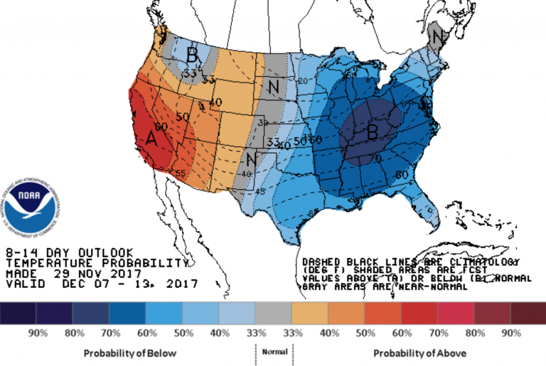
NOAA image.
If you’ve been waiting for prolonged chilly weather to accompany the holiday season, you’ll like this news.
The National Weather Service Climate Prediction Center forecasts between a 50 and 60 percent chance of below normal temperatures in New Jersey between Dec. 7 and Dec. 13.
But that doesn’t necessarily mean Arctic temperatures — at least not yet.
In Toms River, the normal high temperature for the first week of December is in the upper 40s, according to the Office of the New Jersey State Climatologist.
So that means high temperatures could be in the lower to middle 40s, which is cooler than some recent temperatures and the 50s that are in the forecast for the first three days of next week.
The position of the jet stream, a “river of air” in the atmosphere, will likely dip downward from Canada and allow the chilly air to spill into the region.
By the middle of December, even colder air is possible.
“Arctic air with intense cold is most likely to first invade the northern Plains then progress eastward toward the middle of December,” AccuWeather Lead Long-Range Meteorologist Paul Pastelok said in a report.
WHYY is your source for fact-based, in-depth journalism and information. As a nonprofit organization, we rely on financial support from readers like you. Please give today.


