Here’s how Tropical Storm Debby will impact the Philly region
Some areas have already seen a month’s worth of rain this week.
Listen 1:06
A pedestrian walks with little protection from his collapsed umbrella during a rainstorm, Wednesday, April 30, 2014, in Philadelphia. (AP Photo)
This story is part of the WHYY News Climate Desk, bringing you news and solutions for our changing region.
From the Poconos to the Jersey Shore to the mouth of the Delaware Bay, what do you want to know about climate change? What would you like us to cover? Get in touch.
Tropical Storm Debby, which remains in the Southeastern U.S., is expected to travel up the East Coast later this week, passing over the Mid-Atlantic Friday, bringing high winds and downpours.
Forecasters at the National Weather Service in Mount Holly, New Jersey, say the Philadelphia region could see severe thunderstorms, and even some tornadoes. “But the greatest impacts are going to be the potential for some heavy rainfall,” Mike Lee, meteorologist at NWS in Mount Holly, said Wednesday. “Some scattered to widespread instances of flash flooding that could lead to road closures, flooded roadways.”
Debby made landfall in Florida early Monday, bringing catastrophic flooding and contributing to at least six deaths. Its center moved off the coast of the Carolinas Wednesday and made a second landfall Thursday. The storm is expected to dump potentially historic amounts of rain on parts of the Southeastern U.S. by the end of the week.
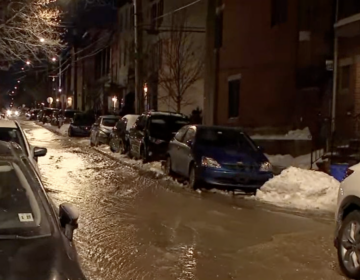
On Tuesday, the storm’s moisture supercharged an unrelated cold front that passed through the Philadelphia region, causing flash flooding in some areas.
Central Jersey saw the heaviest rain, with some locations — like Delran, Pennington and Hopewell Township — recording more than 7 inches over 24 hours. Areas of Bucks County, Pennsylvania, saw roughly 4 inches of rain — about a month’s worth.
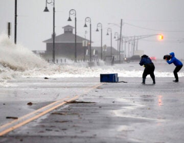
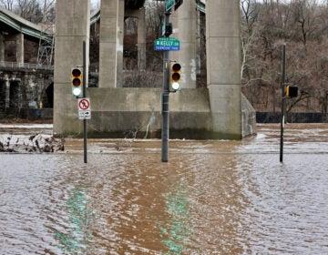
Floodwaters shut down a highway in Cinnaminson, New Jersey, blocked streets in Beverly, New Jersey,, and filled an underpass in Bensalem, Pennsylvania. A downpour caused a roof to collapse in Croydon. Dozens of people were rescued from flooding in Burlington County, New Jersey.
Lee said the direct impacts of Debby on Friday could be similar, but it’s hard to predict where and how intense they’ll be because there is still uncertainty about the precise path the storm will take up the East Coast.
As of Thursday morning, forecasters with the National Hurricane Center predict the storm’s center will likely move up through central and eastern Pennsylvania Friday. They expect “considerable flooding impacts” across parts of the Mid-Atlantic and Northeast through Saturday morning.
The risk of heavy rain will be the highest in central Pennsylvania on Friday, forecasters with the NWS in Mount Holly, say.
Riverine flooding could continue after the rain clouds clear
The rain could clear by Saturday afternoon, meteorologists say. But any flooding of rivers and streams could last longer.
“A lot of those specific details, we’ll have to wait to see exactly … where it’s going to move,” Lee said.
Forecasters in the Philly region expect rivers to rise by the end of this week, potentially overflowing their banks over the weekend or into early next week.
“We know [Debby’s] got a lot of moisture to work with,” Gregory Jenkins, professor of meteorology and atmospheric science at Penn State University, told WHYY News Monday. “And … when that tropical moisture gets up north, it’s going to rain.”
Residents of the Philadelphia region should stay up to date with NWS forecasts throughout the week, Jenkins said.
The multiple bands of heavy rain this week could be problematic, Jenkins said — because they might saturate the ground and leave little room for additional rain to soak in.
“It’s gonna be a doozy,” he said.
The climate connection
Human-caused climate change makes hurricanes more intense, since warmer ocean water provides fuel in the form of evaporating moisture. Rainfall during hurricanes is becoming heavier.
This spring, federal officials issued a record forecast for the Atlantic hurricane season, which stretches from June 1 to Nov. 30. They predicted 17–25 named storms would form in the Atlantic Ocean, including 8 to 13 hurricanes.
Most hurricanes occur between mid-August and mid-October. Jenkins expects the rest of this year’s hurricane season to be active, so it’s a good time to get prepared.
“We are about to enter a very vigorous period of tropical cyclone activity,” he said.
Philadelphians whose homes have flooded before recommend elevating valuable items — such as family photographs — in areas of your home that could flood.
FEMA recommends signing up for local emergency alerts and downloading a weather app; creating a plan with your household for where you’ll go if you’re told to evacuate; and making a home disaster kit and go-bag you can grab in an emergency, which includes prescription medications, important documents and pet food.

Get daily updates from WHYY News!
WHYY is your source for fact-based, in-depth journalism and information. As a nonprofit organization, we rely on financial support from readers like you. Please give today.


