Fair streets in Philadelphia require trade-offs
By forcing hard choices, city streets define transportation planning in a way that's uniquely appropriate for the Great Fighting City of Philadelphia.
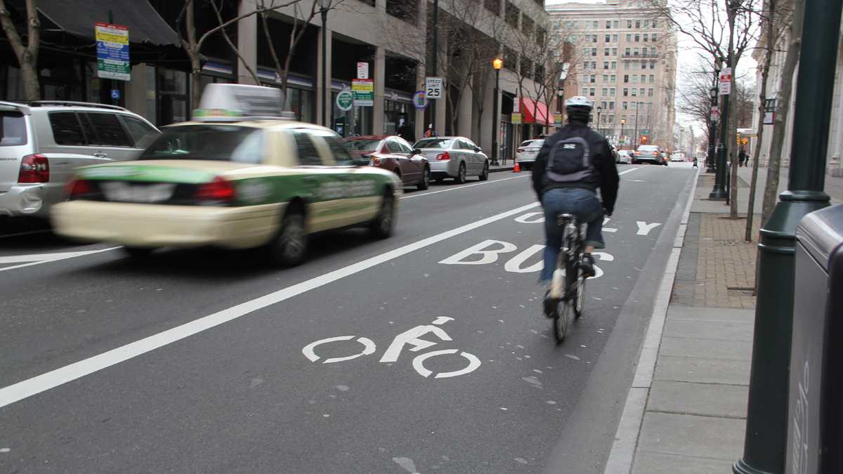
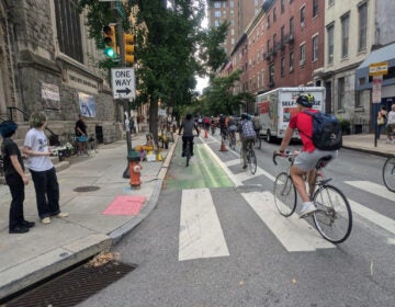
A shared lane for bus and bike is shown on Chestnut Street. (Emma Lee/WHYY)
Speak Easy is examining issues of street use in Philadelphia. What should our priorities be to ensure safe streets for pedestrians, bicyclists, motorists and transit users? Seeking diverse perspectives on these issues, NewsWorks is hosting a public forum, “Philadelphia Streets Under Pressure,” on June 30 at WHYY studios. Registration is free at whyy.org/speakeasy.
—
Streets are the “indicator species” of a city. Taking a fresh look at them can tell you lots of things about who lives and works there, what their priorities are, and how they’re doing.
Streets are public spaces that reflect our collective choices and preferences right now, whereas development is more sticky. After it’s built, most development doesn’t get unbuilt or rebuilt for awhile. Streets are much more malleable; they can be remade overnight to serve a different set of priorities with a fresh set of white lines. If a city’s development is like a painting, its streets are like a chalkboard.
Philadelphia is a city of narrow streets, which help create village-like spaces even in Center City. By forcing hard choices, these narrow streets also define transportation planning in a way that’s uniquely appropriate for the Great Fighting City of Philadelphia.
A city that makes us choose
Want a bike lane? Okay, but that parking probably needs to go.
Like all of those trolleys? Great, but their tracks don’t really play nice with bikes.
Transportation planning in Philadelphia is often about one-for-one tradeoffs, and trying to get the balance right, both for any given street and for the citywide network.
In many other cities, streets are wide enough to give everyone a little bit of everything and serve all interests at once. In Chicago, neighborhood commercial streets are typically 40 to 50 feet wide between curbs (or wider). South Philadelphia’s “main street,” Passyunk Avenue, is just half that in places: 25 feet. With more space, other cities can accommodate new priorities like the rise of city bicycling with world-class bike lanes — and have plenty of space left over for cars, transit stops, parking and loading zones.
In Philadelphia, our streets force more direct tradeoffs between transportation modes — new priorities directly replace old ones, and change means substitution rather than addition. Compromises are almost always necessary.
Take Spruce and Pine streets in Center City: comfortable sidewalks, street trees, a parking lane, a travel lane, and wide, buffered bike lanes — where, still, vehicle loading is permitted all the time, and church parking in bike lanes is okay on Sundays. This is what a “complete street” looks like when you have only about 25 feet to work with, curb to curb — messy and imperfect, but workable; streets where people want to be and feel comfortable, but which can’t be all things to all people all of the time.
Bridge or barrier, depends on design
Streets connect the city with itself. They provide access to jobs, to school, to services, and to life. When transportation planners and engineers get the tradeoffs wrong, however, streets can also create barriers to access and can degrade quality of life.
During college at Penn, I was hit by a car crossing Walnut Street. Technically I was jaywalking, but I was also doing what the street told me to do: A campus path met the street in the middle of the block, directly opposite a CVS entrance. People (whether walking, riding, or driving) will do what the street’s design tells them to do, which may not match the letter of the law. Vision Zero, a new lens through which to view transportation planning and design — one embraced by mayoral candidate Jim Kenney and many others — views every transportation-related serious injury or fatality as a preventable failure of design.
From that perspective, Roosevelt Boulevard is a premiere example of design failure. Because it was designed to be a freeway before there was such a thing, it doesn’t do anything quite right — a fast-moving river of cars with too few bridges, cutting Northeast Philadelphia in two. When legal crossings are thousands of feet apart, people do the harsh math in their heads, weighing risk against time, and cross where they need to. When tragedy results, there’s plenty of blame to go around.
Transportation planning, my profession, is about making tradeoffs and getting the balance right, for today’s priorities and tomorrow’s needs. Sometimes we miss a big opportunity, getting it wrong in just the wrong way or at just the wrong time, and repairs can take decades (or longer). Sometimes we get it wrong in smaller ways, and fixing or changing it just takes a little paint. And sometimes we get it right, and we create streets that become more than the sum of their parts. This city of narrow streets and village-scale spaces has been getting quite a lot right lately, I think.
—
Greg Krykewycz manages the Office of Transit, Bicycle, and Pedestrian Planning at the Delaware Valley Regional Planning Commission. The views expressed here are his own. His chief interest is the relationships among green transportation modes as well as their community and development context.
WHYY is your source for fact-based, in-depth journalism and information. As a nonprofit organization, we rely on financial support from readers like you. Please give today.

