We often draw lines between the structures we build and the natural world, but exploration of an urban waterfront reveals they are never as far apart as we would like to believe.
Industrial and natural forces have been engaged in constant struggle along the Delaware River since the founding of Philadelphia. Decaying and resurgent formations of technology, culture and nature line the river’s 21-mile course along the edge of the city.
These five photographs explore the interacting forces that shape this landscape — and Philadelphia today.
Our tour begins at the eastern edge of Port Richmond, where the Pennsylvania Railroad built the first bridge across the Delaware from Philadelphia in 1895. The Delair Bridge provided a direct connection between Center City and Atlantic City and launched a building boom down the shore. The steel trestles that project the bridge over the river set a rhythmic pattern across the land, echoing the railroad’s standardization of the landscape.
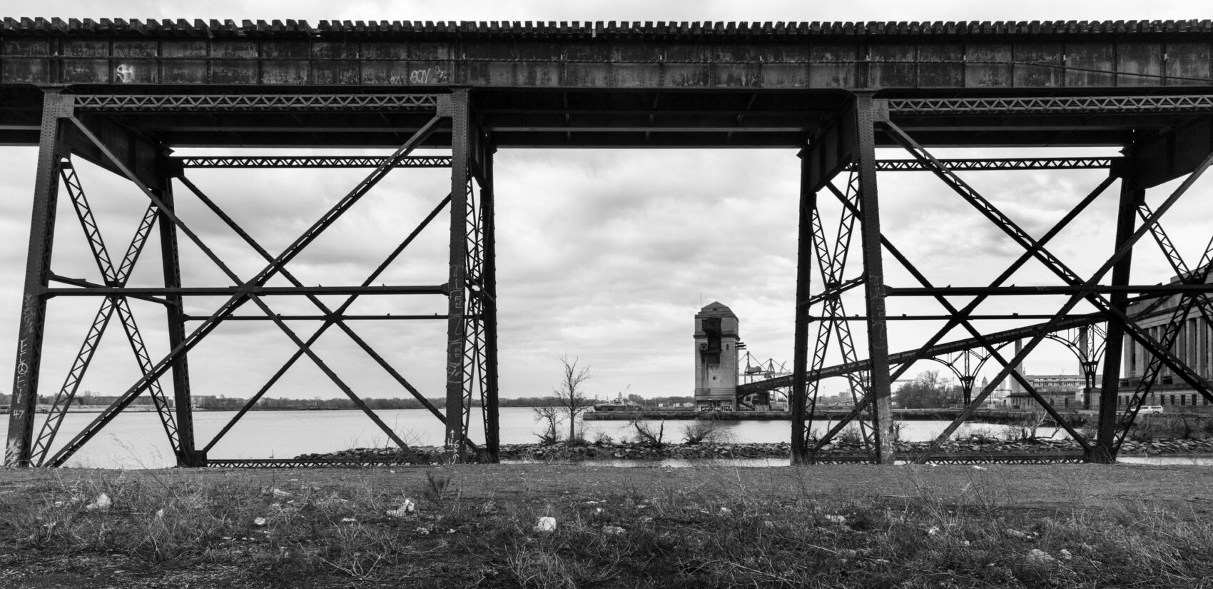
The Pennsy was the largest corporation in the world and its lines branched outward from Philadelphia in a vast distribution network of industrial resources, agricultural goods and passengers between the East Coast and Chicago. The dramatic 19th-century expansion of rail systems across the country transformed conceptions of the continent from an inhospitable frontier to an ordered terrain. The railroads produced unprecedented arrangements of space and time and organized transit and economic power around urban centers.
The railroad corporations ruled the country well into the 20th century. Their slow decline began in the 1930s as the automotive industry dramatically advanced and the centralized order of the railways gave way to the dispersion of asphalt roadways. Cities lost regional control in the subsequent decades as suburbs sprawled outward from urban cores. Despite this revolutionary reordering, the Delair Bridge was maintained and upgraded over its 125-year history and continues to serve its original purpose.
Adjacent to the Delair is a manifestation of the next era of transportation infrastructure. The Betsy Ross Bridge was constructed in the 1970s to connect the expanding Jersey suburbs to the Pennsylvania highway system. The bridge never attained its planned level of utility, however, because adjacent communities blocked construction of the Pulaski Expressway. The connector ramps to the missing highway are still there, without any purpose except to serve as testament to a failed plan.
The association between the thrust of the trees and the bridge trusses is more complex than it first appears. The trees planted themselves on an artificial peninsula, which protects the outlet of Frankford Creek. The creek itself was relocated from its original position one and a half miles upriver. The water was displaced, the bridge was misplaced and the trees are struggling to grasp the situation.
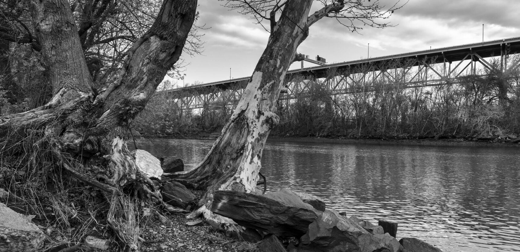
A couple of miles downriver, between Port Richmond and Fishtown, the trees of Graffiti Pier seem more at ease. However, abandoned infrastructure is both figure and ground in this deceivingly natural view. The trees are not growing on land — they have sprouted on another former pier. Both piers were part of the enormous rail yard operated by the Reading Railroad, which transferred anthracite extracted from Northeastern Pennsylvania from rail to ship. The coal was then distributed up and down the east coast to fuel the industrial revolution. Changes to transportation and fuel usage as well as some tricky financial maneuvers by the collapsing Pennsylvania Railroad contributed to the decline of the Reading and the end of operations at the Port Richmond freight yard.
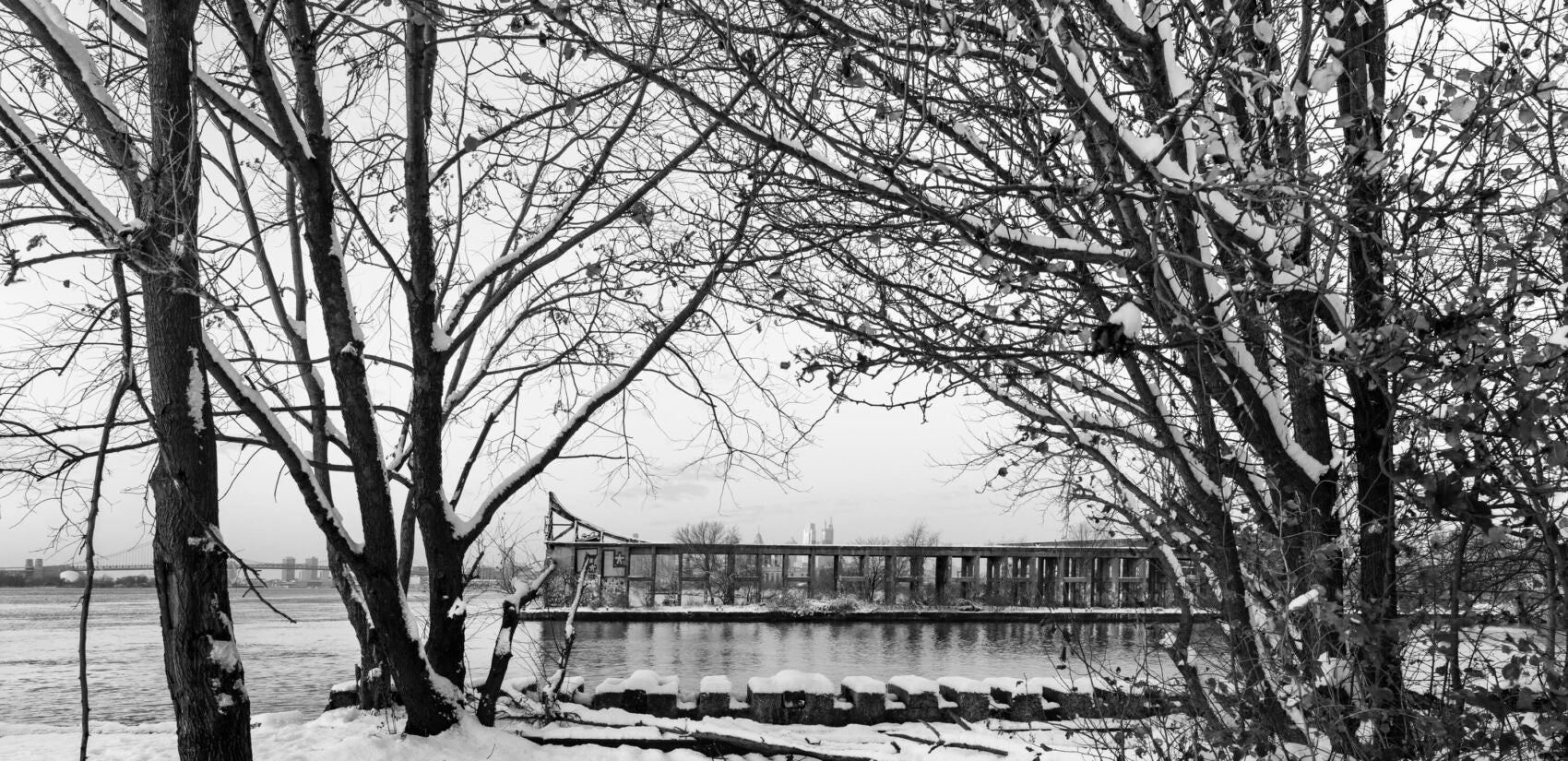
When industrial structures lose their economic viability, they are cut from systems of production and exposed to new forces and associations. Wild plants and animals take advantage of these opportunities and colonize the land through successive stages of occupation. Dirt accumulates and windborne seeds settle into holes and cracks. Grasses propagate and prepare the ground for larger plants. Trees spread their branches and extend their roots, cleaving walls apart and allowing water to penetrate and accelerate the processes of structural decay. Abandoned rail lines across the country have self-transformed into green corridors, which thread through urban terrain and provide linear pathways for animals of various sizes to traverse the land. Wildness advances as technology recedes.
Industrial ruins offer an alternative to the planned spaces of consumption that characterize the 21st-century city. A diversity of visitors frequent the former rail yard, now forested with rogue trees and thick underbrush. Graffiti Pier has evolved into a renowned site of informal cultural activity without any master plan or means of regulation. It is an open-air art gallery, an Instagram spectacle, a setting for fashion shoots and a site of expressive freedom beyond systems of control and surveillance. Improvised creativity and natural resurgence transformed these industrial remains. Graffiti Pier’s concrete arcades are alluring liminal spaces of physical and social ambiguity that disrupt conventional meanings and counteract illusions of normalcy. New plans call for the art to live on within a public park that maintains the space’s feral atmosphere.
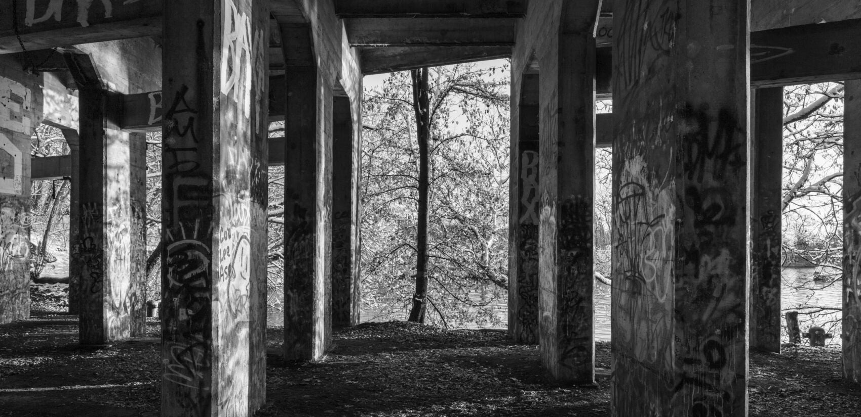
The last stop on our four-mile tour brings us to the back of Rivers Casino where we can find the phantom piers of Philadelphia’s lost Lumber District. As the tide recedes and the water descends, these ancient structures rise from the depths. The bend in the river was a strategic location to collect the enormous lumber rafts that were steered down the river from the forests of the Upper Delaware. Penn’s sylvan lands provided wood for ships, construction and fuel from the time of the earliest European settlements and this location was the thriving center of lumber distribution for over a hundred years. However, by the early twentieth-century, unregulated logging had left nothing of the state’s forests but stumps and ashes and the lumber piers faded away.
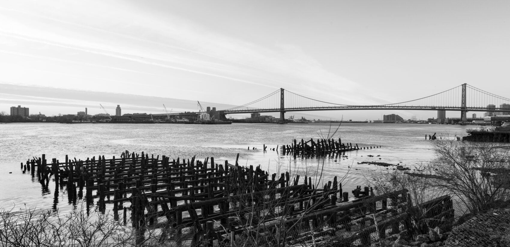
The dangers of erosion were immediately apparent on Pennsylvania’s depleted hills, and the Commission of Forestry was founded in 1901 to replant the state. Through a massive decade’s long effort assisted by the New Deal’s Conservation Corps, Pennsylvania now has 17 million acres of replanted forest, which stabilize the land, provide wildlife habitat, offer outdoor recreation and bring into question the concept of natural landscape.
The city is typically perceived as an artificial endeavor separated from natural ecology. Nature is alternatively considered as a source of extraction, an obstacle to progress, or a fragile entity to be preserved. The dynamic landscapes presented in this essay demonstrate the interconnectedness of humanity and the natural world. The images contribute an understanding of urban terrain as a manifestation of the interactions of built and natural forces. This interpretation decenters human activity and positions it within a network of environmental exchanges. It recognizes the vibrant relationship between humans and their surroundings and highlights the necessity of integrating urban design with ecological forces.
In the Anthropocene epoch, we can no longer draw a line between our actions and the environment. Culture, technology and nature are inseparably entwined. Our actions impact our surroundings and our surroundings impact our lives. A sustainable future depends on the recognition of our responsibilities for the natural world and the integration of our cities within ecologically and culturally integrated regions.
___
Michael Froio is a photographer and adjunct professor at Westphal College of Media Arts and Design, Drexel University. His photographs of landscape and infrastructure have been exhibited at the Perkins Center for the Arts and the Woodmere Museum of Art.
Timothy Kerner is an architect, principal of Terra Studio and adjunct professor at Tyler School of Art and Architecture, Temple University. His articles about the relationship between urban form and social history have been published in Context, PlanPhilly and the Philadelphia Inquirer.

Subscribe to PlanPhilly
WHYY is your source for fact-based, in-depth journalism and information. As a nonprofit organization, we rely on financial support from readers like you. Please give today.


