A major winter snow and ice storm battering the Southern U.S. is making its way north

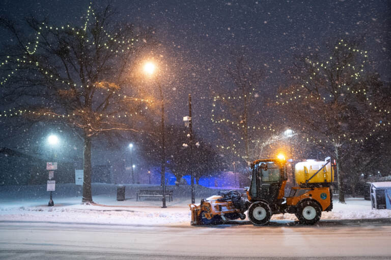
GREENVILLE, SC - JANUARY 16: A snow plow clears Main St. on January 16, 2022 in Greenville, South Carolina. Snow, sleet and freezing rain are expected in the area for the remainder of the day. (Photo by Sean Rayford/Getty Images)
A major winter storm that is already dropping snow and freezing rain on the Southern U.S. will send temperatures plunging, cause hazardous road conditions and power outages and move up the East Coast in the coming hours.
The major system could leave more than a foot of snow and in excess of a quarter inch of ice in some areas, the National Weather Service warned.
Snowfall and freezing rain began before sunrise in areas of North Carolina. Parts of Georgia began to see freezing rain and wind gusts early Sunday. States that don’t typically experience such severe winter weather — such as Arkansas, Alabama and Mississippi — also were seeing heavy snow and ice.
Heavy snow was expected throughout the day in the Tennessee Valley, the Appalachians and parts of the Mid-Atlantic, the NWS predicted, with significant rainfall in parts of the Southeast as well as the Appalachians and the mid-Atlantic.
Meteorologists said the storm system would move north Sunday evening into Monday morning.
Travel is already becoming tricky
Officials from Georgia to the Carolinas and Virginia — all of which were under states of emergency — were urging residents to stay off the roads as snow began falling Sunday morning.
In addition to fast-accumulating snow and the possibility of ice, strong winds were expected to knock down trees and power lines, making driving even more hazardous.
More than 2,500 U.S. flights were canceled Sunday, the flight tracking website FlightAware reported. Slightly less than half of the cancellations were at Charlotte Douglas International Airport in North Carolina.
In advance of the storm, Amtrak also cancelled dozens of trains over the weekend and into Monday.
Power outages have started to pop up
Strong winds and ice accumulation are bringing the threat of widespread power outages – possibly for a few days – and disruptions to the electricity supply were already beginning in the early hours of the storm.
Power went out for more than 109,000 customers in Georgia at one point Sunday morning, according to the website poweroutage.us. Around 89,000 customers in South Carolina, 31,000 customers in Florida as well as another 16,000 customers in North Carolina also had no electricity.
Ice accumulation meant that power outages could persist even after the storm moves out of the area, authorities said.
Given the possibility of significant power outages across the region, officials were urging people to only use gas-powered generators and grills outside to avoid the risk of carbon monoxide poisoning.
Next stop: the northern U.S.
The storm will advance northward overnight Sunday into Monday morning, the NWS said, stretching from the Ohio Valley to New England.
Parts of the Ohio Valley, Lower Great Lakes and the Northeast could expect heavy snow, while rain and freezing rain will hit other parts of the Northeast and southern New England.
New York City is expected to get less than an inch of snow, but New York and New Jersey towns about an hour’s drive west could see around five inches. Washington, D.C. was slated for two to three inches of snow, while parts of western Maryland were bracing for 8 inches to a foot.
Strong winds and flooding along the Atlantic coastline are likely.
By Monday the storm will bring heavy snow to inland Maine with rain along the shore.
9(MDAzMzI1ODY3MDEyMzkzOTE3NjIxNDg3MQ001))


