Tropical Storm Arthur, the first named storm of 2020, forms in the Atlantic
Arthur is expected to remain a tropical storm, potentially making landfall or brushing the Outer Banks of North Carolina on Monday.

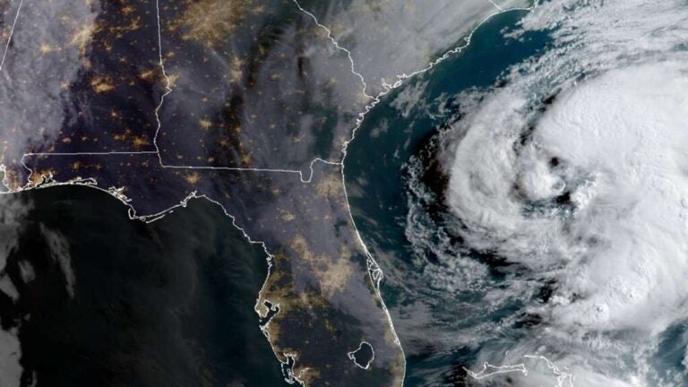
Tropical Storm Arthur as seen by a NOAA satellite on Sunday morning. (NOAA)
Tropical Storm Arthur, the first named tropical system of 2020, has formed.
At 8 a.m. Sunday, Arthur was located in the Atlantic Ocean about 355 miles south-southwest of Cape Hatteras, North Carolina, packing maximum sustained winds of 40 miles per hour and higher gusts, according to a National Hurricane Center bulletin.
The tropical storm is currently moving north-northeast at 9 miles per hour, the bulletin states.
The sparks & swirls of Arthur.
— Dakota Smith (@weatherdak) May 17, 2020
The first tropical storm of the 2020 Hurricane Season. pic.twitter.com/kdoeyf7Olr
According to the latest National Hurricane Center forecast track, Arthur is expected to remain a tropical storm, potentially making landfall or brushing the Outer Banks of North Carolina on Monday before taking an easterly path out to sea and diminishing to a tropical depression.
The primary threats in coastal North Carolina include heavy rain, dangerous surf and tropical-storm-force winds.
The National Weather Service office in Mount Holly, New Jersey, does not expect any direct impacts from Tropical Storm Arthur in the Garden State, as a high-pressure system to the north should be strong enough to keep any precipitation to the south.
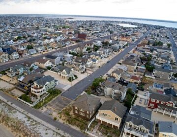
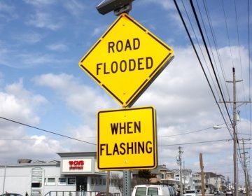
But forecasters say that high-pressure system will generate a persistent onshore flow during the first half of next week that — in conjunction with the approaching new moon — could generate widespread minor to moderate tidal flooding.
The 2020 Atlantic basin hurricane season officially begins on June 1, and continues through November 30. The cyclone names are Arthur, Bertha, Cristobal, Dolly, Edouard, Fay, Gonzalo, Hanna, Isaias, Josephine, Kyle, Laura, Marco, Nana, Omar, Paulette, Rene, Sally, Teddy, Vicy and Wilfred.
Tropical Storm #Arthur has formed off of the southeast US coast - the first Atlantic named storm of the 2020 Atlantic #hurricane season. This is the 6th year in a row that the Atlantic has had at least 1 named storm form prior to official start of the hurricane season on June 1 pic.twitter.com/yUPt26tBj4
— Philip Klotzbach (@philklotzbach) May 17, 2020
The 2020 Atlantic hurricane season will possibly feature “above-average” activity, according to a prediction by atmospheric scientists.
The report issued by Colorado State University anticipates 16 named storms, including eight hurricanes and four major hurricanes, or cyclones that reach Category 3 strength or higher on the Saffir-Simpson Hurricane Wind Scale.
The reports call for a 45 percent probability of at least one major hurricane striking the Eastern Seaboard, compared to a 31 percent average.
Between 1981 and 2010, the Atlantic basin has produced an annual average of 12.1 named storms, 6.4 hurricanes and 2.7 major hurricanes.
The forecasters cite an anticipated lack of the El Niño weather pattern and sea surface temperatures in the tropical Atlantic running warmer than normal.
Some Atlantic basin seasons feature below-average activity but still result in a devastating storm, like Hurricane Andrew in 1992. Other active seasons — as in 2010, the third most active season on record — did not feature a hurricane making landfall.
NOAA offers a comprehensive guide on storm preparations.
WHYY is your source for fact-based, in-depth journalism and information. As a nonprofit organization, we rely on financial support from readers like you. Please give today.


