


Philly citizen scientists gather heat and air quality data in hopes of a ‘more livable’ city
Philly is one of 14 cities and counties across the country chosen by a federal agency to collect heat data this summer, in an annual citizen science project.
Listen 4:01

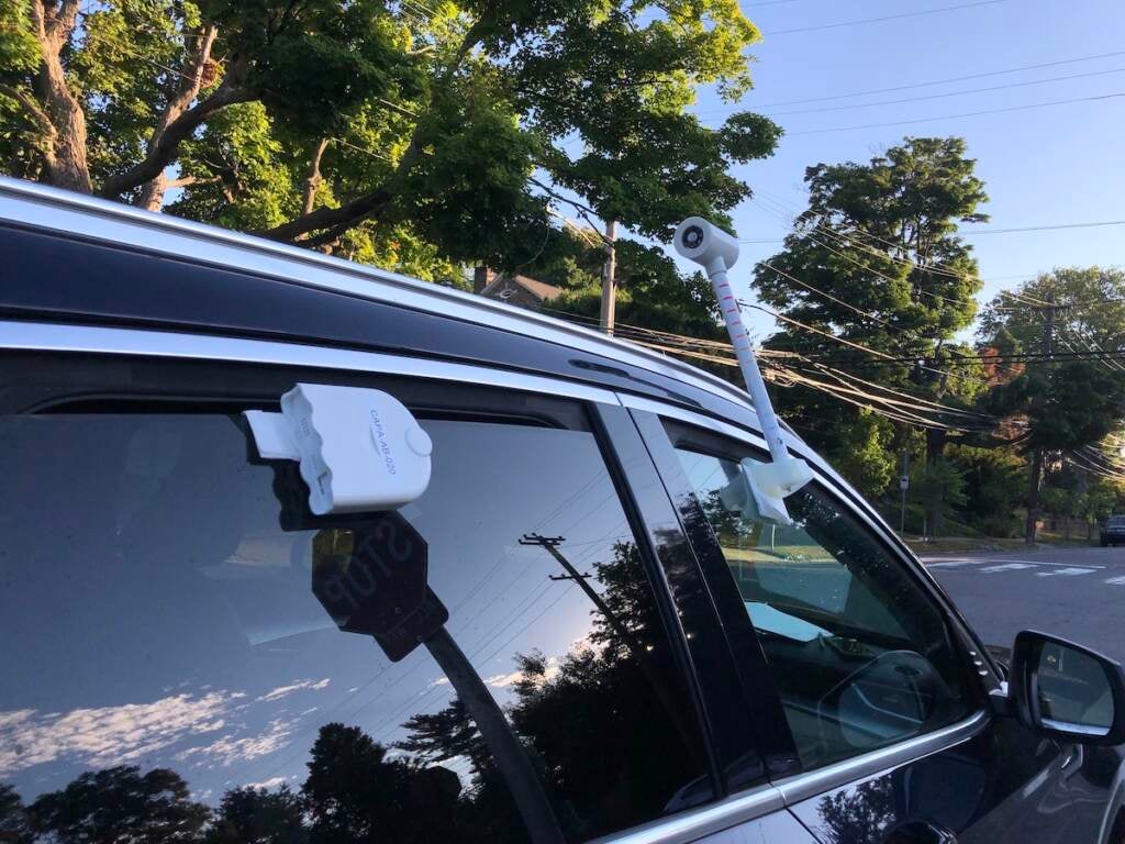
Carolyn Martin collected air quality and temperature data in North and Northwest Philadelphia with sensors attached to her car. (Sophia Schmidt/WHYY)
This story is part of the WHYY News Climate Desk, bringing you news and solutions for our changing region.
From the Poconos to the Jersey Shore to the mouth of the Delaware Bay, what do you want to know about climate change? What would you like us to cover? Get in touch.
As the sun rose over Philadelphia last Saturday, two people drove a circuitous path through North Philly, for science.
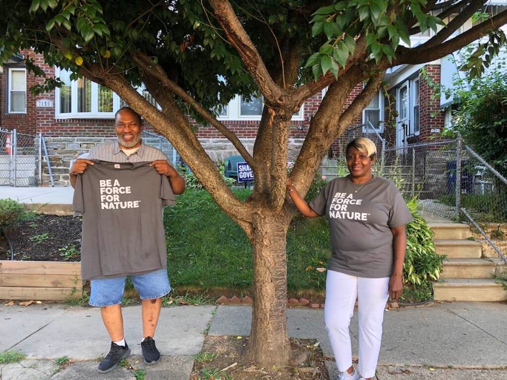
Carolyn Martin, a resident of West Oak Lane, took the wheel. Her neighbor, Waymith Cargill, navigated, reading step-by-step instructions from a piece of paper like a treasure map.
“It says turn right toward Reservoir Drive,” he said. “So we made the right turn.”
“This is fun,” he laughed.
As the two drove, a white sensor attached to Martin’s car window measured the temperature and humidity each second. Another sensor recorded the concentration of small particles that can affect people’s lungs and hearts.
Related Content
-2")
Air conditioning is key in Philly’s hot neighborhoods, but resources are limited
“Air conditioning … is no longer a luxury in an era of climate-driven, change-driven temperature increases,” says one expert about the urgent need.
4 years ago
Listen 4:08Philadelphia is one of 14 cities and counties across the country chosen by the National Oceanic and Atmospheric Administration (NOAA) to collect heat data this summer, in an annual citizen science project. Philly is one of just two cities also measuring air quality.
The information will be used to map urban heat islands, or areas of cities that get much hotter than places with more shade and less concrete. NOAA officials expect to finish the maps this fall.
The ultimate goal is to inform solutions that will keep communities safe and healthy.
“Solutions, you know, to [poor] air quality and heat, and also how it affects human beings’ health,” said Martin, who is retired from an investment management company.
Climate change, driven by humans burning fossil fuels, is making the problem of extreme heat worse. Philly’s average summer temperature has risen about 3 degrees Fahrenheit in the last five decades. The city now experiences on average a dozen more days above 90 degrees each year than it did in 1970.
Philly’s heat isn’t distributed evenly. Some neighborhoods can get up to 22 degrees hotter than others.
And heat can be deadly. Heat-related deaths in Philly have dropped in recent years — but at least six Philadelphians have died from heat-related causes since July 23.
Martin and Cargill got involved with the heat mapping project through their neighborhood group, United Neighbors of West Oak Lane, where they run voter registration efforts for high schoolers. The group is also involved with the Pennsylvania Horticultural Society’s Tree Tenders program, and members hope to bring more trees to West Oak Lane.
Driving through North Philly, Cargill, a retired social worker, took photos to go along with the data.
“Just getting the idea as to where we are in trees versus concrete,” Cargill said. “Because there’s not a lot of trees.”
Drexel University’s Academy of Natural Sciences led the heat mapping project locally, in partnership with the Pennsylvania Horticultural Society and Philadelphia Department of Parks and Recreation.
“We’re going to take the stories that we collected and all the thousands and thousands of pieces of information and measurements that we got that day and then use that to make better informed decisions in the city about how to address heat and air quality issues, especially in the communities that are experiencing a disproportionate amount of those issues,” said Richard Johnson, director of community learning at the Academy of Natural Sciences.
Fifty participants drove around Saturday, gathering data through about 70% of the city. They focused on the hottest neighborhoods, and the ones where residents are the most vulnerable to heat, Johnson said.
Right now, the city uses land surface temperatures to map neighborhoods’ exposure to heat — and pairs that with demographic and health factors to produce a Heat Vulnerability Index.
But the new data gathered this weekend measures the temperature of the air, plus humidity — so it’ll reflect what the heat actually feels like, Johnson said.
The resulting maps will be “very high resolution,” with a precision level comparable to a census tract, said NOAA spokesperson Monica Allen. That’s higher resolution than the city’s existing heat maps, said Saleem Chapman, the city’s chief resilience officer. The data will give officials new insight into the cumulative impacts of heat, humidity, and air pollution on neighborhoods, he said.
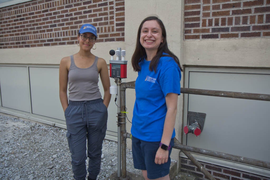
“We hope [the project] proves what we’ve always known, which is that our neighborhood is hot and that there’s very little relief because there is a lack of shade,” said Ivana González, a community outreach coordinator with the nonprofit Esperanza, based in Hunting Park, who helped gather data.
Related Content

‘It’s bad’: City pool still not open in one of Philly’s hottest neighborhoods
City officials say opening the pool is a “major” priority, but that supply chain issues and labor shortages have delayed needed repairs.
4 years ago
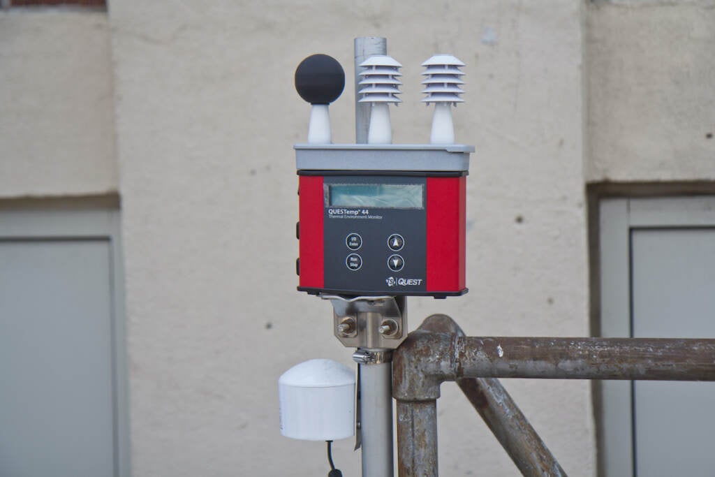
Esperanza also runs a stationary sensor at its headquarters that measures temperature, humidity, and air quality. González hopes both the mobile and stationary data collection efforts help attract money to fund solutions, like planting trees and replacing dark roofing material and hot, black asphalt with materials that reflect heat.
“It’ll help us to prove that we need to fund those things more, as well as hopefully inspire new solutions to these problems,” she said.
The new data could help determine where the city places spray parks, cooling centers, and green stormwater infrastructure, said Chapman, with the city’s Office of Sustainability. It could also guide future efforts to protect residents from the impacts of climate change, such as resurfacing roads with cooler materials, and help the city apply for federal grants.
“We see incredible value in this project,” Chapman wrote in an emailed statement.
The new information could also guide tree plantings and tree care efforts, according to city officials. A citywide planning process to increase tree cover and reduce sweltering summer temperatures in Philly neighborhoods prioritizes areas based in part on heat exposure.
The heat mapping project in Philly will also provide new data on air quality, specifically fine particulate matter, which can aggravate asthma. The city’s public health department currently measures fine particulate matter (PM2.5) at seven permanent air monitoring stations, plus a network of 48 street-level air monitoring sites throughout the city. Johnson, of Drexel, said the new data will help fill in the gaps.
“If we do find that there are areas with higher air pollution, then that could be something that could be used to justify putting in more monitoring around these communities so that they’re not being underreported or ignored,” Johnson said.
Carolyn Martin, of United Neighbors of West Oak Lane, is anxious to see the new data analyzed alongside health metrics, to find solutions that will protect people’s health. Members of her family, including her grandson and granddaughter, have allergies and asthma.
Several ZIP codes in North Philly have among the city’s highest rates of childhood asthma hospitalization. Black and Hispanic kids in Philly have dramatically higher rates of asthma-related hospitalizations compared to white children.
“I was really concerned about health issues like the asthma that’s in our community, the allergies and the air quality, period,” Martin said. “It’s a health issue as far as I’m concerned.”
Back in the car, Martin and Cargill drive through their neighborhood, and collect data on Martin’s street. They stop to look at a cherry tree in front of Martin’s house, which she calls her “baby,” because of its beautiful spring blossoms and the way it shades her yard and home on hot days.
Cargill hopes the new data will back up the need for more trees like this one.
“If we can provide data to make our community more livable, by all means, let’s get it done,” he said.

Subscribe to PlanPhilly
WHYY is your source for fact-based, in-depth journalism and information. As a nonprofit organization, we rely on financial support from readers like you. Please give today.
Brought to you by PlanPhilly

PlanPhilly
In-depth, original reporting on housing, transportation, and development.
Part of the series

Reprieve from wildfire smoke expected to come over the weekend, meteorologists say
Rainfall and a change in wind direction are expected to push the smoky air away from Philadelphia.
4 days ago

Philly pools closed, trash pickup canceled due to very unhealthy air
Wildfire smoke is bringing very unhealthy air pollution to the Philadelphia region. Officials say everyone should avoid optional outdoor activities.
4 days ago
Listen 0:58
Wildfire smoke sparks Code Red air quality warning for Pennsylvania
Air quality in the Philadelphia region is forecast to be unhealthy for everyone Thursday. Officials advise limiting outdoor activities.
6 days ago