Governor orders Delaware coast evacuation
-
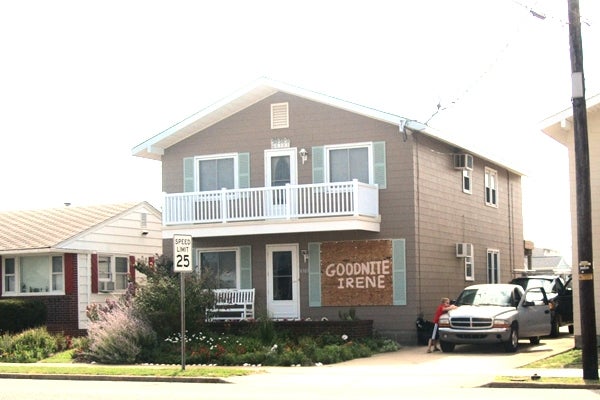
In Cape May Friday, residents finish boarding up before evacuating. (Kim Paynter/NewsWorks)
-
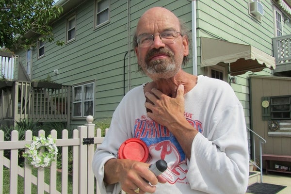
Barry Sharp in front of his home in Wildwood Crest. He has been a resident for 50 years and plans to ride out the storm. (Kimberly Paynter/For NewsWorks)
-

The Paradise Motel is boarding up for Hurricane Irene in Wildwood, N.J. (Kimberly Paynter/For NewsWorks)
-
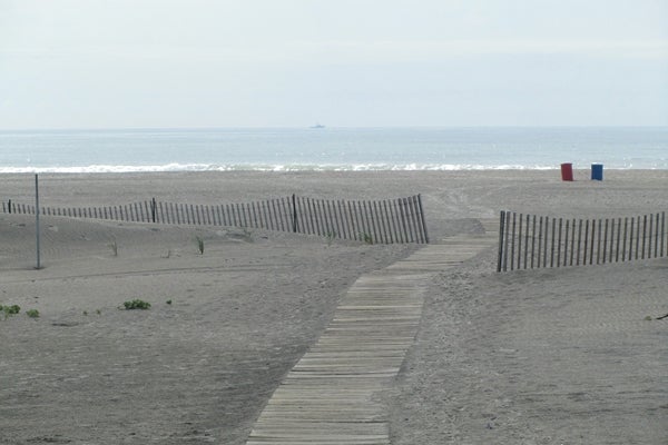
A deserted beach at Wildwood Crest. (Kim Paynter/For NewsWorks)
-

-

-

-

-

-
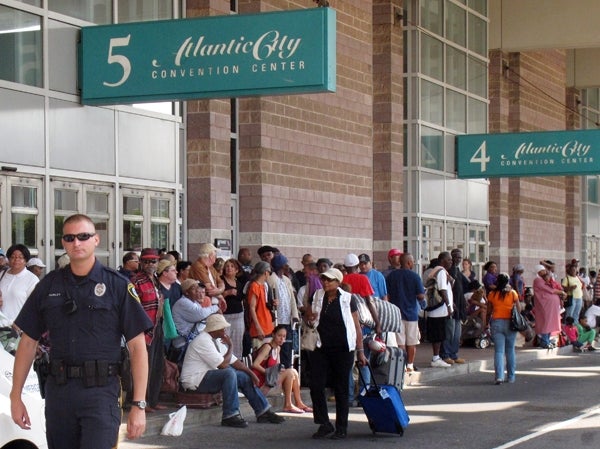
A police officer is on crowd-control duty outside the Atlantic City Convention Center, which is being used as an evacuation center for hundreds of city residents fleeing the approach of Hurricane Irene. (AP Photo/Wayne Parry)
-

Patience was required for shore evacuees on the Parkway. (AP Photo/Mel Evans)
-

Hurricane preparation near Washington Mall in Cape May, N.J. (AP Photo/Mel Evans)
-
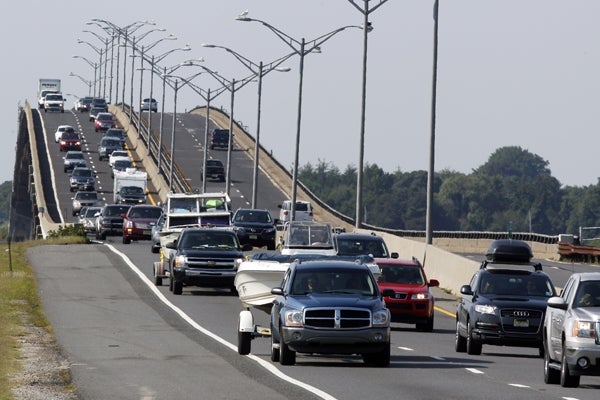
Traffic jams the Garden State Parkway across the Great Egg Harbor Bay Inlet Bridge near Ocean City, N.J. (AP Photo/Mel Evans)
-

A Superfresh employee replenishes depleted stocks of bottled water at a store in the Northern Liberties. (Peter Crimmins/For NewsWorks)
-
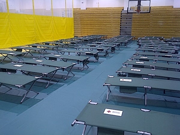
The Southeastern Pennsylvania chapter of the Red Cross set up a shelter Friday night at Lincoln High School in Mayfair.
-

Home Depot remained open late into the night as residents prepare for the worst as Hurricane Irene makes it's way up the east coast, Thursday Aug. 25, 2011 in Manahawkin, N.J. Tens of thousands of visitors to the New Jersey shore and many residents have begun an orderly exodus after a series of requests to evacuate because of Hurricane Irene. (AP Photo/Joe Epstein)
-

Shoppers Friday had to wait in long lines at one Philadelphia market as many stocked up on supplies for Hurricane Irene.
-
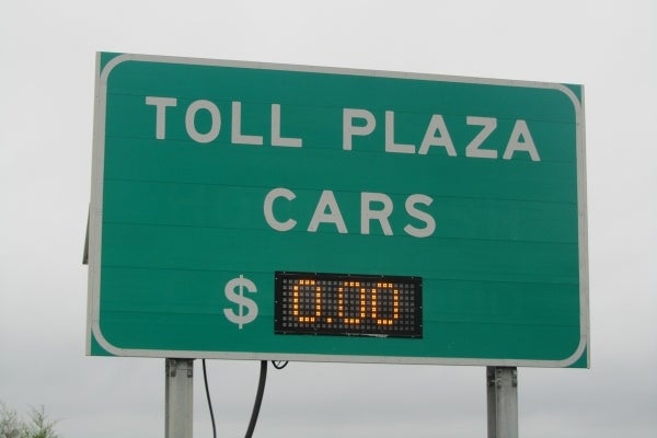
Governor Jack Markell waived all tolls on Delaware Route 1 to make sure people could evacuate the coastal areas quickly. (John Mussoni/For NewsWorks)
-

The abandoned toll booth on Delaware Route 1 at the Roth bridge. (John Mussoni/For NewsWorks)
-
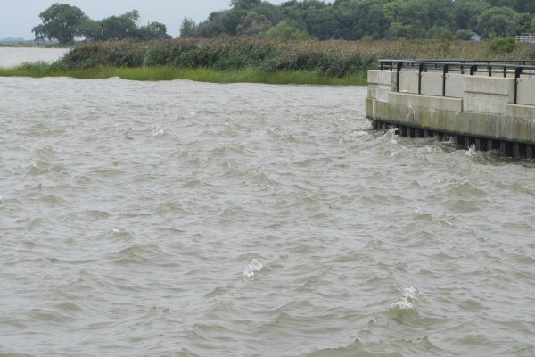
There were only light winds at 10am Saturday, but the Delaware River was already getting choppy at Delaware City. (John Mussoni/For NewsWorks)
-

Businesses in flood areas were ordered closed by Governor Jack Markell. Crabby Dicks in Delaware City got the message. (John Mussoni/For NewsWorks)
-
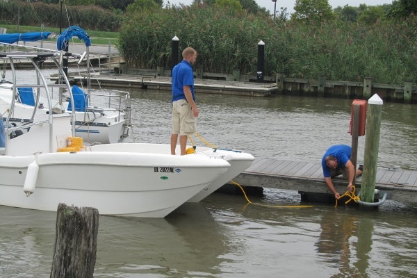
Some boaters at the Delaware City marina made last minute preps hoping for the best during Irene. (John Mussoni/For NewsWorks)
-
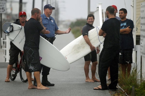
A Cape May police officer, second from left, talks with a group of surfers on the boardwalk early Saturday, Aug. 27, 2011, in Cape May, N.J. (AP Photo/Mel Evans)
-
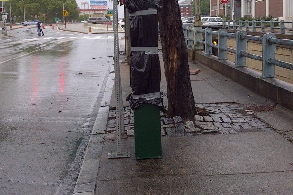
A parking payment station in Center City Philadlephia is wrapped in plastic. The city is offering free parking during the hurricane. (Tom MacDonald/For NewsWorks)
-

Some people turned to movies ahead of Hurricane Irene's visit. A small line formed at the $1 DVD rental stand as some look to keep busy while waiting out the hurricane. (Tom MacDonald/For NewsWorks)
-

New Jersey Gov. Chris Christie gives a news conference in Trenton, N.J. as the state prepares for the arrival of Hurricane Irene on Saturday, Aug. 27, 2011. (AP Photo/Julio Cortez)
-
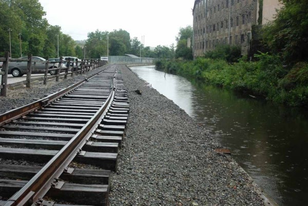
Rain began to fall on the Manayunk Canal around 11 a.m. on Saturday. (Max Matza/for NewsWorks)
-

-
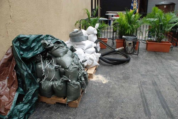
Manayunk Brewery is prepared with sandbags and water pumps (Max Matza/for NewsWorks)
-

Sandbags sit at the front door of a furniture store on Main Street (Max Matza/for NewsWorks)
-
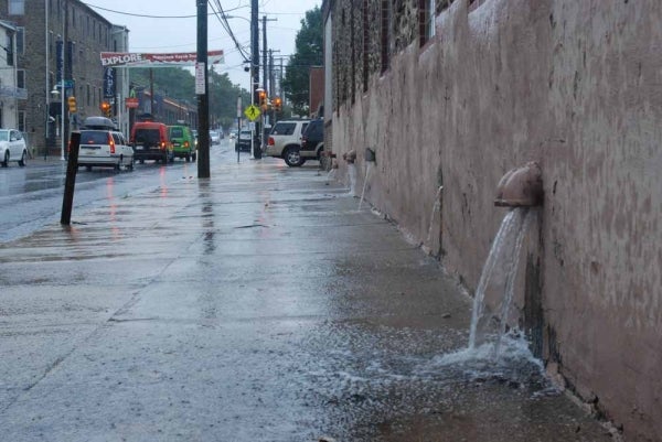
Main Street in Manayunk (Max Matza/for NewsWorks)
-

Main Street in Manayunk (Max Matza/for NewsWorks)
-
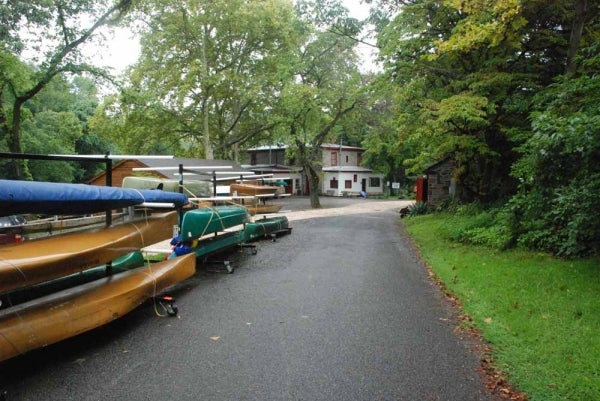
The entire driveway is expected to flood. Building caretaker, Kris Alutius, jokingly calls the Philadelphia Canoe Club
-

About 30 members showed up at 8 a.m. on Saturday to help move the boats and equipment. (Max Matza/for NewsWorks)
-

Whatever can't be moved to higher ground is being tied down at the Philadelphia Canoe Club, including these benches (Max Matza/for NewsWorks)
-
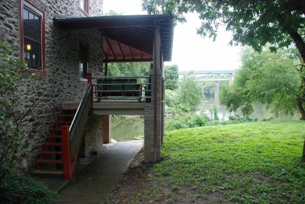
Members of the Philadelphia Canoe Club have kayaked inside the building during previous hurricanes. (Max Matza/for NewsWorks)
-

A house on Main Street along the Manayunk Canal prepares for the storm. (Max Matza/for NewsWorks)
-
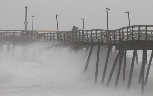
In the Outer Banks of N.C., a fishing pier looses pilings. On Saturday night, Atlantic City, N.J., and other evacuated shore towns stood in the path of the hurricane. (AP Photo/Charles Dharapak)
-
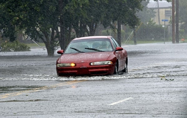
A man drives his car through a flooded street in New Bern, N.C. With flooding likely here, area motorists have been warned to never drive into standing water. (AP Photo/Chuck Burton)
-
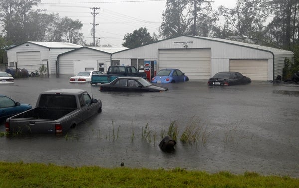
Vehicles sit in flood waters at a auto repair shop in North Carolina on Saturday. Phila. Nutter and other officials are extremely worried about regional flooding. (AP Photo/Chuck Burton)
-

-

-

-

-

-

-

If you live within three-quarters of a mile of Delaware’s coastline in any of the state’s three counties, Governor Jack Markell’s mandatory evacuation order affects you.
The state’s mandatory coastal evacuation is now in effect. Because conditions on the roads are expected to deteriorate as the storm arrives, Governor Markell has encouraged all residents in the evacuation zone to get out by 9 a.m. Saturday.
Markell says residents should not underestimate the power of Hurricane Irene. “If this hurricane occurs in Delaware as currently predicted, the damage will be unlike anything seen in this state for more than 50 years. Do not take this lightly. Today is the day to act.”
Communities being evacuated in Sussex County include Fenwick Island, South Bethany, Bethany Beach, North Bethany, Dewey Beach, Rehoboth Beach, Henlopen Acres, Lewes, Broadkill Beach, Prime Hook Beach, Slaughter Beach, Long Neck, and Oak Orchard.
In Kent County, the evacuated communities include Woodland Beach, Pickering Beach, Kitts Hummock, Bowers Beach, South Bowers Beach, and Big Stone Beach.
Evacuated communities in New Castle County include the following areas in the City of New Castle: Buttonwood, Bull Hill – residences around Broad Dike; City residents from the River up to 3rd Street including the Strand, Deemers Beach, and the Twin Spans and Riveredge Industrial Parks. In Delaware City: Businesses and residences from Battery Park to 2nd Street, Governor Bacon Complex excluding the Tilton Bldg State Nursing Home, all residences in the 100 block of Fifth Street including Polktown Place and Delaware City Trailer Park. Areas along the coastal zone south of the C & D Canal east of East Route 9, to include Port Penn, Augustine Beach, Bay View Beach, and all residences east of Thomas Landing Road.
State officials have suspended toll collection on Route 1 in an effort to speed the evacuation process. Markell says once the storm hits, it will probably force DelDOT to close the Indian River Inlet Bridge due to flooding, and all bridges crossing the Chesapeake and Delaware Canal because of high winds.
Sussex County is expected to get the worst of the storm, but Kent and New Castle County will not be spared hurricane force winds and heavy rains. Sustained winds in Sussex County are expected to top 75 mph, with possible gusts to 100 mph. A storm surge of three to six feet is expected along the oceanfront, Delaware Bay and Inland Bays. The storm is expected to dump 7 to 10 inches of rain in Sussex.
Late Friday afternoon officials posted their evcauation map on the web showing the affected areas. Sussex County Council President President Michael Vincent urged residents to follow the Governor’s orders. “This is the most significant threat Sussex County and Delaware has faced in at least a generation, maybe even longer,” Vincent said. “We cannot stress how important it is for people to follow the advice of our emergency planners and use this time now to get out of harm’s way.”
“We’re getting it all,” says Governor Markell. “We’re getting very significant rains. We’re getting very significant winds, and we’re getting a significant storm surge.”
WHYY is your source for fact-based, in-depth journalism and information. As a nonprofit organization, we rely on financial support from readers like you. Please give today.


