

Levee plan not viable for Philly’s flood-prone Eastwick neighborhood, says U.S. Army Corps
Earlier this year, the U.S. Army Corps of Engineers announced that the formally proposed levee would be downsized. Now they say the levee is not feasible.

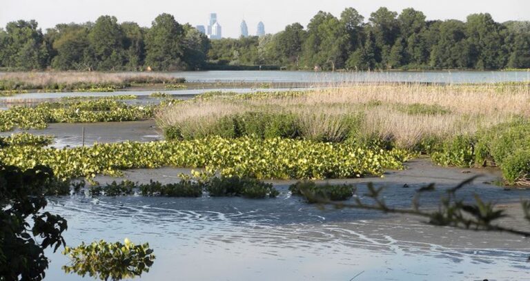
Philadelphia's skyline is visible above the Eastwick tree line. (Eastwick Friends & Neighbors Coalition)
This story is part of the WHYY News Climate Desk, bringing you news and solutions for our changing region.
From the Poconos to the Jersey Shore to the mouth of the Delaware Bay, what do you want to know about climate change? What would you like us to cover? Get in touch.
For over a decade, the U.S. Army Corps of Engineers has studied the feasibility of an earthen berm-style levee in Philadelphia’s flood-prone Eastwick neighborhood. Over the years, residents have tracked proposals and hoped that this structure, designed to alleviate flooding from Darby and Cobbs creeks during major storms, would eventually be implemented.
Unfortunately, hope for that solution may be dashed after the Corps said that the levee is not feasible.
“The levee plan does not appear to be viable under our current authority based on our findings,” said Stephen Rochette, the Corps’ Philadelphia district spokesperson, in an email.
The agency shared their assessment with community members at a stakeholders meeting on May 29. The Corps explained that the project is bound by a familiar constraint: they couldn’t guarantee that the latest design for the levee would not cause induced flooding to nearby areas.
“It was disappointing,” said Ted Pickett, president of Eastwick United and a resident of more than 40 years. “And it’s been such a long time that the Corps has been looking into the levee.”
Years of devastating flooding
While longtime residents remember conversations about a protective barrier starting during the aftermath of Hurricane Floyd in 1999, the first formal mention by the Corps dates back to 2014. In December of that year, the Corps completed the Eastwick Stream Modeling and Technical Evaluation report, conducted under the agency’s Planning Assistance to States program.
The study was preliminary in nature, but it evaluated whether a levee could provide flood risk management for Eastwick during extreme rainfall events without impacting nearby properties and residents who live near Darby and Cobbs creeks.
The results and further studies led to a proposal that drew attention in 2023: a 15-foot-tall earthen berm-style levee stretching nearly 1,400 feet along Cobbs Creek, designed to block overflow waters from entering low-lying streets. The 100-year-storm levee would prevent the kind of catastrophic flooding that the neighborhood has already endured after major weather events like Tropical Storm Lee in 2011 or Hurricane Ida in 2021.
That plan ran into a problem when the Corps’ modeling found that the levee would induce flooding in Delaware County. The agency scaled the design back and introduced a redesign earlier this year.
Related Content
Sunoco pipeline leak cleanup in Upper Makefield is ‘moving too slowly,’ residents say
Bucks County residents are raising concerns over noise and safety, as well as impacts on the water supply, as Sunoco works to clean up leaked jet fuel.
3 months ago
Listen 1:06But even after scaling the Eastwick levee back, cutting the barrier down to 8 feet, roughly half the size of the original, the agency told residents that it is still not feasible.
Carolyn Moseley, an Eastwick resident of 30 years, was disappointed with the news, but said the conclusion makes sense.
“It’s scientific law,” she said. “If you put water in an object, the water is going to find somewhere else to go. If they put a levee up there, that water is going to other parts.”
Mitigating induced flooding
Induced flooding has become a major and expensive legal hurdle for the Corps. In 2014, hundreds of landowners along the Missouri River sued the agency. They argued that changes to river management, which was altered to benefit endangered species, caused recurring flooding on their properties. After a decade of shifting trials, a federal appeals court ruled against the Corps in 2023, causing the agency to pay out more than $7 million to affected farmers.
Then in 2025, the Corps issued updated guidance stating, “recent court decisions on the takings implications of induced flooding have prompted questions concerning how and when project teams should evaluate the potential for project-induced flooding and the steps teams should take if models predict an increase in flooding.” The memo suggested steps teams should take if their engineering models predict an increase in flooding on neighboring land.
As for the Eastwick project, Rochette said in an email, that the Corps is “evaluating all options in partnership with the City before making our best technical recommendations on the path forward.”
Moving forward
While the Army Corps deemed the latest levee design as infeasible, the city remains hopeful.
“The City is continuing to work with the U.S. Army Corps of Engineers and stakeholders to evaluate next steps regarding a levee in Eastwick,” said Korin Tangtrakul, senior water inequity manager for Philadelphia’s Office of Sustainability, in a statement. “No determinations have been made and it is still a very active conversation. In the meantime, the City is continuing to work on the design of an interim flood barrier in Eastwick.”
While the levee was just one part of the long-term flood mitigation strategy proposed by Tangtrakul’s office and the Corps earlier this year, other solutions remain on the table. The strategy includes the use of nature-based solutions, such as restoring wetlands, stormwater infrastructure designed to move water faster and buyouts.
The neighborhood also welcomed a new flood-monitoring system this spring with flood gauges that inform residents when rainfall and water levels become dangerous.
In the meantime, community members like Pickett are not deterred by this setback.
“At this point we’re not considering moving,” he said. “Hopefully there are some other ideas that will come about before we make that judgment.”

Get daily updates from WHYY News!
WHYY is your source for fact-based, in-depth journalism and information. As a nonprofit organization, we rely on financial support from readers like you. Please give today.
Part of the series
Part of the series
Watershed
Preserving Our Water: How we use our Delaware Watershed.
The project is funded by The William Penn Foundation.
Hydropower parts manufacturer in Northeast Philadelphia lands federal research partnership
Kingsbury plans to test new materials for hydroelectric power equipment that can support the needs of modern-day grids.
9 hours ago

Conservationists launch plan to protect Wissahickon Valley Park and Creek
During the aftermath of Hurricane Ida in 2021, water rushed down the creek, flooding Forbidden Drive.
5 months ago
Listen 1:26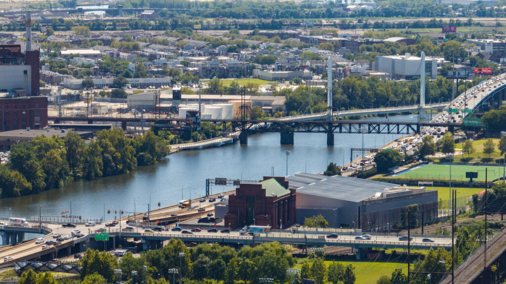
Why billions of gallons of raw sewage keep ending up in Philadelphia waterways
With a new analysis showing where the pollution is going, environmental advocates call on public officials to do more to stop it.
11 months ago