Citizen created district maps come closer to getting it right
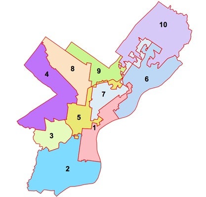
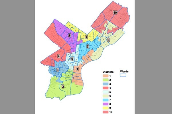
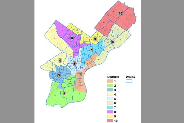
City Council has a plan for re-drawing the city’s councilmanic districts. Actually, it has two. Council’s deadline for adjusting the city’s map based on new Census numbers was technically this past Friday. On Thursday, two different plans were introduced.
Under the city charter, Council members can’t collect another check until they pass a plan.
The current official map is an embarrassing mess with weirdly shaped districts, driven by the political self-interest of incumbents back in 2001. The fact that Council drew this year’s maps behind closed doors, without much public engagement, raised questions – including from It’s Our Money – about whether selfish concerns would corrupt the new map as well.
A local geospatial analysis firm called Azavea tried to help citizens get involved by building software that allowed them to draw their own maps. It also held a contest, in partnership with the Daily News, WHYY and the Penn Project for Civic Engagement, to see who could produce the best one. The winners were announced last week.
On this week’s It’s Our Money podcast, we speak with Robert Cheetham, the president of Azavea, about why the average citizen should give a hoot about council districts. He also tells us how Council’s proposed maps compare to the contest winners.
It’s Our Money is a joint project of the Daily News and WHYY, funded by the William Penn Foundation, that works to shed light on where your tax dollars are going.
WHYY is your source for fact-based, in-depth journalism and information. As a nonprofit organization, we rely on financial support from readers like you. Please give today.
