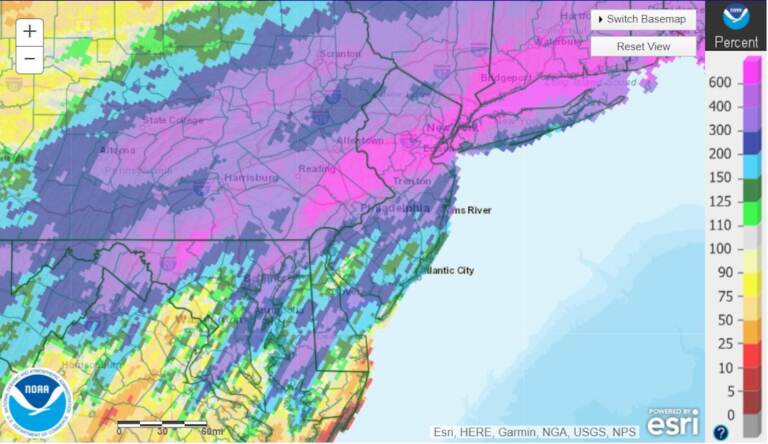
Tracking severe storms, flash flooding, tornado threat in the Philly region
A line of storms is forecast to move through the Philly region starting Wednesday evening as cleanup continues in the wake of Hurricane Ida.

A line of storms is forecast to move through the Philly region starting Wednesday evening. (NWS)
The Philadelphia region is bracing for more severe storms and flooding as cleanup continues from the damage wrought by the remnants of Hurricane Ida.
By early Wednesday night, between 7 p.m. and 1 a.m., a line of storms is forecast to move through the region.
Valerie Meola, a meteorologist with the National Weather Service in Mount Holly, said the additional rain could spell trouble for the region.
Although there may be only an inch or two of rain from the stormfront, Meola said, its combination with previous rainfall could mean more flooding.
“The ground is pretty wet,” Meola explained, “so it’s not going to absorb the water as we expect from the storm, and that’s going to be a lot of runoff and that’s what leads to the flash flooding problems.”
Most issues are anticipated along the I-95 corridor: Philadelphia and suburbs north and west of the city. That includes Montgomery, Bucks, Chester, and Mercer counties, where flash flood guidance indicates that less than an inch in an hour would cause localized flash flooding.
Spinning winds in the atmosphere, or shear, indicates that a tornado threat also exists for Philadelphia, plus areas north and west of the city.
Meola cited wind damage as the main threat, but cautioned: “We could see some isolated tornadoes as well, so we definitely need everybody to stay weather-aware.”
Flash Flood Watch
A Flash Flood Watch will be in effect for Philadelphia, plus areas north and west of the city, late Wednesday afternoon into the overnight hours.
Rip currents at the shore
Hurricane Larry, currently a Category 2 storm, has led to a high rip current risk for Atlantic beaches that will likely last through the end of the week.
Extended forecast
- Thursday: A transition day from showers and clouds to start, with a brighter finish. The humidity will drop with the returning sunshine. Highs in the upper 70s.
- Friday: A pleasant end to the work week with a mix of sun and clouds and a below-average high of 77. Humidity will be lower.
- Saturday: A nice start to the weekend with plenty of sun. High of 80.
- Sunday: A few more clouds will enter the picture, and there’s a slight chance for a stray shower, especially at night. High of 84.
- Monday: Sun mixes with a few clouds. High of 84.
- Tuesday: Partly sunny skies. High of 85.
6ab contributed reporting.
WHYY is your source for fact-based, in-depth journalism and information. As a nonprofit organization, we rely on financial support from readers like you. Please give today.


