


Postcard from Texas

July 21
Previous postcards: China, San Francisco, Germany, Pittsburgh, New Orleans, New York City, Boston, San Antonio, Minneapolis
By John Davidson
For PlanPhilly
At first glance, Philadelphia and Austin, Texas, don’t appear to have much in common. Even at second and third glance they don’t have much in common; one is a hardscrabble former industrial city in the northeast, the other a smaller yet bustling southern city known for its music and nightlife.
But like Philadelphia, Austin has a riverfront close to its downtown that frames and shapes the city in significant ways. In fact, the Colorado River runs directly through Austin and forms what locals call the Town Lake Corridor or Lady Bird Lake shoreline – a waterfront that stretches roughly four miles, from Lady Bird Lake on the east to Zilker Park on the west.
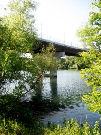
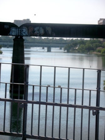
James Pfluger Bridge and pedestrian walkway
The lake is actually a reservoir the City of Austin built in 1960 as a cooling pond for the Holly Street Power Plant. That year, the city constructed Longhorn Dam, which became the lake’s eastern boundary; the western end of the “lake” is the Tom Miller Dam, which was built in 1939.
Although the reservoir itself was made for an industrial use, part of the master plan was to create a recreational area in the heart of the city. By the 1970s, an early system of hiking and biking trails was built on the reservoir’s shoreline.
So although it has some industrial roots, Austin’s waterfront – unlike Philadelphia’s – was never a commercial hub, and is neither dotted with ghostly 20th century industrial ruins nor used as an active shipping corridor.
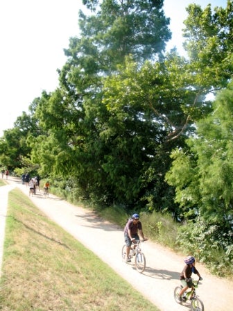
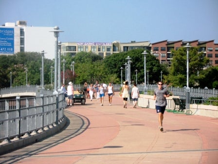
Looping bike and pedestrian trail
Lucky for Austin, the Town Lake Corridor is primarily a mix of vast public parks, institutional land and private land quickly being developed into condos, hotels and mixed-used projects. Because a majority of the city’s waterfront is parkland, the corridor teems with activity: joggers and cyclists pack shoreline trails every day while kayakers and boaters frequent the river itself.
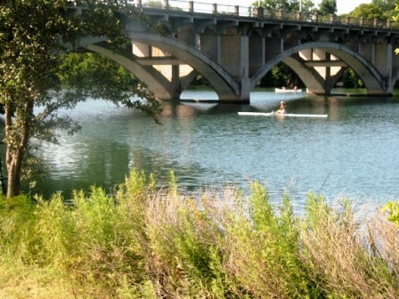
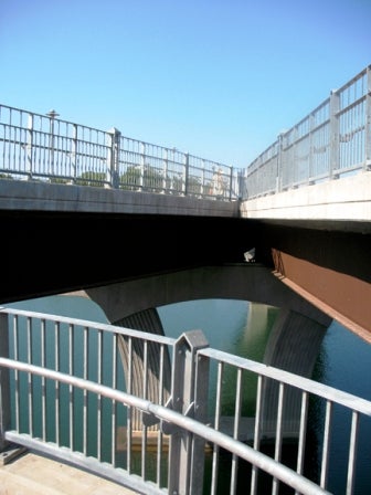
Lamar Blvd. Bridge
Yet for all its idyllic, pedestrian use – the kind of use urban designers in Philadelphia dream about for the Delaware – lately Austin’s waterfront has been awash in competing interests and bureaucratic delays. In recent months, some controversy has surrounded the recommendations of the Waterfront Overlay Task Force, a body convened last year and charged to revise elements of the original 1986 Waterfront Overlay Ordinance, which established rules for development along the river including height limits of 96 feet on all development in the Waterfront Overlay district.
James Pfluger Br. pedestrian walkway
Height limits along Austin’s waterfront have been a contentious issue for some time. In a 1999 rewrite of the overlay ordinance, height limits were effectively eliminated – a move conservationists have loudly decried. The current ordinance rewrite, which Austin’s City Council recently passed, reinstated the 1986 height limits with exceptions for Planned Use Developments.

Looking east toward development on the Colorado River / Town Lake
However, the task force’s recommendations – and even its existence – are making waves, and attempts to rewrite zoning overlays for the city’s much-used waterfront are pitting private developers against community and conservationist groups like SaveTownLake.org.
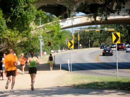
Railroad Bridge over Colorado / Town Lake
The rewritten ordinance also includes a commitment “to help further the goals of the Town Lake Corridor Study,” a 1985 document that advocated for environmental protection, increased public access and ownership of the shoreline, and urban planning and design. It was that study that was essentially codified into the original 1986 overlay ordinance.
As part of the 2009 rewrite, the City of Austin has created a Waterfront Planning Advisory Board to be named in early August, charged to “assist in promoting excellence” in the development of the waterfront overlay district.
But to look at Austin’s waterfront, you wouldn’t imagine so much wrangling behind the scenes. The challenge for Austin is quite different than it is for Philadelphia; Austin needs to protect its publicly accessible, pedestrian waterfront, while Philadelphia needs to create one.
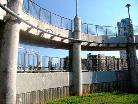
W. Cesar Chavez Street
Still, Austin’s experience can be instructive in this respect: the reason all this is happening is because, despite the creation of a sweeping waterfront overlay ordinance in 1986, and a rewrite in 1999, the city has still not implemented some of the key “action priorities” laid out in the 1985 study.
Pfluger Br. trail
With so much effort in recent years going into studies and sweeping civic plans for the Delaware Waterfront, Austin’s 25-year delay in implementing important waterfront goals should be a warning to Philadelphia: all the planning in the world does not make a waterfront. Without a decisive action and implementation, Philadelphia might find itself wrangling over sections of Central Delaware Riverfront Overlay District in 2030 – and still not have public access to the waterfront.
Contact the reporter at jddavidson9@gmail.com
WHYY is your source for fact-based, in-depth journalism and information. As a nonprofit organization, we rely on financial support from readers like you. Please give today.
Brought to you by PlanPhilly

PlanPhilly
In-depth, original reporting on housing, transportation, and development.

South Jersey woman opts for mediation in eminent domain fight over her Whitesboro property
Dawn Robinson has been fighting efforts from the city to force her to sell her 2.4-acre property in Middle Township.
2 weeks ago
Listen 0:57")
Philadelphia is technically a buyer’s market, but housing economists say that’s misleading
Sellers are less serious, and buyers can’t afford anything. Economists say it will likely take years for things to improve.
3 weeks ago

What lower interest rates mean for homebuyers
Mortgage rates dropped below 6% last week for the first time in years, a sign that some economists believe will trigger a more active and competitive housing market.
Air Date: March 3, 2026 12:00 pm
Listen 51:41