Neighborhood Connections

Live news from Neighborhood Connections segment (Team leader: Denise Scott Brown)
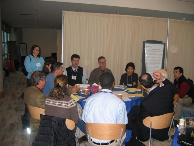
10 a.m. update: Architect Denise Scott Brown gathered her group of experts and community representatives and charged them with charting the myriad connections Philadelphia has with the Delaware River and its landscape along the city’s eastern edge. Scott Brown inspired the group to think beyond physical connections and by 9:30 a.m., city planner Alan Urek had commandeered the flip chart and enumerated the connections. They were history/heritage; streams, waterways, sewer; transportation, including roads, rail and pedestrian footpaths; visual connections, better known as views; the city across the river, Camden, the public connections such as Penns Landing and Penn Treaty Park, the structured relationship of the city to the river; the north-south systems such as roads and highways and bridges. Scott Brown also asked that the group considfrom the scale of connections and their levels relative to the river.
From these ideas, the group came up with five maps they wanted to create, and the tracing paper was unfurled to compose these maps: transportation connections, community connections, natural connections, visual connections and sites with some uncertainty about development, ie. casinos. The mandate was to finish the maps by noon.
11:02: With the scent of magic marker wafting through the room, the maps began to emerge. M. Richard Nalbandian, Temple University professor and hydrologist, was monitoring a map that included the watersheds. Blue lines indicated underground streams that spread like so many veins throughout the city. The red lines, most by the waterfront ending in squares, indicated manmade combined systems that carried stormwater and sewage. These were the points where the city met the river. Nalbandian said that Philadelphia was grappling with a problem that many older cities were confronting, that is, how to separate storm water from sewage. When rainwater is low, there is no problem. Sewage gets treated and cleaned before joining the rainwater that flows into the river. But when there’s excess, nothing can stop the raw sewage from flowing straight to the river. Nalbandian said Philadelphia’s Water Department was one of the more progressive in the country in solving the problems of stormwater overflow.
And Howard M. Neukrug, director of the department’s office of watersheds, explained how the city was pushing the solutions. One of the most effective is to get commercial developers to help manage stormwater. New regulations require that developers get rid of the first inch of rain. They do that by building green roofs, planting trees, installing porous pavements and planting green lawns.
By 11:40, the maps were complete, hung from the walls with black electrical tape. Scott Brown stood before the curtain of information, her pencil-written notes firmly grasped in her hand.
“The next step is understanding what we see here,” she said. After some moments of contemplation, she suggested that the map showing areas of potential development be combined with the transportation map that shows the various access routes to the river.
“We need to circle the opportunity areas in black,” she instructed.
Some accesses were more desirable than others, she said. “Underpasses are awful for pedestrians. They’re smelly and they’re not safe.”
Minutes earlier, landscape architect Jose Almiñana had been admiring the Conrail site in the northern end of the seven-mile area included in the Central Delaware River area that Penn Praxis is studying.
“The obvious thing that could happen here is open space. Recreation. The problem with this site is you have to be sure it has enough connectivity to the housing stock.”
And he reiterated his point as the group mused over the combining of the opportunity zones with the transportation map.
N. Richard Nalbandian, the Temple professor, pointed out that the parking lot surrounding the large-box stores in the southern end of the Penn Praxis zone, were underutilized, hardly ever full, even on the busiest shopping days. He suggested that maybe the parking lot could be deputized by those who wanted to park and ride their bikes or hike along a riverside trail envisioned but still nonexistent.
Scott Page, principal of Interface Studio, and a Northern Liberties resident, pointed out the areas where Interstate 95 was at its widest, eight lanes wide at the edge of Northern Liberties.
The transportation map combined with the opportunities was the gateway to the afternoon session, to begin after lunch.
“We want to talk about the next steps,” Scott Brown said. “We’re trying to get a set of variables here.”
She said the next steps would be to synthesize the information, create overlays of the systems they had mapped individually, large areas, regional subareas of connections, conditions for the smaller connections.
Page suggested the maps could be redrawn and digitized later. But that would all happen later, after lunch.
2:30: After viewing the work of the four other groups, the connections-to-the-community team reconvened. Scott Brown wasted no time in leading the charge: “We need to refine the scope of our thinking.”
The eight sites that had been identified before the lunch break were numbered and Alan Urek once again commandeered the flip chart.
Scott Brown asked for a one- or two-sentence description of each of the sites and a name, even a catchy name, if possible for each.
And so the key points of access were officially established. They were:
Pulaski Park – existing community green space
Lehigh Viaduct/Conrail – great regional connectivity via viaduct, mixed-use potential, water transportation capacity
Cramps Ramps – near the Cramps’ Shipyards. Because of the new ramps for Interstate 95, possible to have a not-constrained connection, good views, multiple connections to Pettys Island
Penn Treaty Park/power plant – existing historic green space, best views
Spring Garden/incinerator/Festival Pier – transit (the El), proximity at grade, public ownership
Callowhill Docks – highway access and at-grade, regional, historic opportunity
Penn’s Landing – public, super-regional, transit access, civic space on the river, grade-level pedestrian access, densest population and development, most historic
Wal-Mart Pierland – obsolete uses, marshland opportunity, fill necessary
The group divided in to four subgroups and assigned a draftsman to each one to draw their vision.
“Does everyone understand what they’re going to do?” Urek said. “I don’t.”
The mission was clarified.
The idea was to identify challenges regarding access and the potential for connection. And to reconvene at 4 p.m., exactly one hour later.
At 4:05, Scott Brown surveyed the works in progress. How’s it going?
“It’s going beautifully,” she replied. “There’s lots of creative people here.”
She surveyed the various areas that were being drawn with connections to the neighborhoods. David Brownlee, an architectural historian at the University of Pennsylvania, teamed up with Jose Alminana, and was joined by Janice Woodcock.
They were tackling the South Philadelphia site dubbed Wal-Mart Pierland.
The subgroup had reconnected the neighborhood through the Home Depot parking lot and the Wal-Mart building.
“You wouldn’t plan around them as permanent buildings,” Brownlee said of the big-box stores. “When they go, the city street grid should be re-established there,” he said.
But when Scott Brown showed up to look over their emerging plan, she questioned the wisdom of assuming that the Wal-Mart and Home Depot would be gone in the near future.
“Why wouldn’t it stay?” she asked. “The reality is that it works. How do you get Wal-Mart out?”
Brownlee said the big-box stores were not designed to last a long time, and when they were decrepit, it would be an opportunity to find another use for the area.
By 5 p.m., Scott Brown was ready to bring the group together again for at least some preliminary summarizing.
“We’ve been doing these plans and we’ve been trying to do some consistency in them.” She reiterated that they needed to get all of the ideas onto a diagram with the verbal descriptions added. “Meanwhile, we also have to do the guidelines.”
Small community guidelines and and a north-south riverwalk. “That’s the vision,” she said.
Then the subgroups explained to the rest of the group how their work had proceeded.
Naphat Sitisara of Wallace, Roberts and Todd, headed the subgroup tackling Penns Landing.
“It’s well-maintained, but nobody loves it,” Sitisara said. Her group suggested that Independence Park between Fifth and Sixth Streets and Market and Chestnut should have a better, smoother paths to the riverfront.
“Why don’t we try to open up this connection?” she asked.
Scott Brown looked at the map, pointing to the Great Plaza. “People used to love to come to this park to listen to music or watch fireworks. We should keep this a big open space.”
Penn’s Landing and its connections to the city and the neighborhoods nearby was still a work in progress. But it was time to move on.
7:13: You wouldn’t exactly call it panic, but there is an air of concern in the room. How to get the eight maps overlaid into one presentation? One map was out of the question, Scott Brown said. There was a discussion of colors to be used. “Try to get really red, not brown,” Scott Brown instructed.
Five maps would do, Scott Brown said.
But how to translate to Power Point?
Janice Woodcock went to scope out a computer. “Who knows how we’re going to do this.”
Scott Brown vowed they’d be finished by 10 p.m.
8 p.m. Humor is beginning to ooze from the tension while the markers are shared. “Who needs a red?” Scott Page calls.
And what is the exact purpose here, one asks. “To get out of here before dawn,” quips David Brownlee.
Scott Page has just experienced a peak moment of frustration. “This is the second time this has happened to me.” He means the tracing paper has slipped and he has to start over. “It teaches me a lesson on making sure things are taped down,” he says philosophically.
Naphat Sitisara reaches for a coloring pencil. Scott Brown stops her. “We need to use magic marker, not crayon,” Brown Scott says.
The colors are to be consistent and are established. Crimson red for commercial, canary yellow for residential blocks.
Everyone is drawing furiously. And there are two hours to go.
8:46: Scott Page, the urban planner, was finishing off his map of the area surrounding Festival Pier at Spring Garden Street.
“Basically what we’re suggesting is a park on the chunk where there is parking. Bring the water in closer. What we’re thinking is dig out the inlet so the Delaware gets closer to Delaware Avenue (Columbus Avenue) so it becomes visible. It’s really about getting the neighborhood to the water at a critical juncture,” Page said.
The map is converging into a final product, but the ideas keep coming.
“You can take the fill and extend the end of Festival Pier, providing a space for a small residential development. That’s assuming that events stay at Penn’s Landing.”
Still not done. “I’m going to draw a trail in here as well. There are moments when the trail will follow the coastline but it can also float between the piers.”
The diagram may be nearly finished, but the process is not.
“We have to scan them in and overlay them.” And two of the other working groups have already finished and called it a day (and a night).
WHYY is your source for fact-based, in-depth journalism and information. As a nonprofit organization, we rely on financial support from readers like you. Please give today.


