Timeline: The battle over Pennsylvania’s congressional district map
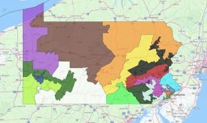
Pennsylvania’s congressional map has been recognized nationally as having some of the starkest examples of gerrymandering in the country, prompting both a state and a federal lawsuit in 2017.
A three-judge panel in the federal case upheld the map as drawn by Republicans in 2011. The state case compelled the Democratic-majority Pa. Supreme Court to strike it down as an unconstitutional partisan gerrymander.
This ruling seems likely to alter the partisan tilt of the state’s congressional delegation, which has held a steady 13-5 Republican advantage.
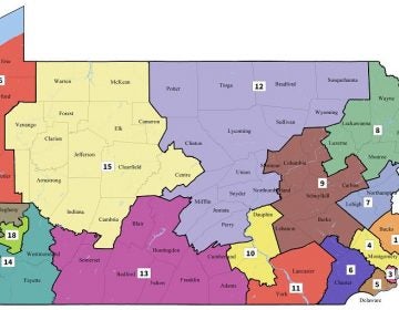
On Feb. 19, Pennsylvania’s high court issued its own version of the map without the support of legislation. It’s much more compact and contiguous than the 2011 version. It also seems to value the idea that the state’s congressional delegation should better reflect the state’s voter rolls, where Democrats have the majority.
Republican state lawmakers have challenged this action in federal court and asked the U.S. Supreme Court to intervene.
With the next turning point imminent and national interest piqued, the interactive timeline above looks back at how the story has developed.
WHYY is your source for fact-based, in-depth journalism and information. As a nonprofit organization, we rely on financial support from readers like you. Please give today.


