Forecaster: Warmer than normal temps ahead; no snowstorms in sight at Shore
The year began with unseasonably warm weather, and there's not prolonged cold air or a snowstorm in sight at the Jersey Shore for at least the first half of January.

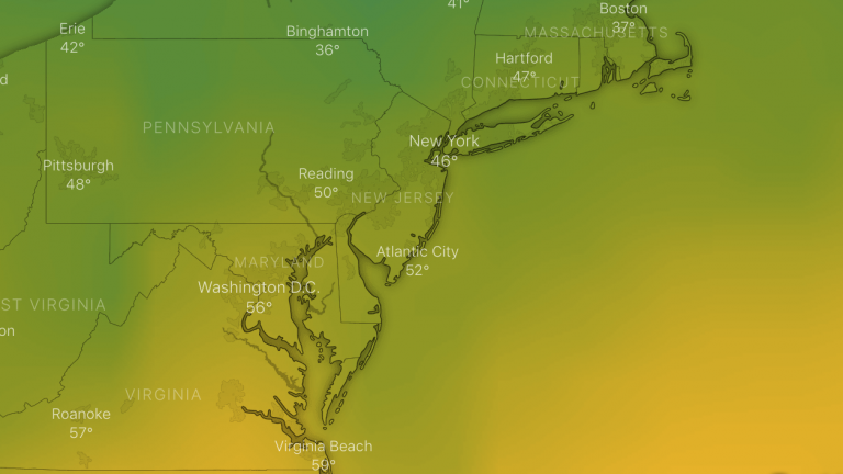
The GFS forecast model animation for next Tuesday, indicating warmer than normal temperatures in the New Jersey region.
The year began with unseasonably warm weather, and there’s not prolonged cold air or a snowstorm in sight at the Jersey Shore for at least the first half of January.
So what’s happening with winter?
Well for starters, snow lovers just have to remain patient, because winter’s not even two weeks old, says New York Metro Weather founder and forecaster John Homenuk.
He says December was unusually warm across the country, and the Pacific Jet Stream — the fast flowing air current in the atmosphere — will continue to keep warmer air flowing into the country over the next two weeks, save for some colder periods.
The National Weather Service’s Climate Prediction Center is aligned with Homenuk’s analysis, indicating a probability of above normal temperatures through January 16.
The Climate Prediction Center 8-14 day outlook has most of the Lower 48 unseasonably mild through January 16th and a change to drier than normal weather in the eastern 1/3 of the nation. pic.twitter.com/DCTBgRYThX
— Tom Tasselmyer (@ttasselWBAL) January 2, 2019
But toward the second half of the month, Homenuk expects the pattern to largely begin a transition away from widespread warmth and toward a colder and potentially stormy pattern by late January.
That coincides with the Climate Prediction Center outlook for later in the month.
“My message? Enjoy the next few weeks and warmer than normal temps we get them, because winter is far from over,” Homenuk said.
WHYY is your source for fact-based, in-depth journalism and information. As a nonprofit organization, we rely on financial support from readers like you. Please give today.


