District-level comprehensive plans for West Park, Lower South, unveiled
City planners Tuesday unveiled drafts of the first two district-level portions of the city’s new comprehensive plan, outlining future goals for neighborhoods near Fairmount Park and in southernmost Philadelphia.
“This is a very important moment,” said Alan Greenberger, deputy mayor for economic development and chairman of the planning commission. These two district plans and the 16 that will follow are where the broader goals of the city-wide comprehensive plan, adopted in June, translate into actual neighborhood commercial centers and land use changes. Philadelphia2035 is the city’s first comprehensive plan since 1960.
Mayor Michael Nutter repeated a theme of his: Planning matters. Zoning Matters. Design matters. He said the packed room at the Center for Architecture showed Philadelphians clearly understand this, and praised everyone who participated in the process. “It will ensure that Philadelphia is a 21st Century City,” he said.
Deputy Mayor Alan Greenberger and Community Planning Director Richard Redding on the importance of district plans and the process.
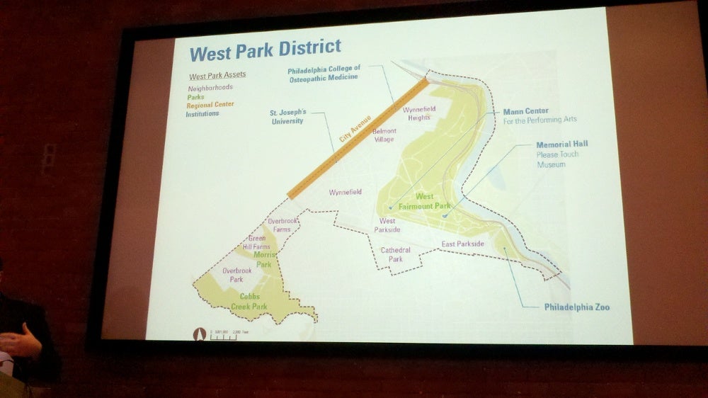
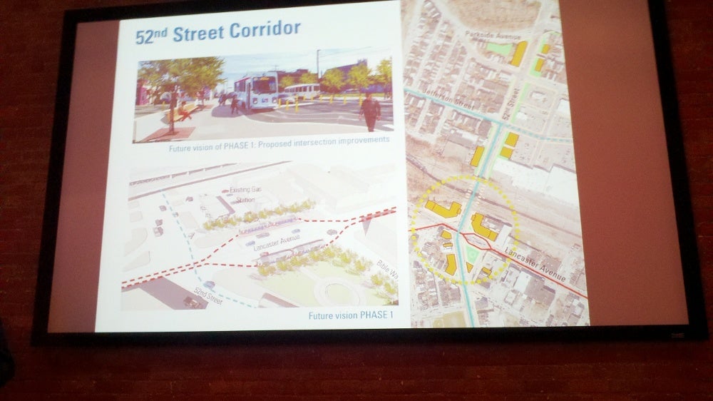
The West Park plan includes the western part of Fairmount Park and nearby neighborhoods, including East Parkside, West Parkside and Cathedral Park. The plan calls for beefed-up and concentrated commercial corridors with new mixed-use development on 52nd Street and Lancaster Avenue and Parkside avenues. Another big theme: Better connecting the park and the surrounding neighborhoods by planting trees and other greenery along major connecting streets and creating smaller, neighborhood-oriented playgrounds and green space at the parks’ edges.
Improving athletic fields and playgrounds and stretching the green space back into the neighborhoods will help neighbors “feel the park is a part of their everyday lives, and is not just for tourists and out of town visitors,” Planner Andrew Meloney said.
Key plan goals in the near term include: Relocating a Streets Department facility from its prominent location at 40th and Jefferson, improving pedestrian crossings over Parkside Avenue and replacing the sea of blacktop at an elementary school with green, park space that could be used by surrounding neighborhoods.
Meloney details the West Park Plan (note: Meloney gave the presentation in two parts. We’ve edited them together)
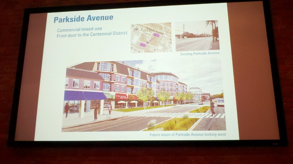
While it probably wouldn’t happen for 10 years or more, Meloney showed a possibility for the future of Parkside Avenue, with a median in the middle as a safe haven for pedestrians crossing the road and plenty of businesses and homes lining the street. This is the gateway to the Centennial District, Meloney said. Those who live in upper-floor residences would get prime views of the park, and both they and park visitors could take advantage of ground-floor retail.
Changes would be made to make moving around West Park easier and safer for transit riders and pedestrians, he said, including the use of planted medians, which slow drivers down.
Meloney said the opening of the Park West Town Center added much-needed amenities to that area, including a grocery store and a home-improvement store. But pedestrian access to the center “is not great.” That could be remedied by extending Jefferson across 52nd and into the shopping center.
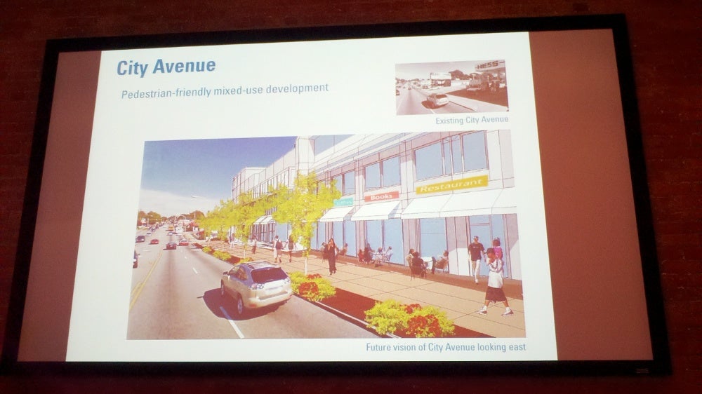
The plan also calls for big changes to City Line Avenue. Mixed-use development of the future would be geared more toward pedestrians and less toward cars. A landscaped buffer would separate cars and pedestrians.
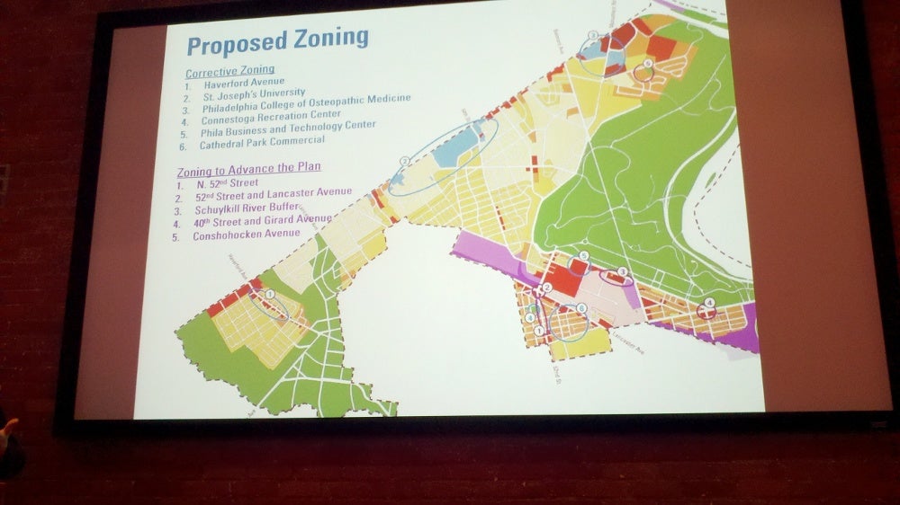
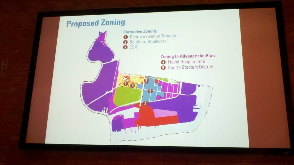
All district plans will suggest zoning changes, some corrective steps that would change the classifications to match what is already on the ground in reality, some changes to advance the vision in the district plan.
In West Park, for example, the north side of Overbrook Farm’s Haverford Avenue currently is zoned residential, but much of the properties are actually mixed-use commercial. The plan calls for changing the zoning to commercial to foster a successful business corridor, Meloney said.
Conversely, nearly 50 percent of the stores along the 40th and Girard business corridor are vacant. The most successful ones are closest to the intersection, Meloney said, and so the plan calls for keeping the commercial designation only in blocks near the intersection. The idea is to create a dense commercial area where businesses do well, and allow the unsuccessful area to become residential.
Mayor Nutter on the significance of the city’s new comprehensive plan and zoning code, and his delight at the level of citizen participation.
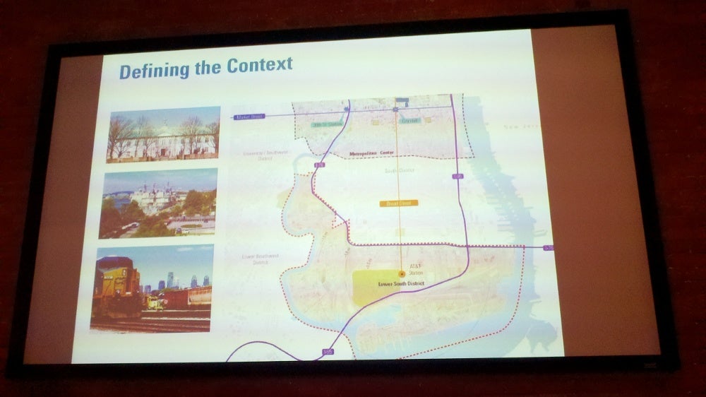
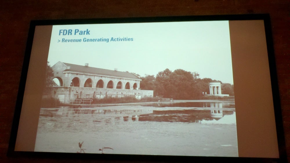
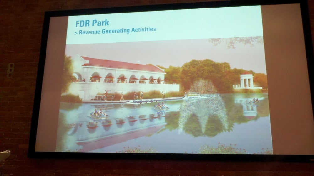
The Lower South plan covers the Navy Yard, stadium complex, Sunoco refinery and neighborhoods to the south of Packer Avenue. The draft plan calls for improved highway and transit access, more housing for seniors and families, and better connections to FDR Park and the riverfronts.
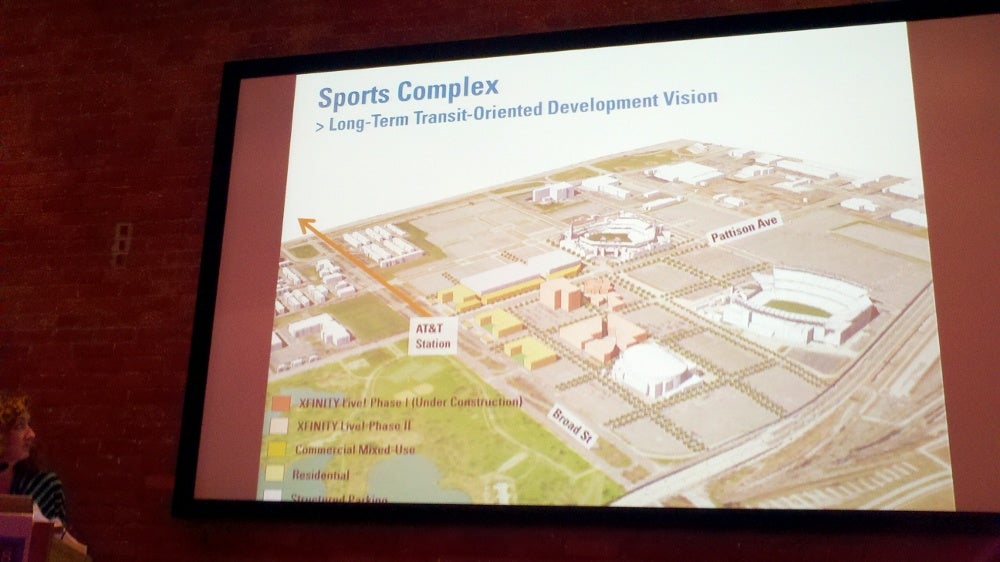
Planner Jennifer Barr described big changes for the sports complex of the future, building on PhillyLive, the first non-sports venue in the complex, which is expected to open this spring.
“We’d like to see any new development that might at the sports complex to be urban, to meet both the needs of tourists, people coming down to enjoy events, but also the needs of the residents.” The idea is that much of the development would be focused around AT&T Station – the subway stop.
Exploration to be done to see if there is a market for more residential development near the complex, she said.
Barr gives the Lower South District Plan draft presentation
Before that long-term, 2035 vision can happen, infrastructure improvements are needed, Barr said. Extending Terminal Avenue and 7th Street would provide “another valve” for car drivers to get out of the area on event days, because it would allow them to connect to Broad Street.
“Also, we’d like to think about introducing street grid into any future developments that might happen where there is surface parking now,” she said.
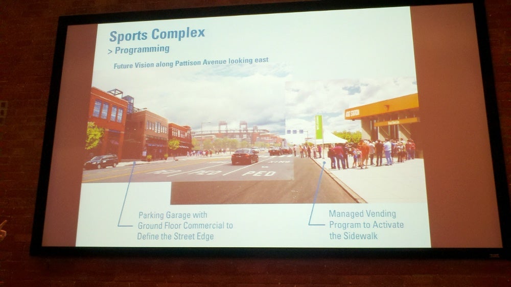
Barr showed a photo illustration of both short-term and long-term improvements to the part of Pattison Avenue where people walk from transit to the events. In the short term, planners would like to see the area energized by the presence of high-quality, more-organized street vendors selling everything from food to T-shirts.
The picture of the future shows a row of stores and restaurants geared toward pedestrians on the sidewalk, but masking a parking garage behind them.
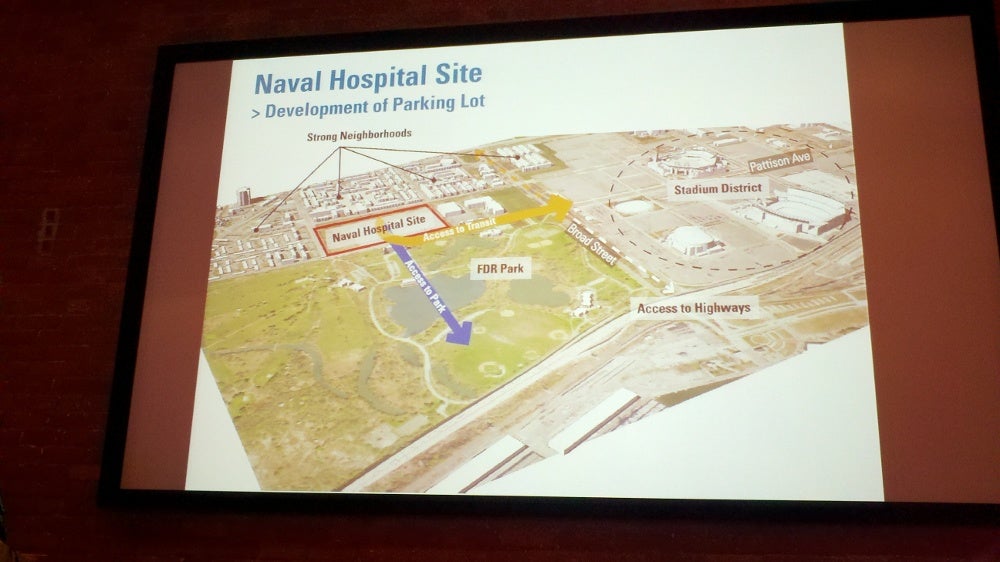
The plan calls for the former Naval Hospital site, now used as employee parking for the sports complex, to be re-developed with mixed commercial and residential development. Some residences would be specifically for seniors, for whom there is a dearth of housing in South Philadelphia, Barr said. Here again, streets would be extended through the development. This would better link the new and existing neighborhoods with FDR Park, and provide views through the new development to the American Swedish Museum.
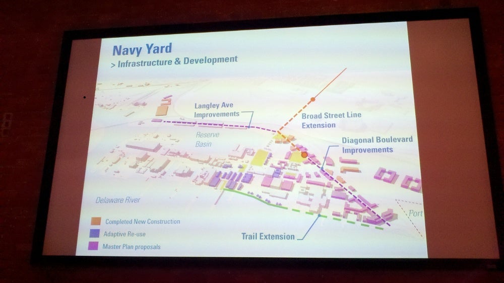
Long-range plans for the Navy Yard include improved public transit – SEPTA is interested in extending the Broad Street Line – and other steps aimed at fostering the growing commercial and industrial uses, and the energy research hub.
Short term recommendations call for:
-Conducting an environmental assessment of the Naval Hospital site to determine any problems and releasing a Request for Qualifications to garner interest in development of the site.
-Conduct an alignment and engineering study to lay the ground work for a future extension of the Broad Street subway line.
-Revising the Special Purpose Sports Stadium District text. There won’t be any zoning classification changes, said Barr, but language outlining use from all of the various leases and other documents would be complied into a single document so anyone can tell what is or what is not allowed their by looking at a single document.
The unveiling of the two plans took place during a special meeting of the Philadelphia City Planning Commission. Usually public comment is taken near the end of each meeting, but Greenberger said since the room was hot and people wanted to get home, comments should be submitted by email to Phila2035@phila.gov. Comments must be received by March 1. The West Park and Lower South plans are slated to go back before the planning commission for a vote on final adoption at their regular March 20 meeting. To learn more about the comprehensive plan and see the full drafts of Lower South and West Park, go to the Philadelphia 2035 website.
Staff has begun working on the next district plans for the Central, University/Southwest and Lower Northeast. The first public input meetings are expected to be held in March.
Reach the reporter at kgates@planphilly.com
WHYY is your source for fact-based, in-depth journalism and information. As a nonprofit organization, we rely on financial support from readers like you. Please give today.


