‘Bottom-up’ plan underway to catalogue N.J.’s vulnerable coastal communities
The Department of Environmental Protection is increasingly focusing on the roughly 1,800 miles of tidal marshes, estuaries and back bays of New Jersey’s coastal zone.

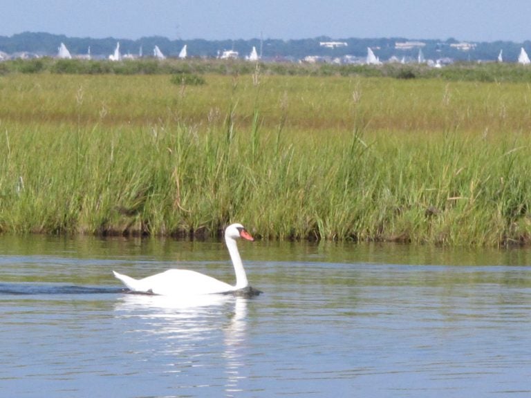
A swan swims in Barnegat Bay in Toms River, N.J. (AP Photo/Wayne Parry)
This story originally appeared on NJ Spotlight.
___
As the Murphy administration works toward its goal of better preparing the state for the impacts of climate change and reducing greenhouse gas emissions by 80% by 2050, the Department of Environmental Protection is increasingly focusing on the roughly 1,800 miles of tidal marshes, estuaries and back bays of New Jersey’s coastal zone.
But with well over 100 municipalities in that region, most with their own land use rules and needs, and each with a unique set of environmental challenges, it would be virtually impossible to develop from Trenton alone a comprehensive outline of climate priorities based on urgency and individual vulnerability.
To avoid the blind spots that can come from top-down climate policy and funding allocations, a team of researchers from the DEP, Rutgers University, Jacques Cousteau National Estuarine Research Reserve, Partnership for the Delaware Estuary, and other environmental groups is working at the local level to map areas across the state that offer the largest value for net carbon sequestration, ecosystem health, and community resilience — three key priorities in Gov. Phil Murphy’s climate agenda.
“Ecosystem projects need landowner and community buy-in and need to be maintained over time to function, just like a garden,” said Liz Semple, a manager in the DEP’s Office of Coastal and Land Use Planning. “We’re looking to identify areas and ultimately projects that will have state, regional or local/nonprofit champions.”
Harnessing local knowledge
The initiative, called the Coastal Ecological Restoration and Adaptation Plan and funded by a $150,000 grant from the DEP, will be implementing a nomination process to identify projects that address these priorities in critical areas of the state. Ultimately, the list will be synthesized into a publicly available map layered with in-progress and potential projects that focus on either environmental restoration, enhancement or preservation. Completed projects going back at least 10 years will also be included.
“The result of this effort will be a mapped catalogue of sites and projects to help inform the DEP and others on where resources could be allocated for future projects,” said Richard Lathrop, director of Rutgers University’s Center for Remote Sensing and Spatial Analysis and one of the project’s leads. “And to help the human and natural communities in the state’s coastal zone adapt to ongoing climate change and sea level rise.”
The process for soliciting future restoration and adaptation projects will kick off with a webinar on April 14. Along with officials from all levels of government and organizations like the Barnegat Bay Partnership, NY-NJ Baykeeper, and the Partnership for the Delaware Estuary, the public is also invited to participate and nominate projects.
“This initial nomination process represents a bottom-up approach to harness local knowledge about problem areas in our coastal zone,” said Lathrop. “And to also identify gaps where there might be issues that haven’t been recognized.”
The key issues
Lathrop and his colleagues began developing the project last spring and received funding approval from the DEP in October. In that time, they have homed in on eight issues that future restoration, enhancement or preservation projects may improve:
- Coastal ecosystem degradation and habitat loss
- Shoreline erosion
- Coastal flood damage
- Nuisance flooding
- Coastal storm damage
- Water quality degradation
- Loss of CO2 sequestration
- Social vulnerability
Restorative projects would encompass problems like ecosystem degradation, habitat loss, and water quality degradation, due to factors like pollution and development, as well as shoreline erosion caused by sea level rise.
Coastal storm damage and nuisance flooding can be assuaged in some areas through enhancement projects like living shorelines and replenishment using materials from adjacent channel dredging.
Land preservation — unlike conservation, which seeks to regulate human manipulation of nature rather than eliminate it altogether — would benefit New Jersey’s efforts to boost CO2 sequestration, which is quickly becoming a priority for the state.
New Jersey’s wetlands, especially those along the southern Atlantic and Delaware Bay coasts, hold the state’s most effective carbon sinks, which are considered integral to reducing CO2 concentrations in the atmosphere.
“But sea level rise has the potential to ‘drown’ and destroy coastal marshes, which would release huge amounts of this stored carbon dioxide into the atmosphere,” said Jacques Cousteau National Estuarine Research Reserve’s Vanessa Dornisch, who is working on outreach and communications for the project.
When all the data has been collected for the project’s ArcGIS map, the hope is that Lathrop and his team will be able to assign estimated levels of vulnerability to each of these areas of concern in every municipality within New Jersey’s coastal zone.
A detailed map of vulnerability
The eighth issue of concern — social vulnerability — intersects with every type of project, whether it be focused on restoration, enhancement or preservation. A more resilient shoreline might mean the difference between costly flooding and staying dry; preserved or enhanced open space could help improve air quality or simply provide space for healthy recreation.
Integrating social vulnerability, then, makes public input all the more important for an initiative like the Coastal Ecological Restoration and Adaptation Plan. While the nomination process will be geared toward participating governmental officials and environmental organizations — since they will be the entities implementing the projects — “we also want to include private citizens who are interested in planning a restoration project at a neighborhood site,” said Dornisch.
Josh Moody, restorations programs manager for Partnership for the Delaware Estuary, agreed. “No one knows better what is occurring in an area and how dire it is than the people who live there,” he said. “Coastal resilience planning can be very effective when top and bottom perspective are aligned to identify the areas important to everyone — residentially, recreationally and ecologically.”
WHYY is your source for fact-based, in-depth journalism and information. As a nonprofit organization, we rely on financial support from readers like you. Please give today.


