Rescuing earthquake survivors…there’s a map for that
Listen
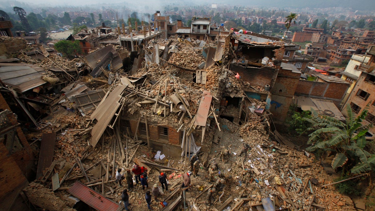
Rescue workers remove debris as they search for victims of earthquake in Bhaktapur near Kathmandu
In the wake of massive earthquakes or floods, resue efforts relied on muscle power. But in the digital age, social media is playing a bigger and bigger role in saving lives.
Rosy Karmacharya was getting ready to eat lunch when the first 7.8 magnitude earthquake hit Nepal on April 25, 2015.
“I was standing in the kitchen,” she says. “I couldn’t do anything. It started shaking and everything started falling down.”
Karmacharya lives in the Bhaktapur neighborhood of Kathmandu, one of the hardest hit places in the Nepalese capital. When the quake struck, she was home with her younger sister.
She was on the fourth floor but as the foundation shook, she found herself falling, eventually to be stuck halfway through the floor and the wall, with her legs in one room and arms in another.
Miraculously, she survived the fall and quickly looked for a way to take control of the situation.
“I told [my sister] to take out the mobile from my pocket, and I’ll call my uncle for help. But there was no connection; we were not able to connect to anybody,” she recalls. “And even if we tried, nobody was there to hear us.”
Later she found out her neighbors could hear them yelling, but no one knew how to get inside the rubble. They were trapped: “I was thinking oh my god this must be my imagination, this couldn’t happen to us. This might be a nightmare.”
Solving problems like this is the work of Prabhas Pokharel, a fellow at Kathmandu Living Labs. His organization is working to provide a crucial piece of infrastructure in Nepal that saved people like the Karmacharyas: maps.
As Pokharel explains, “One of the issues we had is that in the early days we didn’t know where people were most affected and where people providing relief should go.”
The Living Labs’ maps of Nepal provide exactly that, because they aren’t your average piece of cartography. They look like Google Maps but layered with information about buildings, like which are damaged; hospitals, including which ones have open beds; and roads, including ones too crumbled to drive on.
During the latest earthquake, a lot of the hardest hit areas were in the remote areas that haven’t necessarily been mapped before. The Living Labs empower residents to map their own homes, and because they know the places so well, they’re some of the best cartographers.
“The online volunteer community has contributed in an amazing way, so in a lot of the affected districts we have maps that are all of a sudden some of the best maps available for Nepal,” says Pokharel.
People were also able to use the maps to call for help. Even though phone lines were down across the country, in many cases, the Internet still worked – so one group in Dolokar used it to put a pin on the Living Labs’ map site and send an S.O.S.
There were 20 people in a school that were scared about landslides and didn’t know who to call, says Pokharel. “They put up a report and then we were able to call them and figure out what was going on.”
People who build these types of maps call them “crisis maps,” and it’s not just in Nepal. Now, when a disaster strikes, crisis maps are one of the first pieces of aid that hit the ground.
“Venwatu with the typhoon, Napa California with the earthquake that they had, flooding in the Midwest, you name it,” says Chris McIntosh, emergency manager for Esri, formerly known as the Environmental Systems Research Institute.
Esri is the worldwide version of Kathmandu Living Labs, working at a much bigger scale. McIntosh says people who aren’t familiar with crisis mapping think it’s just about finding a little dot on a globe. But he thinks of it more as a phone line.
“Instead of voice communication, you’re sharing data and information. Everything is somewhere,” he says. It’s almost like having another language that everyone shares, in GPS coordinates.
Chris says crisis mapping is the tool you hope you don’t have to have. However for now, for survivors of the earthquake, they’re just grateful someone’s keeping an eye on them.
“I feel like I was saved by the Gods or something like that,” says Karmacharya.
It’s going to take her family another five to six months to begin rebuilding their house. And when they do, Kathmandu Living Labs will undoubtedly be one of the first to put them back on the map.
WHYY is your source for fact-based, in-depth journalism and information. As a nonprofit organization, we rely on financial support from readers like you. Please give today.


