

Historic Virginia island fights for its future amid rising seas
Listen
The island of Tangier is facing rising seas because of climate change. (Carolyn Beeler/WHYY)
A historic community on Tangier Island in the Chesapeake Bay may be underwater in 50 to 100 years. With increasing competition for money to protect against rising seas, this tiny town faces a big fight for its future.
Tangier Island is a place caught between its past and its future.
Most of the residents on the island in the Chesapeake Bay are descendants of the original British families who first settled here. They speak with a unique Cornwall, England-tinged accent, and though the crab industry here is shrinking in importance, Tangier still identifies as a town sustained by the bay’s bounty, as it has been for generations.
But the island’s biggest threat is a very twenty-first century one: sea level rise.
Standing in front of one Tangier’s two churches on a late-summer afternoon, longtime resident Carolyn Charnock explained to me that during Nor’easters, storm waters flood the streets here, blocks inland from the harbor.
Charnock has lived all but two of her 72 years on the island, and remembers a path she used to walk as a girl to get to the beach.
“Now it’s in the water,” Charnock said.
Living on an island shaped by the water
Tangier Island is located in the Chesapeake Bay between Virginia’s mainland and the thin peninsula of the state’s eastern shore, about halfway between Washington, D.C. and Norfolk.
Crab shacks and piles of cages line parts of the Tangier Island shore, greeting visitors who arrive by ferries from nearby Maryland or Virginia towns. Inland from the harbor, the island’s houses have tidy yards dotted with white crosses and lined by white picket fences. With few cars on the island, scooters and golf carts rented by visitors for tours rule the road.
This inhabited part of the island is just a fraction of its historical size.
In the first few decades of last century, the residents from the upper half of the island moved to the lower half, as erosion overtook “Uppards” and turned yards and streets into marsh. Today, fewer than 500 people live on Tangier, down to about a third of the population from the early 1900s.
Within a century, scientists expect the entire island to be underwater. Due to a combination of sea level rise and subsidence caused by glacial rebound, water levels in this region of Virginia are expected to rise between four and six feet by century’s end.

Floodwaters from Hurricane Isabel surround houses on Tangier Island, Virginia in 2003. The island was evacuated for Hurricane Isabel and sustained flood and wind damage. (AP Photo/Steve Helber)
The land on Tangier had been eaten away by erosion for as long as anyone can remember. Some Tangier islanders don’t believe that sea level rise is accelerating, or that rising waters will make erosion worse and eventually cover the island. But they do agree that the island has a problem.
“We don’t have any protection,” said Tangier mayor James “Ooker” Eskridge. “The island itself is only three or four feet above sea level, and it’s just soft material, sod.”
“I don’t believe the erosion has increased,” Eskridge continued, “it’s been going on since Captain John Smith came up the bay, but when it gets to your doorstep you pay more attention to it.”
Eskridge said the island looses 10 to 20 feet of shoreline per year in some unprotected areas. The day I talked to him, one of his offshore crab pots got stuck in the roots of a tree that used to be standing on dry land.
It’s a long fight for improvements on Tangier
While the causes may be debated, everyone on Tangier agrees the island is shrinking and needs help. About 25 years ago, the Army Corps of Engineers built a sea wall that protects the island’s airstrip and sewage system.
Now, the Corps is planning to build a stone jetty on the west side of the island to protect the harbor. The jetty was approved almost 20 years ago, but it wasn’t until after Hurricane Sandy in 2012 that Congress appropriated $3.2 million for it. Virginia is kicking in nearly a million dollars more.
Construction is slated to begin in the next two years, but Mayor Eskridge knows it won’t save the whole island.
“We have nothing really going on the east side of the island to protect us, and whenever we get tropical systems, hurricanes or tropical storms, that’s where the wind will be on the east side,” Eskridge said.
Eskridge and others believe what Tangier really needs is a seawall going all the way around the island.
“I got grandkids living here, you know,” said Mark Crockett, a crab fisherman turned ferry captain and proponent of the wrap-around seawall idea. “I ain’t gonna probably be here much longer, but they’re coming along and I want it to be here for them.”
It’s hard for Tangier Islanders not to compare themselves to residents on Smith Island, the only other inhabited island in the Chesapeake Bay.
There, residents fought offers of government buy-outs after Sandy and are now receiving disaster relief funds to shore up the island. About $9 million of that is going to build a living shoreline to protect a national wildlife refuge.
“They could do stuff like that down here, but they won’t do anything to even try to save a little place,” said Norwood Evans, who grew up on Smith Island. “There’s so much washing away from here it’s unreal how quick it’s going.”
Evans moved to Tangier from Smith Island when he married a local girl more than two decades ago.
“I love living on this little island,” Evans said. “You know everybody and all, and it’s a unique place. For the stuff that I love to do for sport, like fishing and hunting and all, (there’s) no place like it on earth, I don’t think.”
He said it is time to start bringing more attention to Tangier’s looming crisis.
“If people don’t start talking about it it’s going to be too late,” Evans said. “We need help right now.”
Tangier’s near future a question of money and political will
The biggest problem with securing Tangier’s short-term future is money.
As more communities start to plan for sea level rise, regional planner Curtis Smith said competition for funds to lift houses or armor the shoreline is getting fierce.
Smith is the director of planning for the Accomack-Northampton Planning District Commission, the regional planning organization that includes Tangier Island.
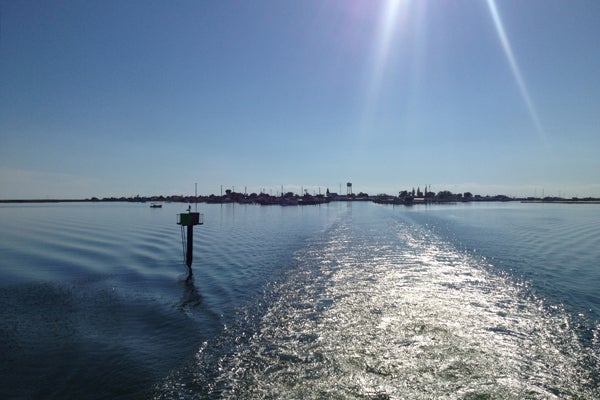
The view of Tangier Island from a departing ferry. (Carolyn Beeler/WHYY)
“It definitely seems like there’s more localities competing for the funds than there were previously,” Smith said. “And it’s harder for rural, small localities like the ones that we work with on the Eastern shore to compete for those funds.”
Smith said tiny towns have fewer staff members to work on grant applications, and it is harder for them to raise the matching funds many federal grants require.
“The largest town we have is less than 4,000 people, and the majority of the towns in my region are less than 1,000 people, and we’re competing against New York and New Orleans and Miami,” Smith said. “It’s definitely an uphill battle.”
The Army Corps of Engineers has proposed breakwaters off the western shore of the Island to prevent erosion, but the Corps said neither the feds nor local partners have shown much interest in funding the project.
With seas rising, questions emerge on what to protect
Smith and Tangier Islands are in trouble, but by many measures they’re both in better shape than other towns that don’t have the same quaint tourist appeal.
Skip Stiles, head of the Norfolk, Virginia-based conservation group Wetlands Watch, points to Saxis. It’s a town on the Eastern shore of Virginia that juts out into the bay east of Tangier.
“[They’re] two communities on the bay that are being inundated, about the same size, one gets a $4-million sea wall and the other doesn’t,” Stiles said. “How did we make that decision? How should we make those decisions?”
As we begin to answer these tough questions for the first time, Stiles argues conflict is inevitable.
Fortifying an island that computer models show will be completely under water within a lifetime may seem like a waste to some. But if it is your home you’re trying to protect, buying time and hedging your bets against rising seas is understandable.
“If I’m living in Kansas, it probably makes a lot of sense to simply pull the plug and pay people to move off the island,” Stiles said. “If I’m on Tangier and I’ve been there since the first ships arrived, it’s a much more difficult decision.”
A difficult decision Tangier is facing now, and many more communities will face in the future.
Reporting for this story was made possible, in part, by a fellowship from the Institute for Journalism and Natural Resources.
WHYY is your source for fact-based, in-depth journalism and information. As a nonprofit organization, we rely on financial support from readers like you. Please give today.
Brought to you by The Pulse
