Tropical Storm Watch up for Philly region as Isaias heads north
Forecasters with the National Weather Service said the biggest concern for the Philadelphia region is heavy rain that could lead to flooding on Tuesday.

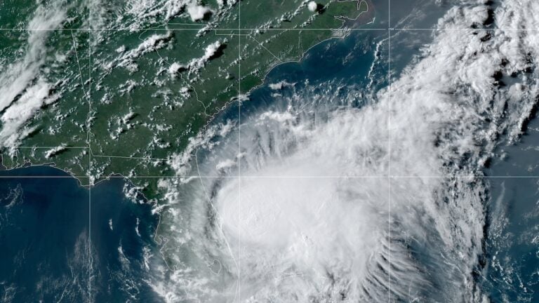
Forecasters with the National Weather Service said the biggest concern for the Philadelphia region is heavy rain that could lead to flooding on Tuesday. (NOAA)
The National Weather Service issued a Tropical Storm Watch late Sunday afternoon for the entire region as Tropical Storm Isaias spins off the Florida coast.
As of 5 p.m. Sunday, Isaias is located about 65 miles southeast of Cape Canaveral, Florida, according to the National Hurricane Center. The tropical storm is producing 70 mph sustained winds and heading north-northwest at 9 mph.
As of Sunday afternoon, the National Weather Service anticipates impacts from Isaias to begin Monday night and continue through Wednesday morning.
Tropical storm watches have been issued for much of the local area. Forecast track for #Isaias on the 500 PM advisory is below. pic.twitter.com/SJnwQGfuw3
— Gary Szatkowski (@GarySzatkowski) August 2, 2020
Dean Iovino, a meteorologist at the National Weather Service office in Mount Holly, New Jersey, expects the region to experience multiple weather hazards, mainly on Tuesday.
The biggest concern for the region, Iovino says, is heavy rain.
“It looks like a lot of the area will receive anywhere from two to four inches of rain, and some areas could receive four to six inches, so that would lead to some flooding,” he said.
In addition to heavy rainfall that could lead to flooding, forecasters anticipate sustained winds at 35 to 45 mph, gusting up to 50 mph, between Tuesday afternoon until early Wednesday morning. Scattered power outages are possible.
Limited tidal flooding in areas prone to storm surge is also possible on Tuesday, along with moderate beach erosion. Isolated tornadoes are also possible.

Get daily updates from WHYY News!
WHYY is your source for fact-based, in-depth journalism and information. As a nonprofit organization, we rely on financial support from readers like you. Please give today.


