Tropical Storm Watch in effect for the Jersey Shore

The Jersey Shore might experience some impacts from Hurricane Jose, a cyclone that forecasters expect to pass offshore Tuesday into Wednesday.
A Tropical Storm Watch is in effect for the Jersey Shore, according to the National Weather Service.
That means tropical storm wind conditions (39 miles per hour or greater sustained) are possible somewhere at the Jersey Shore within the next 48 hours.
As of late Sunday afternoon, the National Hurricane Center expects the center of Hurricane Jose to probably pass 200 to 250 miles east of New Jersey later Tuesday or early Wednesday.
According to a bulletin issued late Sunday afternoon, the National Weather Service expects the following impacts:
Wind:
- Below tropical storm force wind. Peak wind forecast: 20 to 30 mph with gusts to 45 mph. As of late Sunday afternoon, the National Hurricane Center forecasts a 30 to 40 percent chance of tropical storm force winds at the Jersey Shore.
- Emergency planning should include a reasonable threat for tropical storm force wind of 39 to 57 mph. To be safe, prepare for the potential of limited wind impacts. Efforts should now be underway to secure all properties.. Hazardous wind is possible. Failure to adequately shelter may result in serious injury.
- Damage to porches, awnings, carports, sheds, and unanchored mobile homes is possible. Unsecured lightweight objects could be blown around.
- Many large tree limbs may be broken off. A few trees could be snapped or uprooted. Some fences and roadway signs may be blown over.
- A few roads could be impassable from debris. Hazardous driving conditions are possible on bridges and other elevated roadways.
- Scattered power and communications outages are possible.
Tidal flooding:
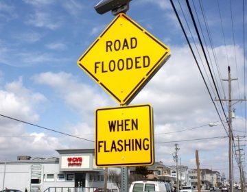
- Widespread minor to possibly moderate tidal inundation coastal flooding is expected with the Atlantic coast high tide cycles Monday evening through Tuesday night due to the passage of Hurricane Jose.
- Whether it is moderate is debatable but we have several model guidances suggesting 2 to possibly 3 consecutive high tide cycles of moderate coastal flooding are possible.
- The high tide cycle of greatest concern at this point is the Tuesday evening high tide, especially Sandy Hook to Cape May.
Rain:
- Around one inch.
- Emergency planning need not include a threat for rainfall flooding.
- Locally heavy rain and nuisance flooding may still occur.
- Little to no preparations needed to guard against excessive tropical rainfall.
- Ensure readiness for the next tropical rainfall event.
WHYY is your source for fact-based, in-depth journalism and information. As a nonprofit organization, we rely on financial support from readers like you. Please give today.


