Tropical Storm Erika forms

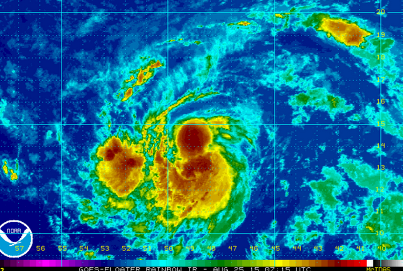
Tropical Storm Erika Tuesday morning. (Image: NOAA)
Tropical Storm Erika formed last night and is on track for the Bahamas by late this week, according to the National Hurricane Center.
At 8:00 a.m AST, Erika is located in the open Atlantic Ocean about 750 miles east of the Leeward Islands, packing maximum sustained winds of 45 miles per hour and higher gusts, according to a National Hurricane Center bulletin.
The tropical storm is currently moving westward near 20 miles per hour, according to the bulletin. Forecasters expect a westward to west-northwest motion slightly decreasing over the next 48 hours.
According to the center’s forecast, Erika will approach the Leeward Islands by Wednesday night, Puerto Rico by Thursday night, and the southern Bahamas as a hurricane by early Saturday.
Forecasters expect steady strengthening for the next 36 to 48 hours as the system moves over an area with warming sea temperatures and light to moderate wind sheer.
But after that, computer forecast models diverge, with some showing additional strengthening and others less aggressive beyond 48 hours, according to the center.
“Due to the large spread in the guidance, the intensity forecast at days 3-5 is of even lower confidence than usual,” the bulletin states.
Although there is no immediate threat to any land mass, anyone traveling in the eastern Caribbean shortly should monitor all official forecasts.
The peak of the Atlantic hurricane season is on Sept. 10, which is the day when historically the maximum amount of convection and minimal amount of shear are found in the Atlantic basin, leading to the best chance of tropical system development.
With the season’s peak approaching, forecasters advise coastal residents to have a plan should a tropical system threaten or strike.
The 2015 hurricane season ends on Nov. 30.
WHYY is your source for fact-based, in-depth journalism and information. As a nonprofit organization, we rely on financial support from readers like you. Please give today.

