Severe thunderstorms possible later today

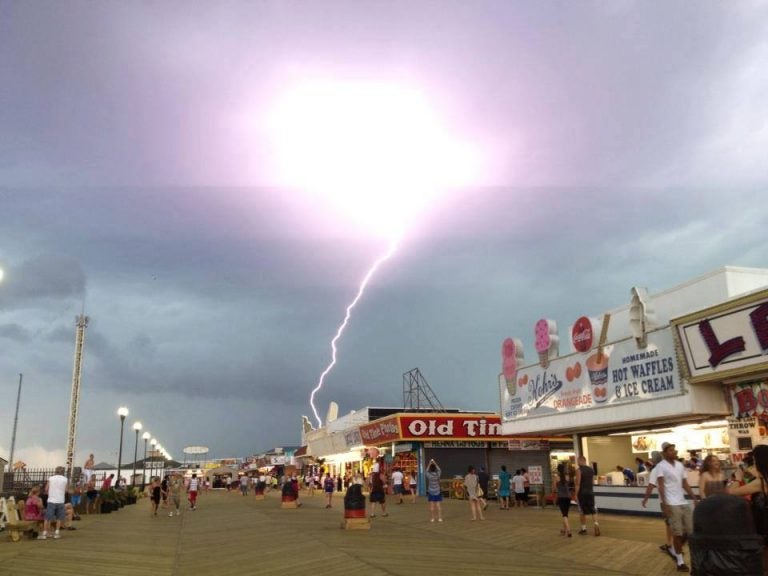
A lightning strike near the Seaside Height boardwalk as captured by JSHN contributor Jillian Speranza on June 24, 2013.
An advancing cold front this afternoon will interact with an unstable air mass, potentially sparking some severe thunderstorms, forecasters say.
Hot, hazy, and humid conditions continue, with temperatures reaching the upper 80s at the beaches and 90s inland.
At the Jersey Shore, showers and thunderstorms are possible mainly during and after the mid-afternoon hours, according to NOAA.
The activity will be advancing from west to east, moving toward the coast after passing through the I-95 corridor.
Some of the storms could reach severe levels, featuring strong winds and small hail. The threat will dissipate as the cold front passes offshore by the early evening hours.
Forecasters say the National Weather Service adage — “when thunder roars, go indoors” — applies today.
Anyone enjoying the outdoors, especially on the beaches and boardwalks, should move indoors when storms approach.
More comfortable conditions will prevail tomorrow after the cold front passage, featuring sunny skies and temperatures in the lower 80s at the coast and middle to upper 80s inland.
WHYY is your source for fact-based, in-depth journalism and information. As a nonprofit organization, we rely on financial support from readers like you. Please give today.

