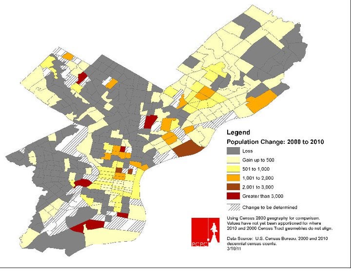
Preliminary 2010 Census Change Map
This updated “comparison map” will better steer city planners in their quest to shape the physical character of the city by offering accurate, block-by-block snapshots of population changes between 2000 and 2010.
Original Posting via Philadelphia 2035’s facebook page
WHYY is your source for fact-based, in-depth journalism and information. As a nonprofit organization, we rely on financial support from readers like you. Please give today.


