Hurricane Fred forms in the Atlantic

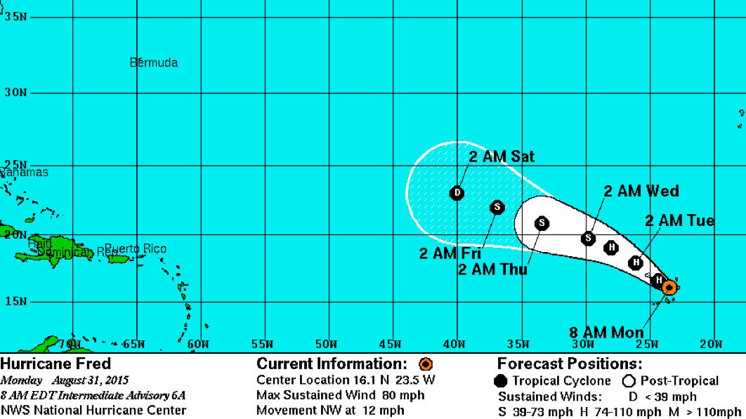
This graphic from the National Hurricane Center shows Hurricane Fred weakening to a tropical depression by early Saturday morning. (Map via NOAA)
Fred has strengthened to a hurricane as it approaches the Cape Verde Islands in the Atlantic Ocean.
The U.S. National Hurricane Center in Miami says Fred’s maximum sustained winds Monday morning are near 80 mph. Gradual weakening is forecast to begin Tuesday.
Hurricane Fred is centered about 40 miles west of Rabil in the Cape Verde Islands and is moving northwest near 12 mph.
The center of Fred is forecast to move over or near the northwestern Cape Verde Islands later in the day. A hurricane warning is in effect for the islands.
Meanwhile in the Pacific, Hurricane Jimena is moving quickly over open water. The Category 4 storm has maximum sustained winds near 150 mph.
Jimena is centered about 1,430 miles east of Hilo, Hawaii, and is moving west-northwest near 17 mph. The hurricane doesn’t currently pose a threat to land.
WHYY is your source for fact-based, in-depth journalism and information. As a nonprofit organization, we rely on financial support from readers like you. Please give today.

