Hurricane Dorian’s center to pass ‘well offshore’ Friday, but N.J. coast likely to experience impacts
Hurricane Dorian will pass "well offshore" from the New Jersey region later this week, forecasters say.

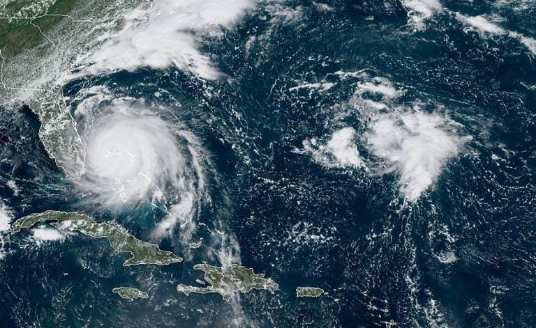
This GOES-16 satellite image taken Monday, Sept. 2, 2019, at 16:40 UTC and provided by National Oceanic and Atmospheric Administration (NOAA), shows Hurricane Dorian, (left), churning over Bahamas. Hurricane Dorian hovered over the Bahamas on Monday, pummeling the islands with a fearsome Category 4 assault that forced even rescue crews to take shelter until the onslaught passes. (NOAA via AP)
Hurricane Dorian will pass “well offshore” from the New Jersey region later this week, forecasters say.
The National Weather Service says the storm’s closest approach to the area is likely to be on Friday.
While the highest impacts are mainly for marine interests, the National Weather Service advises of:
- Northeasterly wind gusts of 40 to 50 mph, probable along the New Jersey coast and Atlantic Ocean waters
- Dangerous surf and rip currents
- Some beach erosion and coastal flooding possible Thursday and Friday
- Some rain along the coast
Conditions should then begin to improve by Friday night as the storm will be quickly moving to the northeast, according to the National Weather Service.
With hurricane season peak approaching, it’s a good idea to have a plan. The New Jersey Office of Emergency Management offers a hurricane survival guide.
Good Tuesday morning! It will be another warm day, however it is anticipated to be dry. The main focus is where does Hurricane Dorian go. Here are the latest local key messages focusing in on the Thursday through Friday time frame. #njwx #dewx #pawx #mdwx pic.twitter.com/dWDStzi3pt
— NWS Mount Holly (@NWS_MountHolly) September 3, 2019
WHYY is your source for fact-based, in-depth journalism and information. As a nonprofit organization, we rely on financial support from readers like you. Please give today.


