How the impending long duration nor’easter will impact New Jersey
Listen
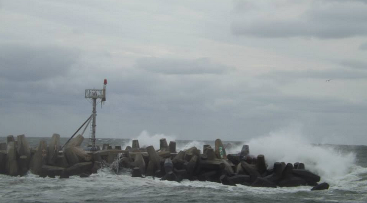
Manasquan Inlet Wednesday morning. (Photo: Jerry Meaney/Barnegat Bay Island, NJ via Facebook)
A coastal storm that is expected to stick around New Jersey for at least a few days is now approaching the New Jersey area from the south.
Conditions will begin to deteriorate Wednesday evening, with rain developing from south to north and wind steadily increasing. The most adverse conditions are expected Thursday and early Friday.
If you live on the coast, you will see the most impacts from the system, but to be crystal clear: this is not a strong coastal storm, nor will it deliver impacts similar to Irene or Sandy.
Let’s break it down.
Coastal flooding
Minor coastal flooding is expected today during the high tide cycle in all tidal areas from Ocean County to Cape May as well as the Delaware Bay.
The National Weather Service has issued a Coastal Flood Advisory for those areas from 10 a.m. until 3 p.m. Wednesday.
High tide along at the Atlantic beaches occurs between 11 a.m. and 12:30 p.m. today, while the back bays and Delaware Bay experience high tide later than the oceanfront.
There are currently no tidal flooding advisories for Monmouth County.
A Coastal Flood Watch has been issued for the same areas for Thursday — again, excluding Monmouth County — indicating that moderate coastal flooding is possible.
“Rain drive by gale force northeast winds combined with high surf could result in even greater coastal inundation flooding during the midday and afternoon hours on Thursday,” the National Weather Service advises.
And the risk is not limited to Wednesday and Thursday, as the National Weather Service advises that coastal flooding may be an issue during high tide cycles through the weekend.
Rain
The latest guidance from the National Weather Service’s Weather Prediction Center indicates that about four inches of rain could fall over the course of several days in southern half of the Garden State.
Rainfall amounts become progressively lower in areas north and west — away from the ocean — but the forecast indicates that at least an inch of rain will fall in northwest New Jersey.
Winds
The closer you are to the coast, the windier it will be.
The National Weather Service has issued a Gale Warning for coastal waters from Manasquan Inlet to Cape May through Thursday afternoon. Seas are expected to run about 8 to 12 feet, gradually subsiding Friday through the the weekend.
On the beaches, there will be sustained northeast winds at 25 to 35 miles per hour, with gusts around 45 miles per hour. Winds will be progressively lighter each mile away from the coast.
Timing
With today being “hump day,” you’re likely wondering if the storm will impact your weekend plans. Unfortunately, it’s a tricky call.
Forecasting model guidance suggests that while steady rain will end by Saturday, the continuing onshore flow may keep the New Jersey area, especially along the coast, cool, dark, and damp all weekend. There will be a chance of showers. On the bright side, the heaviest rain will likely end by Friday. Stay tuned as the forecast evolves.
High temperatures Wednesday through Sunday will be in the middle to upper 60s.
WHYY is your source for fact-based, in-depth journalism and information. As a nonprofit organization, we rely on financial support from readers like you. Please give today.

