From Above: Race Street Pier and High-Pressure Fire Service Building, 1926
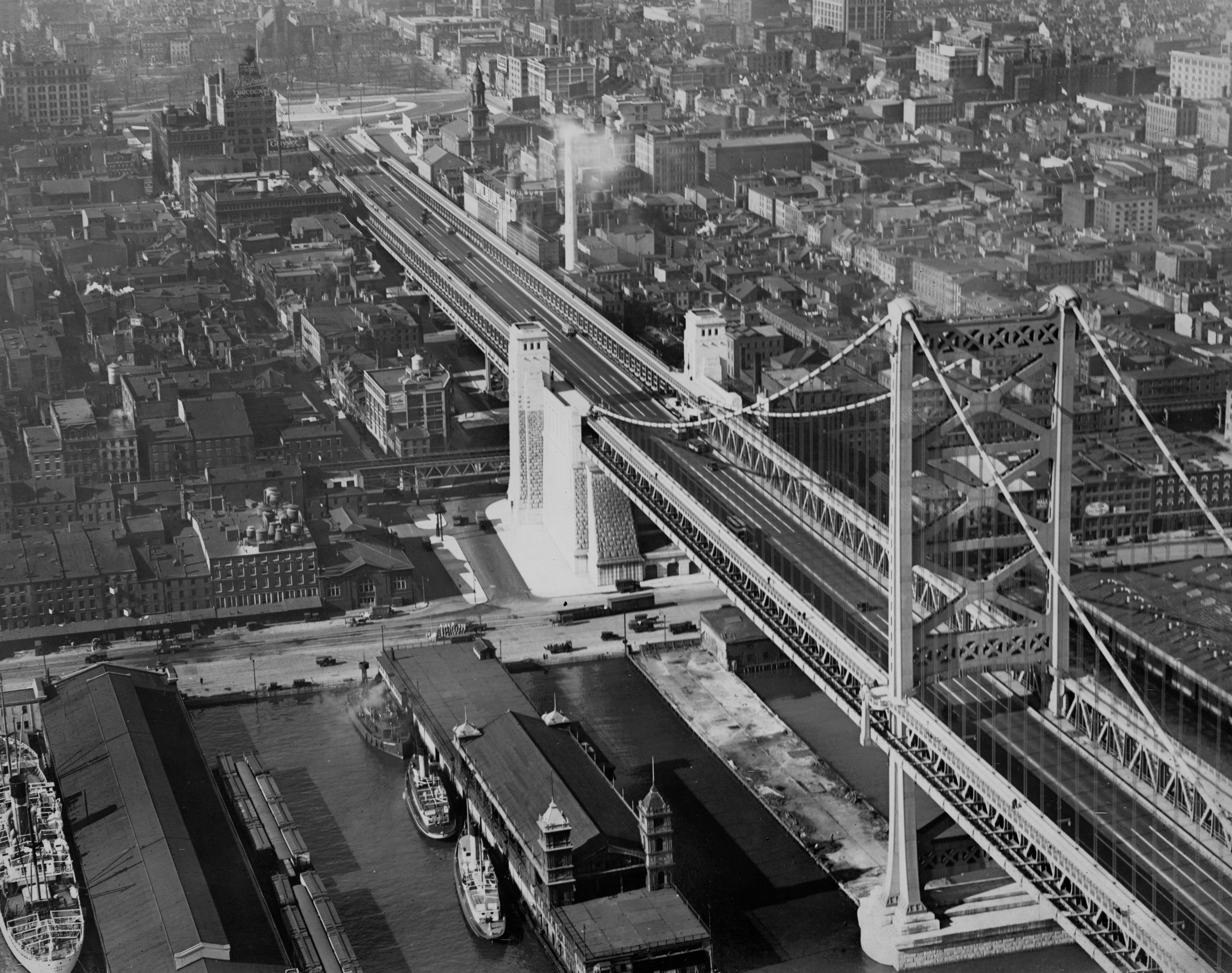
For this installation in our From Above series, we head to a hot spot on the Central Delaware Waterfront for a view of the old Race Street Pier and High-Pressure Fire Service building on November 23, 1926.
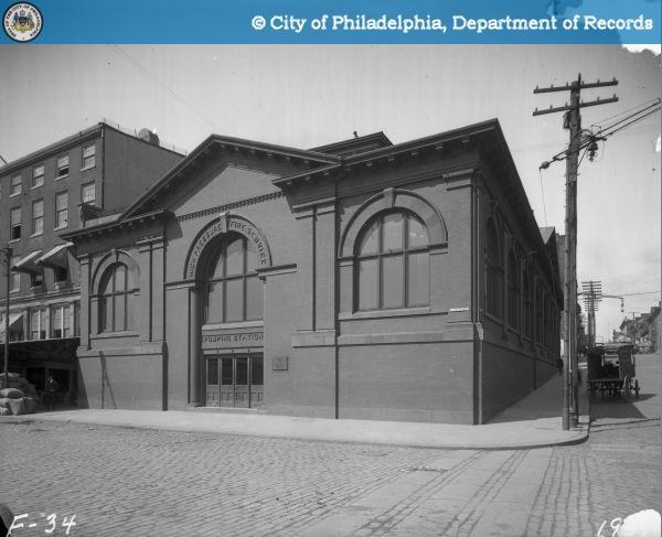
Now that Fringe Arts has started to convert the former High Pressure Fire Service pump house at Race Street and Delaware Avenue into a performing arts hub, I thought it was time to share this aerial photograph showing their future HQ. Here’s how it looked in 1926 alongside the freshly-completed Benjamin Franklin Bridge and the old municipal pier at Race Street.
By 1926 the High Pressure Fire Service pump house had been in use for 23 years, feeding a special hydrant system that fire insurers prompted the city to install in a portion of Center City and the Kensington mill district. (For more on the history of that system, read this fantastic piece on Necessity for Ruins.)
As it happens, in July of 1926 the Benjamin Franklin Bridge (then called the Delaware River Bridge) opened after four years of construction. Seen from above on this November day, traffic is light on the new crossing, it’s new stone anchorages gleam, and there is some sort of pier connecting the shore to the first tower. Follow the bridge approach toward Franklin Square and the plaza at its terminus makes much more design sense that it does today amid its highway tanlge. Just north of the bridge we can see the smokestack from Wilbur’s Chocolates billowing away and the tower from Napolean LeBrun’s St. Augustine Catholic Church rising above 4th Street. The Market-Frankford El tracks are visible below the bridge approach, another visual reminder of what this place looked like before I-95.
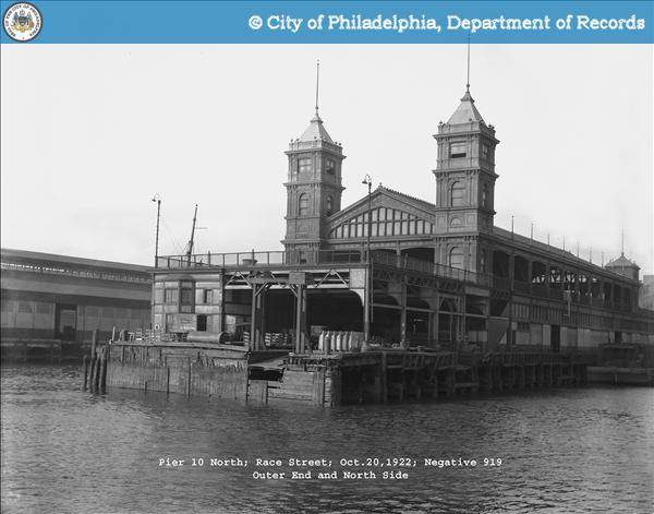
Just south of the bridge this image also provides a cool view of the old Race Street Pier, complete with its fabulous dual towers. (See another view of it at left.) This version of the Race Street Pier was built in the late 1890s with multiple levels that accomodated both shipping and recreation – a design feature that inspired the current Race Street Pier park’s tiered landscape.
_________________________________________________________________________________________________________________________________
NOTE: The aerial image above is part of the Free Library’s Print and Picture Collection, and is used by PlanPhilly/Eyes on the Street with the express permission of Aerial Viewpoint, which owns these aerial images. For reproductions contact Aerial Viewpoint.
To learn more background about these aerial photographs, head over here.
WHYY is your source for fact-based, in-depth journalism and information. As a nonprofit organization, we rely on financial support from readers like you. Please give today.

