Bike-to-transit crowdsource map wants your input

Would you bike to public transportation if there were better bicycle parking options at your local station? Would better transportation amenities make you less inclined to drive for any or all of your commute?
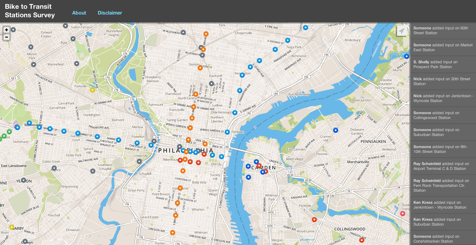
The Bicycle Coalition of Greater Philadelphia, Delaware Valley Regional Planning Commission and three regional transit agencies want to know, and to get feedback they have launched a bike-to-transit crowdsource map. The map-based survey lets users click on a specific station and tell whether or not they currently bike to the station, if the station has adequate bike parking and if they would bike if parking were improved.
The idea behind this is to reduce the number of people who drive for all or part of their daily commute and, to do so, improve the last mile between commuters’ beginning and end points and their local public transportation options.
Improved bike parking at transit stations has been a longtime goal of the Bicycle Coalition.
“In our discussions with SEPTA the question was always raised, where to place the parking,” said Sarah Clark Stuart, Bicycle Coalition campaign director. “… Given how many transit stops [SEPTA has], it’s not unreasonable for them to wonder how to prioritize their investments.”
Stuart said the map, which was created with the help of Open Plans, will help show where investment is most needed.
“If one station gets 30 of these responses and one [station] only gets three, that shows where the demand is,” she said.
For the most part improved bicycle parking means abundant, secure parking and would likely come in the form of sheltered bicycle parking hubs in open areas, which would ideally deter theft. The shelters may also have additional lighting and possibly camera surveillance.
The survey will also help identify gaps in the bicycle trails around transit stations.
“The potential benefit is that more people are encouraged to bike to a transit station and take transportation to their work place rather than drive to a train station where parking is limited… or drive to their office,” Clark said.
The bike-to-transit crowdsource map started as two separate projects, said DVRPC’s Greg Krykewycz, Office of Transit, Bicycle and Pedestrian manager.
“The Bicycle Coalition had this survey in mind and we had [a comprehensive, regional] study in mind, and we just put our heads together,” Krykewycz said.
DVRPC will be analyzing all kinds of data from land use to street networks, job concentrations and more. The survey, which allows for open-ended participant feedback, is the other half of the study – the public preference and public input half.
DVRPC and the Bike Coalition hope to get feedback from the public as well as regional planning partners.
Because this is a regional study, the map-based survey includes SEPTA, New Jersey Transit and PATCO stations. The user-friendly survey also allows participants to see what others have said about the various stations.
“We’re basically trying to get as many ideas as we can for all sorts of improvements,” Krykewycz said.
The Bicycle Coalition encourages cyclilsts and non-cyclists alike to respond to the survey, which is available until December 1 at http://biketotransit.shareabouts.org/page/about.
Contact the reporter at cfisher@planphilly.com
WHYY is your source for fact-based, in-depth journalism and information. As a nonprofit organization, we rely on financial support from readers like you. Please give today.


