Battle over Pa.’s congressional district map begins in federal court in gerrymandering case
A group of Pennsylvania voters are calling for a new map before the 2018 midterm elections.

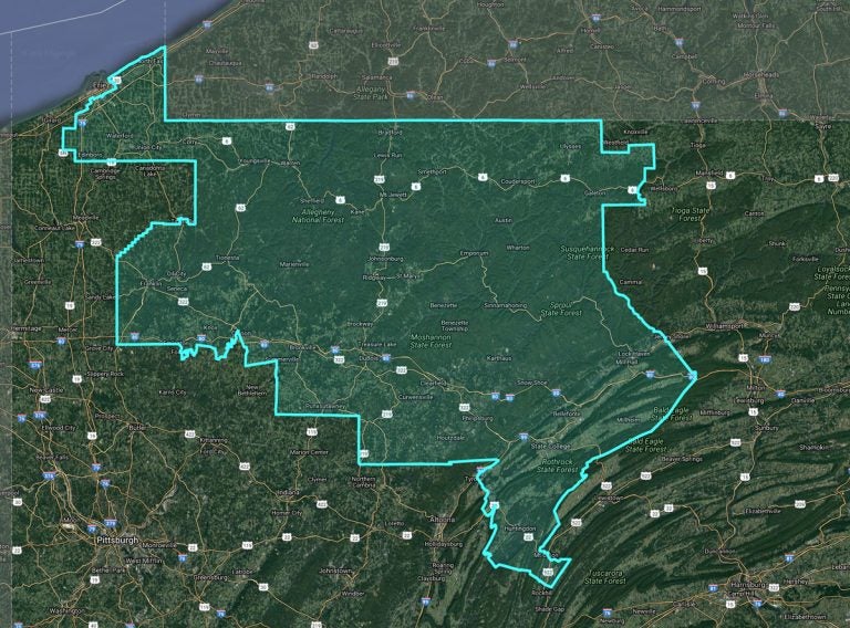
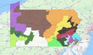
Pennsylvania’s 5th congressional district was among those criticized in federal court on Monday as a possible partisan gerrymander. An expert witness pointed to Erie County in the far northwest corner of the state. The county was split during the 2011 redistricting process. The result, the witness said, dilutes a concentration of Democratic voters and instead favors Republican voters. (Pa. Redistricting website)
Trial began in federal court on Monday in a legal battle over Pennsylvania’s congressional district map. A group of Pennsylvania voters claim that the map created during the 2011 redistricting process is an unconstitutional partisan gerrymander. The plaintiffs are calling for a new map before the 2018 midterm elections.
In his opening statement before a three-judge panel, attorney Thomas Geoghegan, who represents the voters, argued that the outcomes of Pennsylvania’s congressional district elections are predetermined.
“These maps are weaponized to be voter proof,” said Geoghegan.
He pointed out that in the last three elections, Republicans have maintained 13 of Pennsylvania’s 18 seats in the U.S. House of Representatives regardless of the swings in the number of Republican and Democratic votes recorded.
Geoghegan predicted the same outcome for 2018.
He said the plaintiffs intend to show how the map was created and how gerrymandered district lines affect the political process.
The plaintiffs’ case hinges on the Elections Clause of the U.S. Constitution, which they interpret as protecting voters from having the state come between the people and their national government.
House Speaker Michael Turzai (R-Allegheny) and Senate President Pro Tempore Joe Scarnati (R-Jefferson), defendants in the case, argue that voters decide who represents them in congress, not a map.
They say the maps are constitutional and question the standard that the plaintiffs are presenting for what constitutes a partisan gerrymander.
In his opening statement, defense attorney Jason Torchinsky reminded the judges that the U.S. Supreme Court has ruled that politics plays a role in determining district boundaries.
“Political considerations are part and parcel of the redistricting process,” said Torchinsky.
‘A map like Pennsylvania’
As their first witness, plaintiffs’ attorneys called Daniel McGlone, an analyst with the mapping and data-processing company Azavea.
McGlone testified that the congressional district map shows a clear pattern of using election results and voter registration information based on past election returns and party registration information. He says this was used to pack Democratic voters into as few districts as possible and split voters in communities of interest such as: Harrisburg, Bethlehem, Chester, Erie County, and the suburbs surrounding Philadelphia.
District by district, McGlone was asked to compare changes between the 2011 congressional map with past maps. The use of partisan data, he said, resulted in a map that consistently favors Republicans over Democrats in most districts.
During cross examination, Torchinsky asked the witness what happens when partisan data is used in the redistricting process.
“You get a map like Pennsylvania,” McGlone responded, with laughter erupting in the courtroom.
McGlone also testified that partisan data produced by Turzai under court order showed election returns and party registration down to the U.S. Census block level — equivalent to about one city block.
Torchinsky noted several times that although partisan data may have been considered in the 2011 redistricting process, it’s still unclear what exact criteria was used to make the map in question.
Congressional redistricting occurs every 10 years following the U.S. Census. When the current map was drawn, Republicans controlled all three branches of Pennsylvania government. The map, though, did garner significant support from Democrats, especially in areas where lines were drawn seemingly to keep incumbents safe.
Also expected to testify during the trial are Erik Arneson, a former staffer for Delaware County Republican Dominic Pileggi, who was senate majority leader when the map was created, State Sen. Andrew Dinniman (D -Chester), State Sen. Daylin Leach (D -Montgomery), and State. Rep. Greg Vitali (D- Delaware), among other witnesses.
The trial is expected to continue through Thursday. A similar case in state court will begin next week.
Disclosure: Keystone Crossroads has an ongoing contract with Azavea for technical assistance with mapmaking, data-processing and data-visualization.
WHYY is your source for fact-based, in-depth journalism and information. As a nonprofit organization, we rely on financial support from readers like you. Please give today.


