Waterfront study says $250-million Penn’s Landing investment would return $1.6 billion
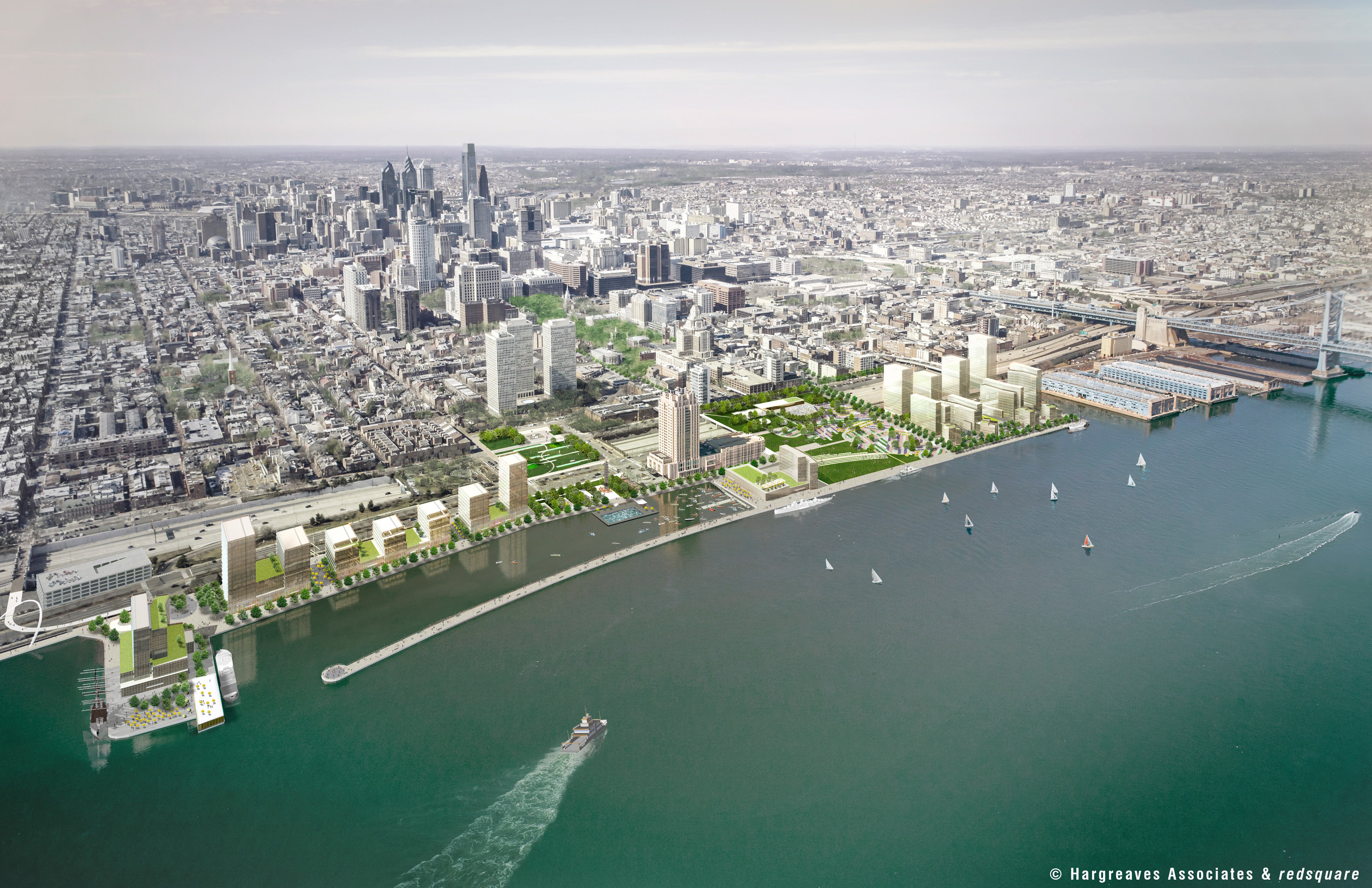
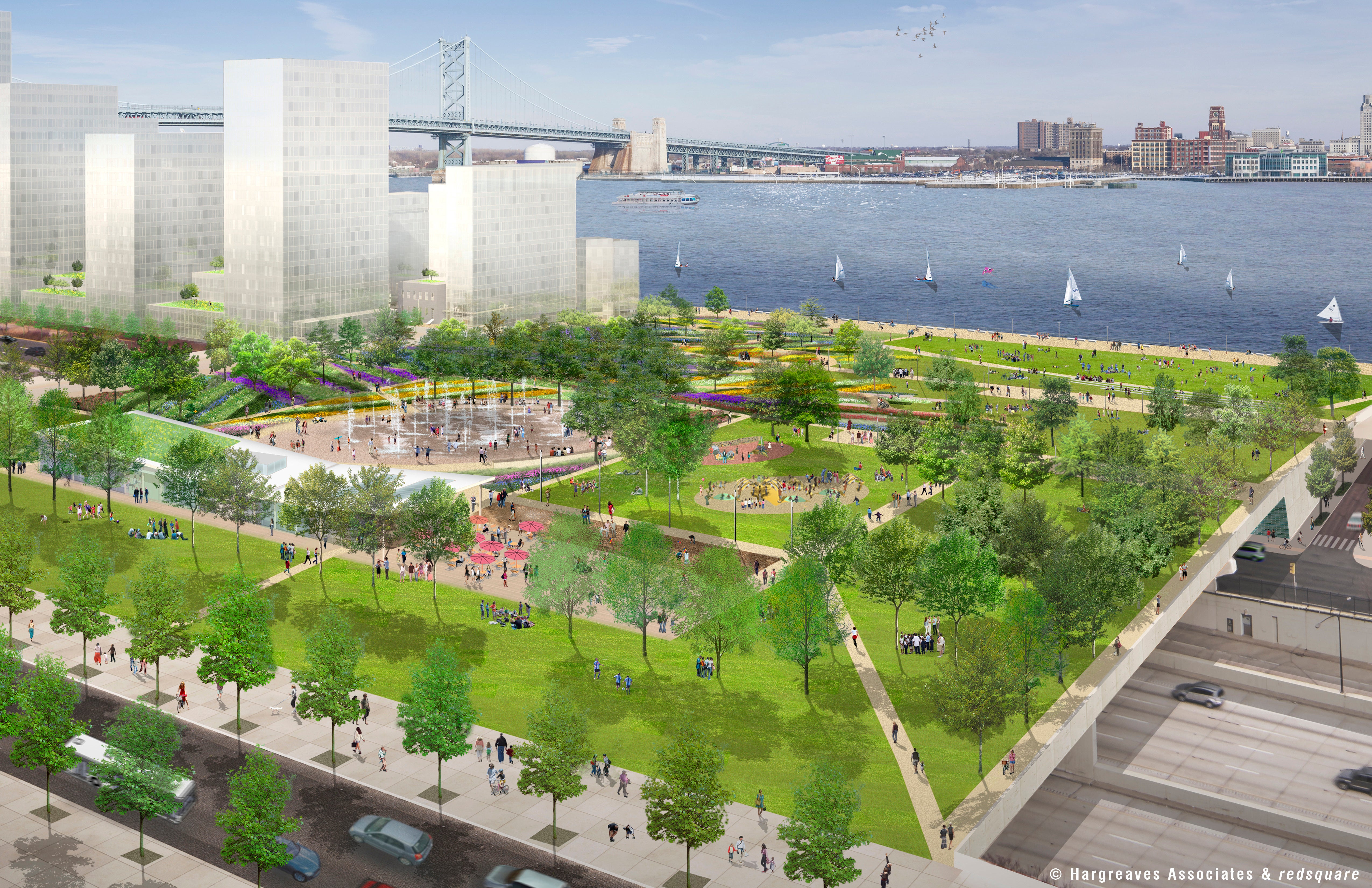
Hargreaves also shows new images of how a new Penn’s Landing Park and two new waterfront neighborhoods might look; The Delaware River Waterfront Corporation says fundraising starts immediately.
Building a four-acre park across I-95 and replacing the mostly paved surfaces of Penn’s Landing with a sloping 11 acres of additional green and recreation space, restaurants, shops and residences, would not only better connect Philadelphia to the Delaware River, but would turn a $250-million public investment into $1.8 billion in economic growth, says a feasibility study released to the Delaware River Waterfront Corporation board Friday.
Projections say the park would eventually be framed with 1,500 new residences, 500 new hotel rooms, and 75,000 square feet of new retail space. It would take about 35 years to fully build-out the private development, but the improvements in the public spaces, including the big new park, would be finished in about five to seven years.
Now comes a tricky part: Raising the $250 million.
Board members and staff at DRWC – the quasi-city agency that manages the public land on the Central Delaware and is overseeing the implementation of the city’s vision to revamp the 6-mile stretch – said the fundraising effort starts immediately.
They are hopeful that the findings of the study, led by Hargreaves and Associates, will persuade those controlling the grant purse strings at both philanthropic foundations and at city, state and federal government agencies that funding the project is a good return on investment.
“I do view it as a true catalyst for the city of Philadelphia as it connects Center City to the river,” said DRWC Board Chairman Donn Scott. “But even more tremendously, is the job creation and taxes (it will create). That is the key.”
Board Member Bill Miller – the CEO and founder of the Ross Associates strategic communications firm – called for meetings with key groups of stakeholders to underline that the benefits of the large project aren’t just about a more attractive waterfront, but will ripple city wide. It’s important to show people this investment will benefit city schools with tax revenue, for example, he said.
DRWC President Tom Corcoran said having the “concrete framework” for what can be done at the river is an important milestone – it is something to show possible investors and a way to explain to them what their money would buy now and help bring about in the future. He also noted that much of the project involves transportation infrastructure, and that can be funded via governental transportation budgets.
Hargreaves’ Senior Principal Mary Margaret Jones presented the study and renderings suggesting what the future could look like to the DRWC board at its Friday meeting. (Board member and Planning Commisison chairman Alan Greenberger cautioned everyone that there’s an additional design step between this study and building, but said the planning committee and DRWC likes the suggestions very much, and it’s likely the final designs would largely resemble them.)
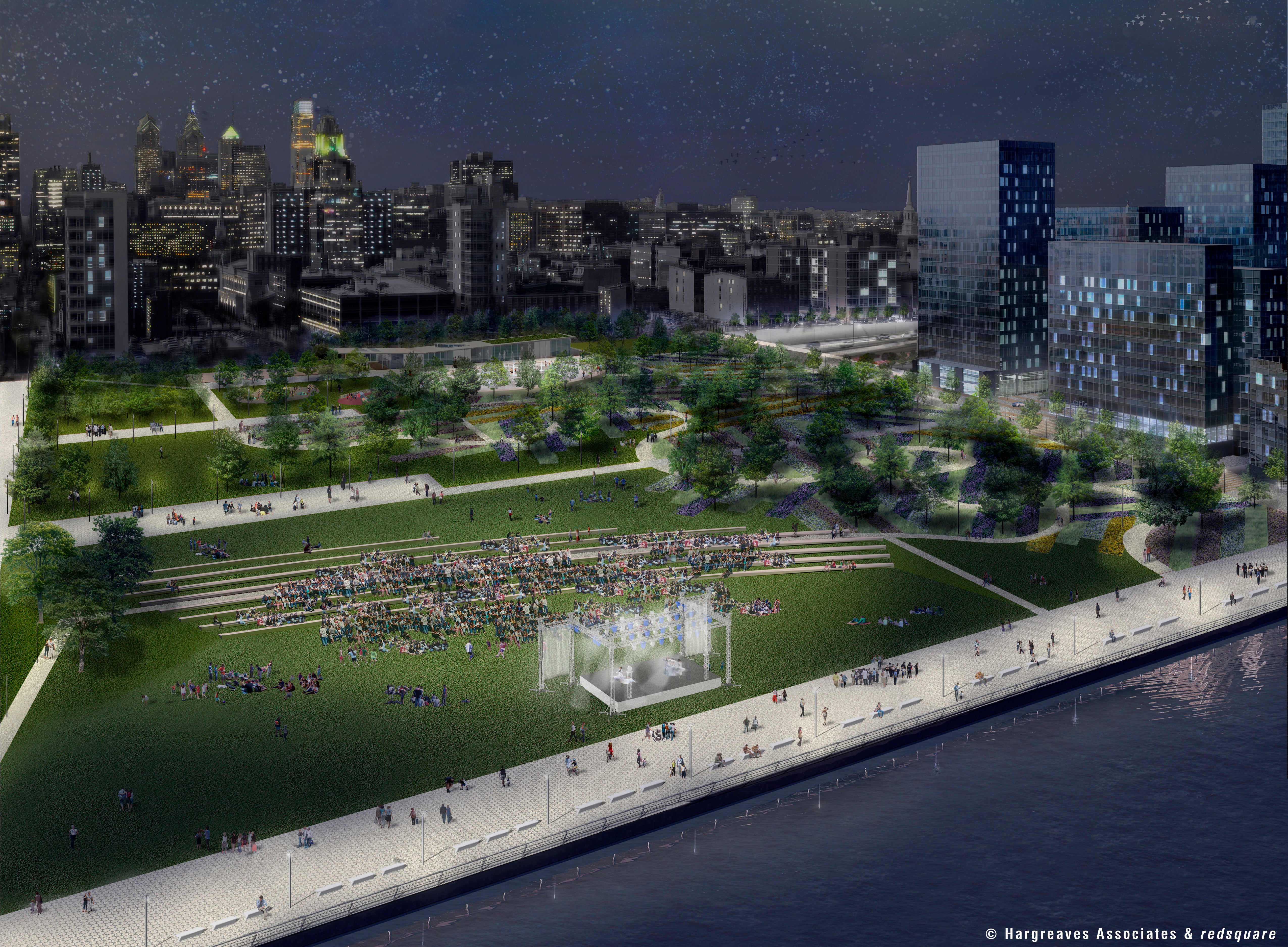
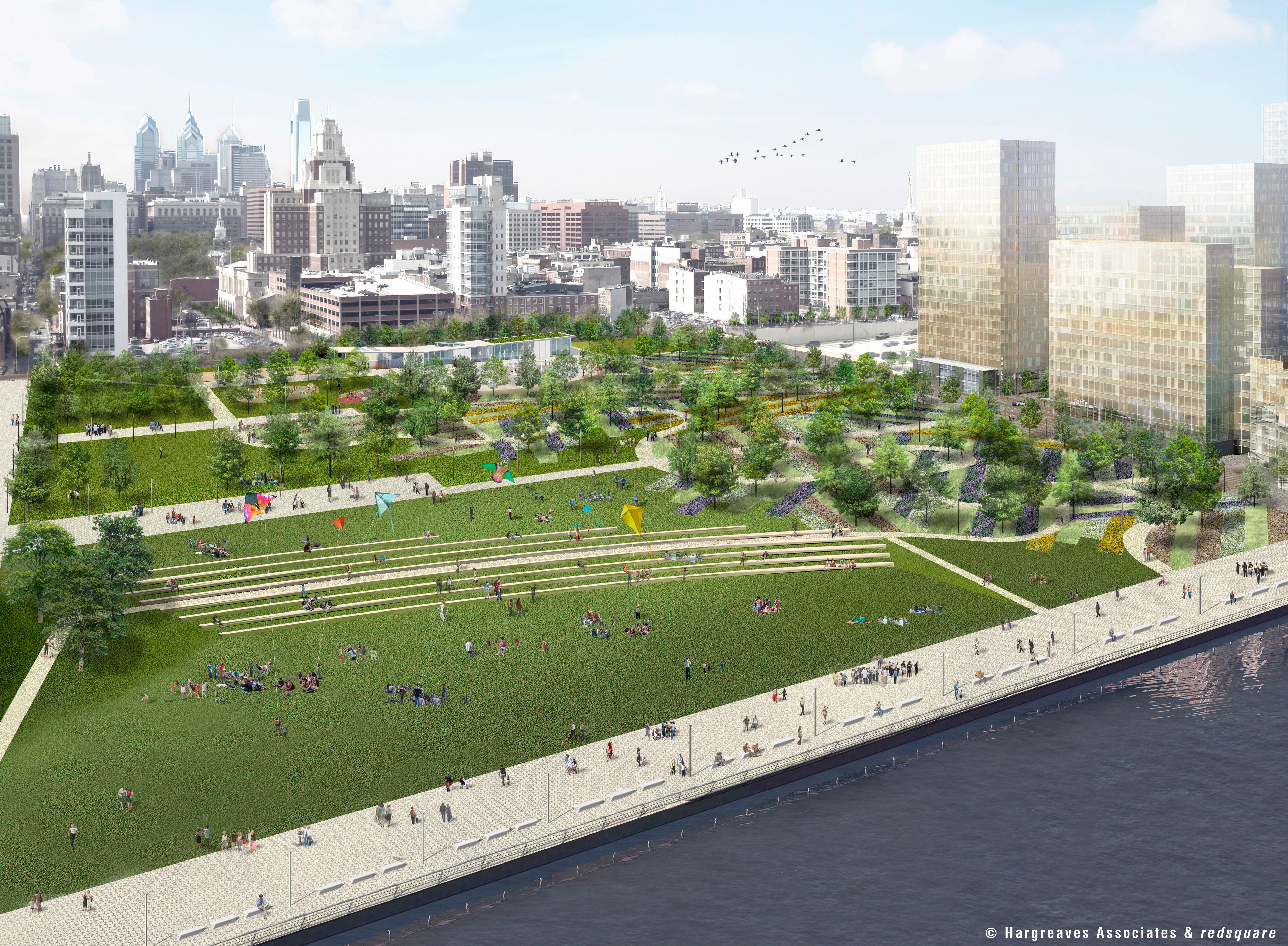
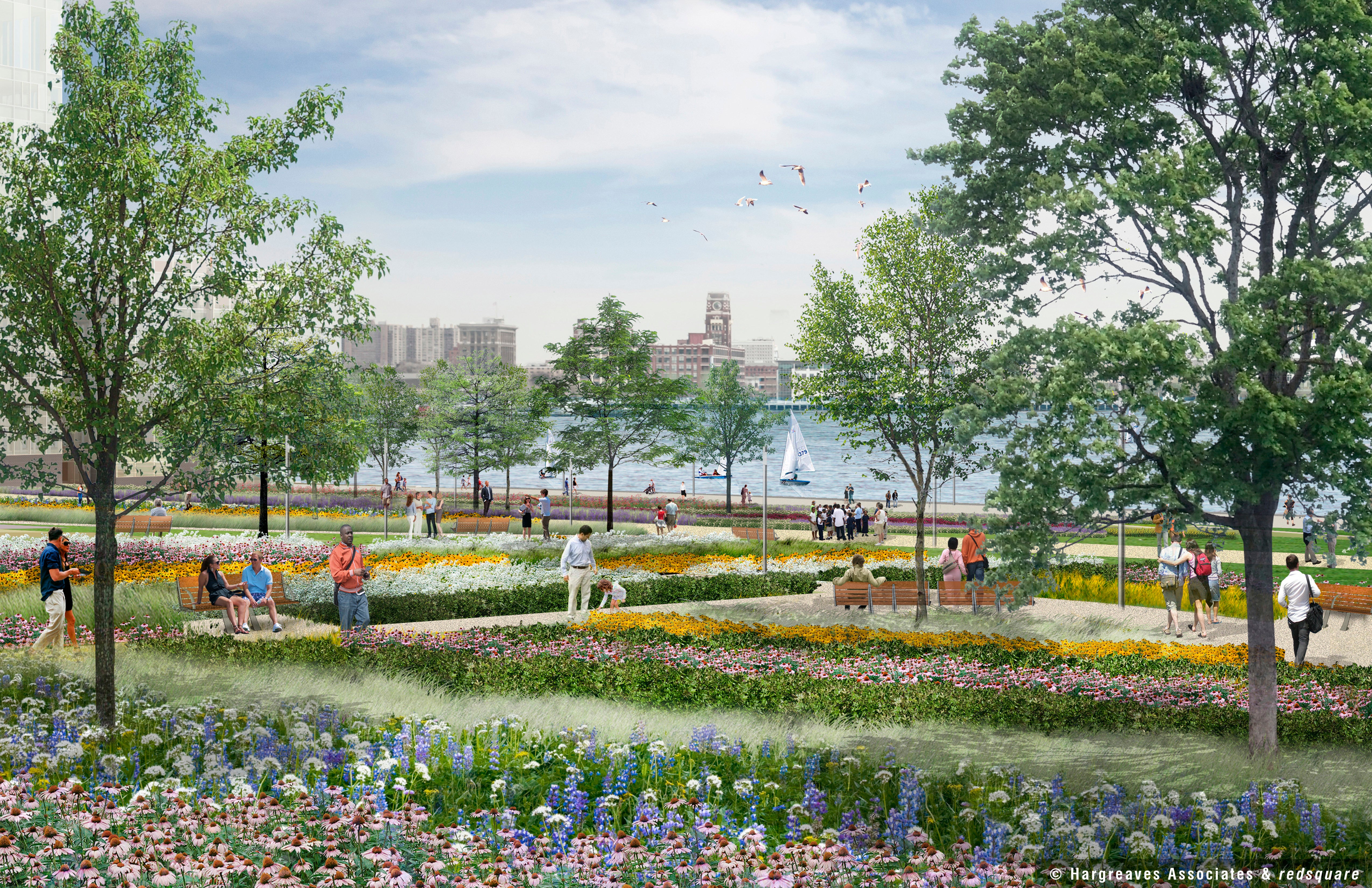
There’s a vast green lawn between Chestnut and Walnut, carried across I-95 with a bridge-like structure. Someone walking from city to river would experience a slight upward slope at first to allow for the roadways beneath. The park is landscaped with trees and crossed with walking paths. Jones said care was taken with both the sloping and tree placement to ensure a visual, as well as physical, connection to the river. It is broken up by spaces designed for specific activities, including an ice rink that by summer could be a spray-ground. There are places for activities like playing soccer and places to just chill.
Once across the roadways, the park will slope down – in some places more subtly than others – to the water. This would best be accomplished with the use of fill, not a bridge-like structure, Jones said.
The entire project area is linked with a north-south pathway, a 50-foot wide pedestrian esplanade at water’s edge. Bike rental stations and transit stops are also encorporated into the plan. At its heart, “This is really a transportation plan,” Jones said.
Many cities are cut off from their waterfronts by a highway, and Philadelphia isn’t the first to try to reunite neighborhoods and waterways, Jones said. But Philadelphia has a rare opportunity: I-95 and Columbus Boulevard aren’t right at the water’s edge. So once across those barriers, there is substantial room not only for trails and park space, but for private development.
The $250 million covers public investment only: The design and building of the big cap over the highway and slope down to the water known as Penn’s Landing Park, a river-side swimming pool on a floating barge, a concert amphitheater, the waterfront trail, and other amenities.
The idea here – and one of the driving principles behind the waterfront master plan – is that all of this new public realm would make private developers want to build housing, retail and restaurants both via RFP on city owned land and on land near the water or on the edges of the existing neighborhoods.
The plan doesn’t call just for better connections between the existing neighborhoods of Old City, Northern Liberties, Society Hill and the waterfront. It calls for the creation of two entirely new neighborhoods: One clustered around the basin at Penn’s Landing and one at the foot of Market Street.
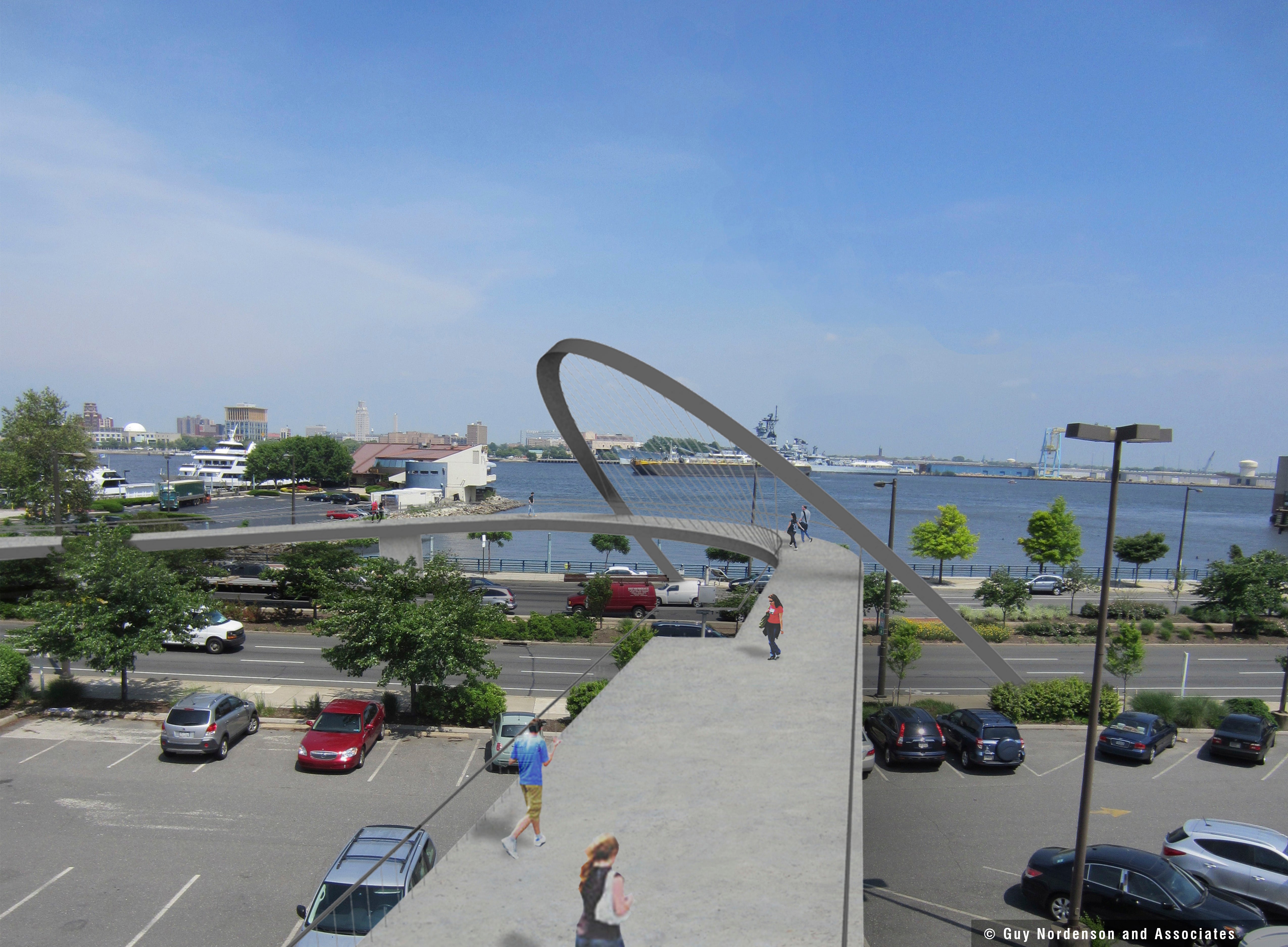
The basin neighborhood would be reachable by a new South Street pedestrian bridge, which would not only give walkers access, but with its sculptural design serve as a gateway marker, Jones said.
Development along the basin is where the residential building should start, Jones said. DRWC Vice President Joe Forkin agreed it’s “ready to go.” It’s the only spot where private development could proceed before the infrastructure work, he said. Jones noted the South Street Bridge and waterfront trail could also be built with a smaller amount of funding, but noted that the bulk of the $250 million is consumed by the new park itself. Bottom line: That money needs to be in hand before much can be done.
One significant change to the local infrastructure could come this fall. DRWC hopes to knock down the Market Street scissor ramps, Forkin said. The viaduct – where SEPTA operates – would remain, he said.
The first video at the bottom of this story, produced by DRWC, features representatives from DRWC and Hargreaves’ Jones discussing the plan. It includes visuals from the study. The video beneath that is Jones’ presenation to DRWC and board discussion. The presentation includes more images of the proposed park and development and details on how much tax and other revenues would be generated for each level of government and the school system over time.
Over the next six weeks, DRWC is releasing more details about specific elements of the study, from transportation to public realm, private develoment to financial aspects. See that here.
WHYY is your source for fact-based, in-depth journalism and information. As a nonprofit organization, we rely on financial support from readers like you. Please give today.
