Storms ahead of schedule; tornado watch continues until 5 p.m. today

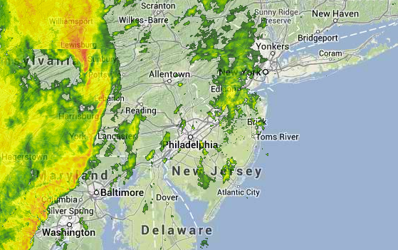
Radar imagery at 11:07 a.m. today. (Image: Weather Underground)
A line of storms heading toward the New Jersey area is moving faster than earlier model guidance suggested.
NY NJ PA Weather‘s Steven DiMartino tweeted that the line associated with a robust cold front is three hours ahead of schedule.
Based on the latest observations, the line should enter the western sections during the early afternoon, crossing the area through rush hour.
Showers ahead of the line are currently moving through New Jersey to the northeast.
The afternoon storms are expected to deliver heavy rain and wind gusts.
Earlier, the National Weather Service issued a Tornado Watch for the New Jersey area until 5:00 p.m.
WHYY is your source for fact-based, in-depth journalism and information. As a nonprofit organization, we rely on financial support from readers like you. Please give today.

