Snow arrives Monday night as coastal storm grazes N.J.
A coastal storm will graze New Jersey on Monday night into Tuesday morning

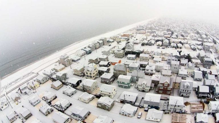
The first snowfall of 2015 in Ocean Beach 2 on January 6. (Photo: JSHN contributor Shane Skwarek)
A coastal storm will graze New Jersey on Monday night into Tuesday morning and deliver light snow before it unleashes blizzard conditions in coastal Massachusetts, forecasters say.
In a late Monday afternoon forecast briefing, the National Weather Service is calling for 2-3″ of snow in Monmouth County, 2-3″ in northern Ocean County, 1-2″ in western and southern Ocean County, 1-2″ in northern Atlantic County, and less than an inch in Atlantic City to the south.
Nor’easter update…Blizzard Warning for eastern Essex, Plymouth, Barnstable, & Dukes Counties in eastern MA. Snow will be moving into the NYC metro & southern New England late this evening and into central & northern New England late tonight & early Tuesday morning. pic.twitter.com/2h11mnARkE
— NWS Eastern Region (@NWSEastern) March 12, 2018
Precipitation will overspread the area between 11 p.m. (Monmouth County) and 3 a.m. (northern Cape May County), beginning as rain or a mixture before changing over to snow.
Snow will then end from southwest to northeast on Tuesday morning, beginning between 6 and 8 a.m in far southern Shore areas and 11 a.m. in northeastern Monmouth County. But the bulk of the snow is likely to occur between 1 and 7 a.m.
If a heavier snow band forms on the backside of the storm, the National Weather Service says six inches or more of snow could fall from coastal Monmouth County to central coastal Ocean County, with less amounts to the south and west.
Spotty minor tidal flooding is possible during the Tuesday morning high tide cycle.
WHYY is your source for fact-based, in-depth journalism and information. As a nonprofit organization, we rely on financial support from readers like you. Please give today.


