NWS: Up to 4″ of snow Thursday night into Friday morning is “worst case scenario”

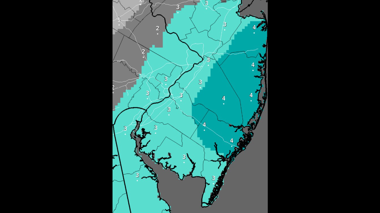
The "worst case scenario" snowfall map through Friday morning as produced by the National Weather Service office in Mount Holly, N.J.
A low pressure system might graze coastal areas late Thursday night into Friday morning, possibly delivering up to four inches of snow.
But that’s the “worst case scenario,” according to the National Weather Service, which says the maximum snowfall that could fall is four inches in Monmouth, Ocean, and Atlantic counties and three inches in Cape May County.
The latest official NOAA forecast for Ocean County is calling for a 40% chance of snow late Thursday night and a 30% chance Friday morning before 7 a.m., with possibly up to around two inches. Similar amounts are possible down to the Atlantic City area, with slightly less to the north of Ocean County and south of Atlantic City.
But as always, the forecast is dynamic and subject to change.
The snow is possible due to colder air moving into the region and an area of low pressure system developing along a lingering offshore cold front and passing near the coast.
Another snow chance is possible for the Monday into Tuesday time-frame, although the details will become clearer over the next several days.
WHYY is your source for fact-based, in-depth journalism and information. As a nonprofit organization, we rely on financial support from readers like you. Please give today.

