NWS: Flooding, beach erosion threat increasing even before any potential Joaquin impacts

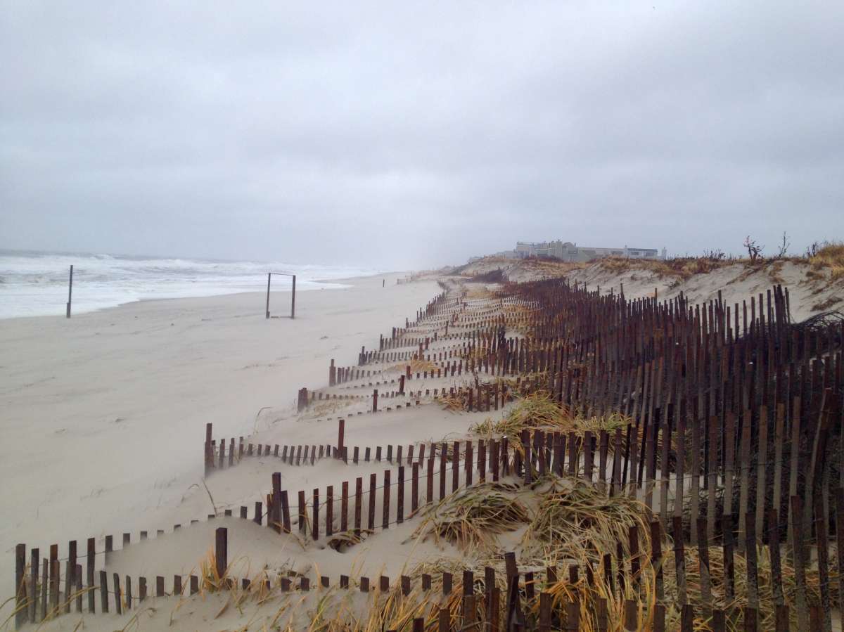
The Midway Beach dune system on Dec. 9, 2014. (Photo courtesy of Dominick Solazzo)
Forecast models indicate an increasing threat of impacts from Hurricane Joaquin, but the National Weather Service says that problems will begin in advance of any potential impacts from the tropical cyclone.
“A dangerous weather pattern is developing for our region,” warns a Wednesday afternoon forecast briefing from the National Weather Service in Mount Holly, N.J.
“Threats include very heavy rainfall, inland river flooding, as well as major coastal flooding with heavy surf and beach erosion,” the briefing warns.
According to the briefing, moderate coastal flooding is now likely on Thursday, with major coastal flooding possible on Friday.
And that’s related to a stalled frontal system during Friday and Saturday — in advance of Hurricane Joaquin, which is now an “increasing threat” even though its track remains uncertain.
That concerns National Weather Service forecasters since the adverse weather could hinder hurricane preparations.
The current National Hurricane Center forecast places Joaquin off the Delaware coast at 8 a.m. Monday as a Category 1 hurricane with 85 mile per hour winds, although the storm could move quicker should it track closer to the coast.
New Jersey is squarely within the “cone of uncertainty,” meaning that the ultimate track currently remains unknown.
“Confidence in the details of the track forecast late in the period remains low, since the environmental steering currents are complex and the model guidance is inconsistent,” a bulletin from the National Hurricane Center states.
The bulletin adds that it is is “way too soon” to talk about specific impacts since “a direct impact of a major hurricane along the U.S. East Coast to a track of Joaquin out to sea away from the coast” are both possible.
But if Joaquin does directly impact our area during the Sunday into Monday timeframe, “all the major hurricane threats (damaging winds, severe coastal flooding, very heavy rainfall with severe inland flooding) could impact the region,” according to the National Weather Service briefing.
The briefing outlines the specific threats:
Rainfall: Many locations saw one to two inches from last night’s rainfall. Additional rainfall amounts over the next seven days of 4 to 10 inches are possible for the region, with some locations seeing locally higher amounts.
Inland flooding: Additional rainfall amounts of 4 to 10 inches will result in a greatly increased threat of flash flooding as well as inland river flooding. If we get the higher rainfall amounts, some of the flooding will be severe.
Winds: Starting Thursday, winds will become northeast and intensify. Wind gusts of 20 to 30 mph are possible over inland locations. Wind gusts of 45+ mph are possible in coastal areas. If Hurricane Joaquin directly affects the region, hurricane force winds are possible.
Tidal Flooding: Moderate coastal flooding is possible on Thursday. Moderate to major coastal flooding is now possible on Friday with the strong northeast winds. This is in advance of any impacts from Hurricane Joaquin. If Hurricane Joaquin directly affects the region, major to record coastal flooding is possible.
Click here to read the full National Weather Service bulletin and here to see the latest National Hurricane Center forecast track for Joaquin. Don’t have a plan? The National Hurricane Center offers these hurricane preparation tips.
WHYY is your source for fact-based, in-depth journalism and information. As a nonprofit organization, we rely on financial support from readers like you. Please give today.

