Tropical Storm Dorian forms in the Atlantic

(Image from Weather Underground)
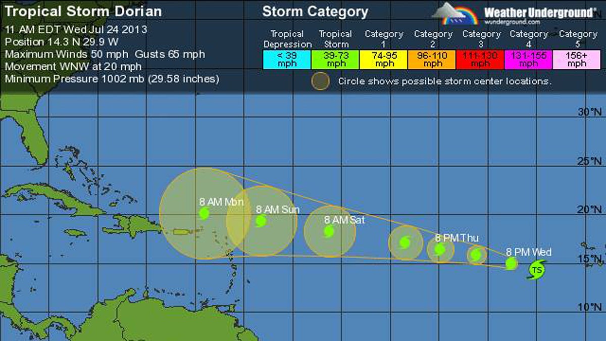
Tropical Storm Dorian, the fourth named storm of the 2013 season, formed this morning in the far eastern Atlantic Basin, packing 50 mph maximum sustained winds, according to the National Hurricane Center.
The current five day forecast shows Tropical Storm Dorian making its way from its current location about 410 miles west-southwest from the Cape Verde Islands westward toward the Lesser Antilles region Sunday into Monday as a tropical storm.
What does it mean for the Garden State? Nothing now. Just something to watch.
Closer to home, forecasters are watching a surface low pressure system about 500 miles east of Bermuda that is currently projected to move northwestward to northward at 10 to 15 mph over the next couple of days. The National Hurricane Center gives this disturbance only a 20 percent chance of becoming a tropical cyclone over the next 48 hours.
Depending on the behavior and movement of the system near Bermuda, which all models showing staying far away from New Jersey, it could send a ground swell toward the coast.
_________________________________________________
Justin Auciello is editor of JSHN, a content partner with NewsWorks.
WHYY is your source for fact-based, in-depth journalism and information. As a nonprofit organization, we rely on financial support from readers like you. Please give today.

