January thaw on tap for late week

The polar vortex isn’t hanging around for long.
The surface high pressure system responsible for the dangerously cold weather will move offshore late Wednesday, according to the latest forecast discussion issued by the National Weather Service office in Mount Holly, NJ.
While remaining chilly on Wednesday, with highs in the 20s and still a biting wind chill, we begin to see improvement Thursday, when winds will decrease and high temperatures rise into the 30s, according to NOAA. Then on Friday, the upward temperature trend will take us to the 40s.
The real “warmth” arrives on Saturday, when a southerly flow delivers mild air to the region, according to the National Weather Service. Daytime highs, ranging from the middle to upper 40s north and middle 50s south, will be 10 to 15 degrees above normal, the service advises. The mild weather continues through Sunday and Monday.
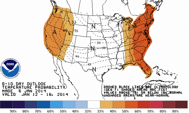
Looking ahead, the National Weather Service’s Climate Prediction Center forecasts a 40 to 50 percent chance of above normal temperatures continuing through next Thursday. But around next weekend, “we can generally expect the colder and active winter pattern we have predominately seen to return,” according to New York Metro Weather meteorologist Doug Simonian.
WHYY is your source for fact-based, in-depth journalism and information. As a nonprofit organization, we rely on financial support from readers like you. Please give today.

