Ivy Ridge Trail project’s public input phase wraps up, work expected to begin in 2014

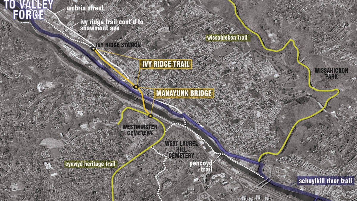
The Ivy Ridge Trail is mapped out to begin at the end of the Manayunk Bridge at Dupont and High streets and continue for six-tenths of a mile to SEPTA's Ivy Ridge regional rail station. (Image courtesy of Interface Studio)
Plans for a multi-use trail from Manayunk to Ivy Ridge are one step closer to fruition.
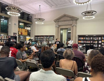
On Wednesday night, project leaders and residents of both Philadelphia and its surrounding suburbs gathered in Manayunk for the last of three public meetings regarding the proposed Ivy Ridge Trail. Utilizing an inactive rail bed, the shared-use recreation trail will begin at the end of the Manayunk Bridge at Dupont and High streets and will continue for six-tenths of a mile to SEPTA’s Ivy Ridge regional rail station.
In addition to connecting with the Manayunk Bridge project, the Ivy Ridge Trail will serve as a paved pathway for walkers and bike riders looking to connect with the section of the Schuylkill River Trail that ultimately leads to Conshohocken and beyond.
The estimated cost for the trail is approximately $3 million.
Access points
For project leaders, the trail’s design is broken down into four areas, each with unique characteristics. Common to each is a combined 16-foot wide bicycle and pedestrian pathway, with landscaping at the sides and two-foot wide soft-surface buffers in between for use by joggers. Concrete and asphalt will be used for the shared-use path on the trail, as maintenance vehicles will still need to access the overhead catenary wires, which are still in use by PECO and Amtrak.
The first section at Leverington Avenue is an important interchange for trail-users, leading to both the Manayunk Bridge – and the Cynwyd Heritage Trail beyond it – as well as to the Manayunk Towpath that skirts the Schuylkill River. While the connection from trail to bridge is contiguous, towpath users will need to use Leverington Avenue to access the trail, introducing safety concerns due to a Main St. crossing.
In the vicinity of Canton Street, designers were faced with the issue of the abandoned rail bed and surrounding area being repurposed as an ad-hoc parking lot for neighborhood residents. With this in mind, project leaders have incorporated dedicated on and off-street parking to accommodate the community. While there will be a net loss of parking, problematic drainage issues will be addressed.
In the Fountain Street area, access to the trail, dozens of feet above the roadway, will be provided adjacent to a set of steps along Fountain Street, which are beloved by local residents. A sloped ramp with an approximate grade of 8-percent is envisioned, providing ADA-compliant access to the trail for Towpath users.
Lastly, at the Ivy Ridge SEPTA station, trail users will cross the existing parking lot to the intersection of Umbria and Lemonte streets, where existing bike lanes along Umbria Street will usher riders westbound to Shawmont and the Schuylkill River Trail beyond.
Kay Sykora, director of the Schuylkill Project and a member of the trail design team, emphasized that many of these features were the result of earlier interactions with community members.
“You folks have spoken,” she said, “and this is what has evolved out of that conversation.”
Resident reaction
While residents present at Wednesday’s meeting appeared generally pleased with the design, some residents expressed apprehension about bicyclists and pedestrians crossing Umbria Street at Lemonte Street from the Ivy Ridge train station.
A traffic study would need to be conducted in order to determine if a light would be placed at the intersection, but at this time there are no plans to perform such an examination.
However, the crosswalk itself will likely have a unique design, which will call attention to the crossing from both motorists and non-vehicular users.
Others were concerned about the impact of the proposed sloped access ramp in the area of Fountain Street, with fears that it might alter or damage the stonework or other elements. These concerns were allayed when project leaders indicated that no impact is foreseen on the Fountain Street steps.
“This is in response to a request from the community to find another way for people to have access to this area,” said Stephanie Craighead of Philadelphia Parks and Recreation. “If in fact it is not desired, we won’t do it.”
Anticipating a 2014 start
With the conclusion of the public input component of the design, Mike Campbell of Whitman, Requardt and Associates said a final report will be compiled with recommendations and cost estimates and will likely be completed by the end of August.
This finalized report will be used to find funding to complete final designs and begin construction. Project leaders expect to receive some allocations from both state and federal sources.
While no funding is currently in place for the trail, Campbell said that the final design on the Manayunk Bridge is “99-percent” complete, and that he expects to begin advertising for construction in the near future. He predicted that work will commence on the bridge in 2014.
He predicted that the sight of construction underway on the Manayunk Bridge will encourage additional support for the Ivy Ridge Trail project.
“When people see the trucks on the bridge,” he said, “a lot people are going to want to see this trail get finished.”
WHYY is your source for fact-based, in-depth journalism and information. As a nonprofit organization, we rely on financial support from readers like you. Please give today.


