Hurricane Matthew: Cautiously encouraging news for East Coast

(Image: National Hurricane Center)
Hurricane Matthew is currently a powerful Category 4 cyclone packing 145 mph winds south of Haiti.
The National Hurricane Center expects Matthew to come very close if not strike the extreme western portion of Haiti tomorrow night, according to the latest forecast.
From there, the official track takes it close if not on the extreme eastern portion of Cuba still as a powerful cyclone Tuesday afternoon before moving over the Bahamas late Tuesday into Wednesday.
Matthew is then expected to head more toward the northwest, tracking somewhere off the northern Florida coast by 2 p.m. Friday.
The ultimate question for our audience is if Matthew will impact the Jersey Shore.
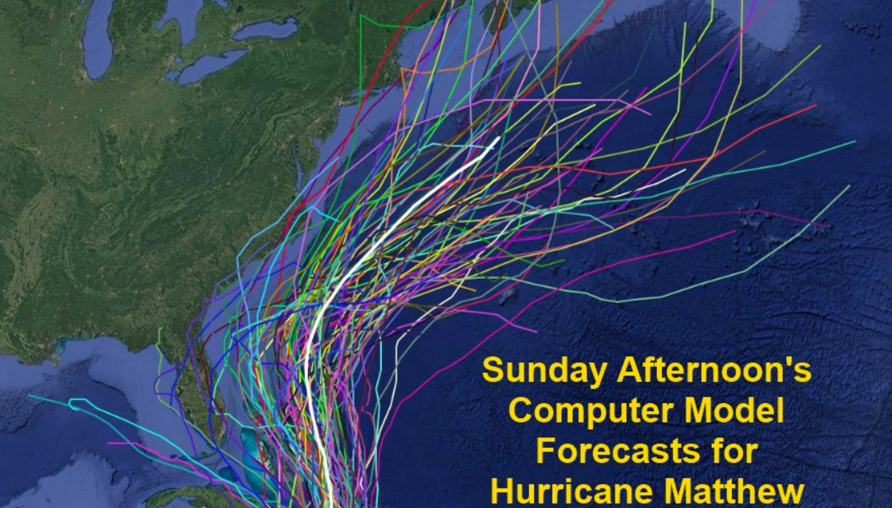
As of this afternoon, most of the model tracks keep the system offshore the Eastern Seaboard and none are over New Jersey, but uncertainty still remains, according to the National Hurricane Center.
“Quite a bit of spread remains in the forecast tracks,” the center states in an update from this evening.
As you can see above, the encouraging news is that the model tracks have shifted east away from the Jersey Shore from yesterday and earlier today.
But forecasters will learn more over the coming days, and it’s still too soon to rule out any impact on the East Coast.
Still, the trends are undeniably encouraging, although a track offshore but closer to the coast late next week or early the following week could generate some impacts on the area depending on the proximity to the shoreline.
Stay tuned to Jersey Shore Hurricane News for updates.
WHYY is your source for fact-based, in-depth journalism and information. As a nonprofit organization, we rely on financial support from readers like you. Please give today.

