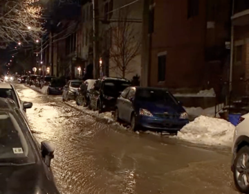
Flooding concerns tomorrow for the Philadelphia region
Rain becomes heavy at times during the middle of the day on Saturday. The heaviest rain looks to fall along the I-95 corridor and areas east of that.
This story originally appeared on 6abc.
A powerhouse coastal low brings 1-3″+ of rainfall and gusty winds to the area tomorrow.
Tonight: Cloudy, rain develops overnight. Low 41.
Saturday: It’s a very wet day. Rain becomes heavy at times during the middle of the day. The heaviest rain looks to fall along the I-95 corridor and areas east of that.
The amount of rain and the intensity of the rain will bring the threat of some flooding. Streams, creeks and rivers will also have to be watched. High in the mid-50s.
As the storm works its way up the coast winds will start to crank. Gusts between 35-45mph are possible, which could lead to isolated outages. Rain tapers off by the evening.
Sunday: Mostly sunny and breezy. High 52.
Monday: Plenty of sunshine. High 55.
Tuesday: Partly sunny. High 54.
Wednesday: Becoming cloudy. Showers likely during the afternoon. High 56.
Thursday: Mostly cloudy, milder. High 58.
Friday: Partly sunny skies. High 61.
WHYY is your source for fact-based, in-depth journalism and information. As a nonprofit organization, we rely on financial support from readers like you. Please give today.


