Don’t overlook the threat of scattered power outages, tidal flooding with impending storm

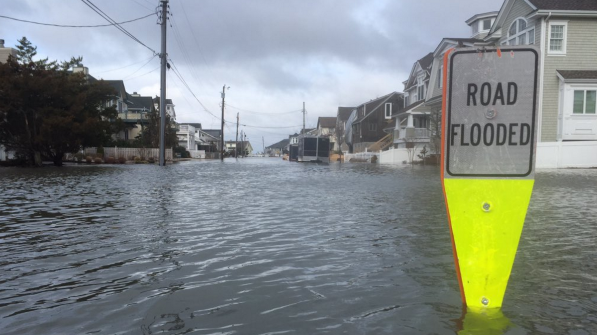
Tidal flooding in Stone Harbor in Feb. 2016 as photographed by Zeke Orzech (@Zeke_O via Twitter).
A potent coastal storm is on tap for the region beginning Monday night, and snow is the main headline across the internet.
But for the Jersey Shore, while forecasters expect significant accumulations for at least the northern half, high winds and coastal flooding are a concern.
Gusty winds will develop Monday night and continue through Tuesday. Gusts up to 60 miles per hour are possible at the coast, with progressively less wind inland. Scattered power outages are possible, so be prepared should you lose power.
Moderate coastal flooding is also possible, particularly during the Tuesday morning high tide. High tide along the oceanfront occurs between 9:15 and 10:15 a.m., occurring later on the back bays and Raritan and Delaware bays.
The surge will be around two to three feet above the astronomical tide. Numerous roadways are expected to flood, with many becoming impassable, according to the National Weather Service.
Minor to moderate property damage is possible in low-lying areas, and significant beach erosion is likely, the service adds.
The forecast calls for snow to arrive Monday evening, becoming heavy overnight into the Tuesday morning hours. It’ll then taper off Tuesday night into Wednesday. The brunt of the storm is likely to occur between 3 a.m. Tuesday and 3 p.m. Tuesday.
The National Weather Service says there are “many complications” that can occur at the Shore, with sleet and rain possibly mixing in. More information will be available tomorrow.
The service’s forecasters are calling for about a foot of snow in northwestern Monmouth County, with progressively less amounts toward Cape May.
Some predictions include 11″ in Freehold, 8″ in Toms River, and 3″ in Atlantic City. The highest accumulations are expected to the north and west of the New Jersey Turnpike and inland from the coastal communities.
Should the track change, the National Weather Service says more than a foot of snow could fall in northwestern Monmouth County, with less to the south and east.
As always, slight shifts in the storm track will have significant consequences. All numbers are subject to change as they’re simply best guesses based on the latest data.
Stay tuned here and Jersey Shore Hurricane News for updates.
WHYY is your source for fact-based, in-depth journalism and information. As a nonprofit organization, we rely on financial support from readers like you. Please give today.

