3 Shore counties under Tornado Watch as storm threat increases
The National Weather Service says a line of severe thunderstorms marching toward the New Jersey coast Friday afternoon could spawn an isolated tornado.

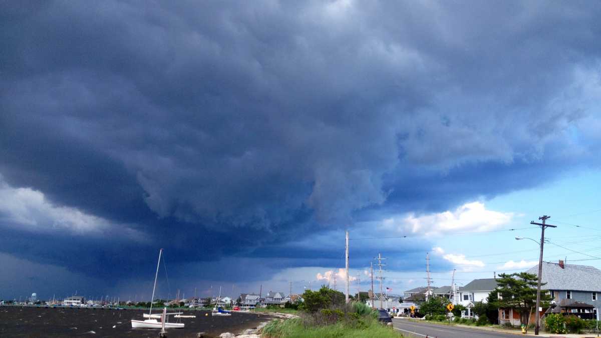
A strong thunderstorm heading over Seaside Park in July 2013. (Photo: Justin Auciello)
The National Weather Service says a line of severe thunderstorms marching toward the New Jersey coast Friday afternoon could spawn an isolated tornado.
At the Jersey Shore, that’s prompted the agency to issue a Tornado Watch for Atlantic, Cape May, and Ocean counties.
It’s in effect until 9 p.m. Friday.
It’s important to understand the differences between a watch and warning.
From the New Jersey Office of Emergency Management:
Watch: A tornado watch defines an area shaped like a parallelogram, where tornadoes and other kinds of severe weather are possible in the next several hours. It does not mean tornadoes are imminent, just that you need to be alert, and to be prepared to go to safe shelter if tornadoes do happen or a warning is issued. This is the time to turn on local TV or radio, turn on and set the alarm switch on your weather radio, make sure you have ready access to safe shelter, and make your friends and family aware of the potential for tornadoes in the area.
Warning: A tornado warning means that a tornado has been spotted, or that Doppler radar indicates a thunderstorm circulation which can spawn a tornado. When a tornado warning is issued for your town or county, take immediate safety precautions. Local NWS offices issue tornado warnings.
The line of severe storms, entering southwestern New Jersey and heading eastbound at 5:30 p.m., is also capable of producing heavy rain, dangerous cloud-to-ground lightning, and damaging winds, according to the National Weather Service.
Forecasters say precipitation should end by mid-evening, followed by drier air filtering into the region.
WHYY is your source for fact-based, in-depth journalism and information. As a nonprofit organization, we rely on financial support from readers like you. Please give today.


