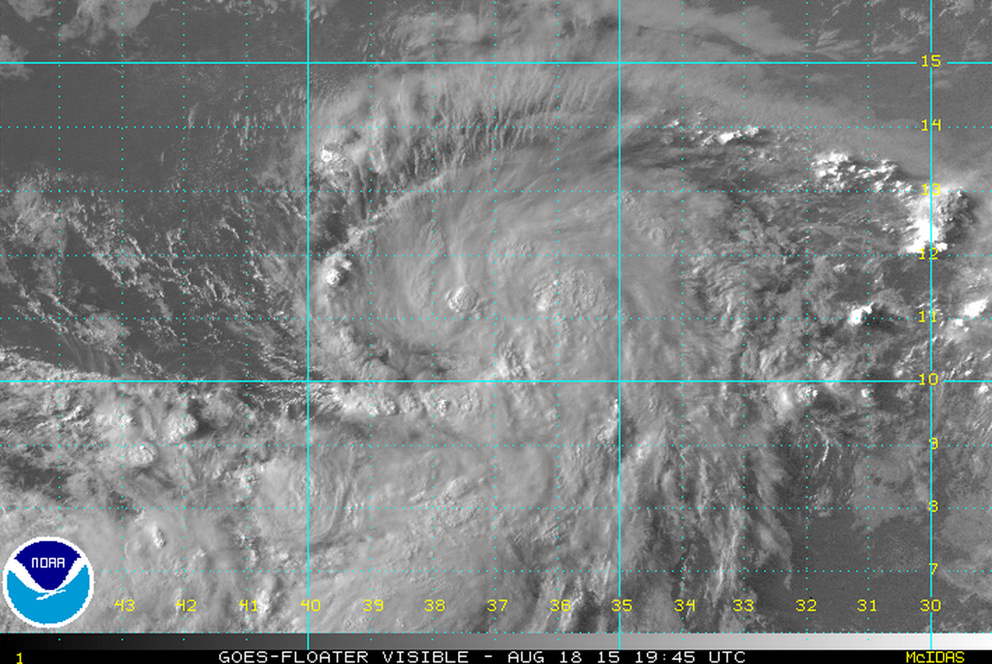
Tropical Storm Danny forms

A visible satellite image of the newly formed Tropical Storm Danny taken late this afternoon. (Image: NOAA)
Tropical Storm Danny, the fourth named tropical system of the 2015 Atlantic hurricane season, has formed.
At 5:00 p.m. today, Danny is located in the open Atlantic Ocean about 1,600 miles east of the Windward Islands, packing maximum sustained winds of 40 miles per hour and higher gusts, according to a National Hurricane Center bulletin.
The tropical storm is currently moving westward, with a turn toward the west-northwest tomorrow, the bulletin states.
According to the latest National Hurricane Center forecast track, Danny is expected to become a hurricane by Thursday and begin nearing the Lesser Antilles — about 1,800 miles away from the Jersey Shore — by early next week.
There is no immediate threat to any land mass.
If Danny does become a hurricane, it will be the first of the current season.
The peak of the Atlantic hurricane season is on Sept. 10, which is the day when historically the maximum amount of convection and minimal amount of shear are found in the Atlantic basin, leading to the best chance of tropical system development.
The relatively quiet season is due to dry air blowing from Africa over the tropical zone and disruptive upper level winds, according to hurricane specialists.
With the season’s peak approaching, forecasters advise coastal residents to have a plan should a tropical system threaten or strike.
The 2015 hurricane season ends on Nov. 30.
WHYY is your source for fact-based, in-depth journalism and information. As a nonprofit organization, we rely on financial support from readers like you. Please give today.

