Stockton report analyzes 30 years of N.J. shoreline change
Since 1986, Stockton's Coastal Research Center has conducted beach surveys each fall and spring to document the shoreline position and sand volume.

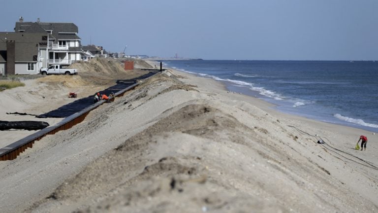
A woman, right, scavenges on the beach while workers labor on the new seawall construction project to protect Mantoloking, New Jersey, from the Atlantic Ocean. As the third anniversary of Superstorm Sandy approaches, New Jersey says it has acquired 90 percent of the easements it needs to do shore protection work along the coast. New Jersey is beginning to exercise its power of eminent domain to secure other easements. (AP file photo)
A new retrospective report released by the Stockton University Coastal Research Center analyzes 30 years of shoreline change in New Jersey.
The report from the Port Republic center reviews monitoring data from 107 beach profile sites, including along the Atlantic Ocean and Raritan and Delaware bays, with at least one site in each oceanfront municipality, according to a university news release.
Since 1986, the center has conducted beach surveys each fall and spring to document the shoreline position and sand volume.
The goal is to help identify areas with potential erosion problems, inform policy decisions that will protect beaches, reduce risks to developed areas, and to assess storm impacts, according to the release.
The report notes that most of New Jersey’s beaches are currently under federal management.
“When the northern Ocean County beach replenishment is complete next year, all 97 miles of the New Jersey developed shoreline will be under U.S. Army Corps management with shore protection projects. The Wildwoods remain under a feasibility study leading to a project eventually,” said Stewart Farrell, the center’s director.
Farrell adds that the most resilient beaches share commonalities.
“Wide, dry beach width plus a decent, continuous elevation dune was the most effective means to avoid or reduce Hurricane Sandy damage from the wave attack,” he said.
While the 130 mile New Jersey coastline between Sandy Hook and Cape May Point is considered the most developed and densely populated shoreline in the country, 31.2 miles are undeveloped, according to the report.
WHYY is your source for fact-based, in-depth journalism and information. As a nonprofit organization, we rely on financial support from readers like you. Please give today.


