Snow squall pushing toward Jersey Shore this afternoon

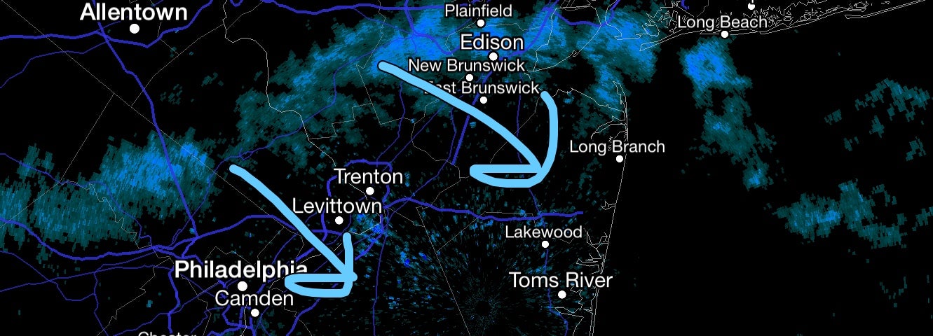
Radar at 3:00 p.m, depicting a snow squall heading southeast toward northern Monmouth County.
A snow squall is heading toward the northern Jersey Shore shortly before 3:00 p.m. today.
The snow squall, which is heading to the southeast and contains wind gusts up to 35 miles per hour along with a burst of snow, will rapidly drop visibilities to a quarter of a mile, according to the National Weather Service.
“This rapid change in visibility will be short in duration,” a Special Weather Statement from the service issued for portions of Central Jersey advises, adding to “use extra caution” if traveling.
Based on radar trends, the squall should be entering Monmouth County around 3:00 p.m.
Since the line extends to the southwest, shore areas further to the south would see impacts later this afternoon, depending on if the line survives.
WHYY is your source for fact-based, in-depth journalism and information. As a nonprofit organization, we rely on financial support from readers like you. Please give today.

