

Rising seas present hidden dangers to Sandy Hook’s ecology, report says
Sea-level rise threatens old-growth maritime forest at the national recreation area, as well as the region’s freshwater.

North Pond at Sandy Hook. (U.S. National Park Service)
This story originally appeared on NJ Spotlight.
Increased sea-level rise — even at levels less than a foot — will reconfigure Gateway National Recreation Area Sandy Hook’s delicate fresh-groundwater system, which sustains one of the last two old-growth American Holly maritime forests in the country, according to a new study by the U.S. Geological Survey.
The study, recently released, modeled different scenarios. Researchers looked at sea-level changes of 0.66, 1.3 and 1.97 feet above the current level and investigated increases and declines in groundwater due to shifts in precipitation and storm frequency. Their models also included one that combines the high-end rise projection and more rainfall.
“This report attempts to quantify those impacts on (groundwater resources) in a way that hasn’t been looked at closely before in this area,” Matthew Pajerowski, a supervisory hydrologist for the agency said in an email. Pajerowski coordinated the Sandy Hook study with two similar models at Fire Island, New York, and Assateague Island, Maryland.
According to the latest assessment by the United Nations’ Intergovernmental Panel on Climate Change, released earlier this week, average global temperature will increase by 1.5 degrees Celsius within the next two decades. That uptick will trigger a rise in sea level of 1 to 2 feet by the end of this century. If warming surpasses 1.5 C, however, the ice sheets at Earth’s poles could further destabilize, forcing even more sea level rise.
The Geological Survey study offers a different perspective on the impact of sea-level rise on New Jersey’s coastlines: Reports like the latest from the United Nations tend to focus on the encroachment of water on land. This one, however, examines the trouble that could come from beneath.
Related Content

There’s not a cloud in the sky, but your house could still be underwater
Coastal neighborhoods around the U.S. are seeing a steady increase in high tide flooding, as sea level rise accelerates and sends seawater into homes, sewers and streets.
5 years ago
Trouble from below
“Not paying enough attention to the below-ground part of the world is the norm, be it sea-level rise or other hydrologic/ecologic changes, simply because it is a lot harder to see and expensive to measure the hidden half of the world,” said Ying Fan Reinfelder, a professor of hydrology in Rutgers University’s Department of Earth and Planetary Sciences, in an email. “This study, among others, made it more transparent.”
At Sandy Hook, fresh groundwater sits just below the soil, in a contact-lens-shaped pocket that rests atop a deeper layer of salty groundwater. As sea level rises, the saltwater presses upward and from the ocean and bay sides, which causes a thinning of the freshwater “lens.”
The recreation area’s unique Bayside Holly maritime forest, along with other areas of vegetation throughout the 6-mile, 27,000-acre park, rely on that already narrow substratum of freshwater to survive. If saltwater creeps in and more frequently inundates the land from the surface, flora with the deepest roots — like the American Holly — cannot survive. Such a phenomenon can now be seen in other coastal areas of the state. The same is true along the southern Atlantic coast and Delaware Bayshore, for example, where saltwater intrusion has killed off swaths of cedar trees.
Subterranean stress
The Geological Survey study also points out that the subterranean stress brought on by sea-level rise will force a more rapid rate of “evapotranspiration,” the evaporation of water from the soil, due to the rising saltwater table’s pressing the freshwater lens up against the ground surface. This, too, will cause the roots of trees, shrubs and grasses to absorb more saltwater than they can handle.
“The important findings of this study show that sea-level rise can pose risks to the shallow groundwater system,” Pajerowski said. “Particularly at barrier-beach islands that have saltwater bodies on either side of a relatively narrow body of land.”
Not surprisingly, the three sea-level rise scenarios the Geological Survey modeled showed significant upland portions of the park transitioning to wetlands — an “increase in area at the expense of other ecosystems” in the park, as the study’s authors put it, “particularly the Bayside Holly Forest.”
Under the low-end sea-level rise projection of 0.66 feet, the study found some 34 acres of “emerging wetlands” will develop. In the worst-case scenario — 1.97 feet of rise — just over 143 acres of land will transition to wetlands.
Related Content

Climate change’s impact on Hurricane Sandy has a price: $8 billion
Using flood maps and sea-level rise measurements, researchers found that human-induced sea-level rise caused an estimated $8 billion in excess flooding damage during Sandy.
5 years ago
Hurricane Sandy hits Sandy Hook
Hurricane Sandy provided a bleak glimpse of the extreme end of the climate change spectrum. The superstorm’s high-water mark was around 3.2 feet above any other storm in recorded history at Sandy Hook. Over 70% of the Bayside Holly Forest was inundated. And because a tide gauge located at the park has been delivering data daily since its installation in 1932, the record shows that water levels have risen about 14 inches in that time. That change, the study’s authors point out, translated to Sandy’s surge being a half-foot higher than it would have been if the storm had slammed into New Jersey in 1962.
While this study examines the impacts of sea-level rise on natural landscapes and ecosystems, it isn’t without a warning for the human-built environment.
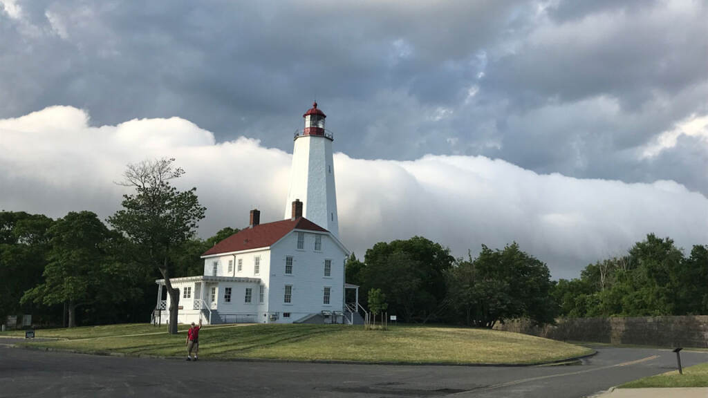
Many of Sandy Hook’s 9.5 million annual visitors come to see the park’s lighthouse, the oldest surviving lighthouse in the U.S., first lit in 1764. In a stroke of luck, thanks to the natural accumulation of sand on the northwestern lobe of the park, the shoreline in front of the lighthouse has grown substantially. But sea-level rise at the higher end of the scale could erase much of that precious gain.
Any other “cultural resources (at the park) with important infrastructure near the water table (such as basements and utility lines),” the study concluded, “are vulnerable to groundwater inundation with sea level rise.”
New Jersey’s groundwater resources are far more abundant, and in much better shape, than those in the West, of course, but in recent decades water has been drawn from some of the state’s aquifers faster than it can be replenished. Along the coast, in densely populated communities, that can translate into saltwater intruding drinking water.
Salt in freshwater aquifers
Last year in Cape May, for example, city officials called for an increase in the capacity of a local desalination plant, after finding that saltwater had begun leaching into some area aquifers.
“Saltwater intrusion will be exacerbated by both aquifer overpumping (reducing freshwater pressure from the land side) and sea-level advance (increasing saltwater pressure from the ocean side),” said Reinfelder. “Think of it as two pressure systems against each other, and the saltwater pressure is (going) to win since it is getting stronger while the freshwater pressure is getting weaker.”
The same type of imbalanced pressure dynamic, Reinfelder agreed, could unfold at Sandy Hook National Recreation Area.
“Homes near the shoreline, if they have shallow aquifers, do have the threat of becoming salty especially if they are in a development or if there are many homes pumping water,” New Jersey’s state geologist Jeff Hoffman told NJ Spotlight News last year. “If you have a very shallow well near the coast, and sea level were to rise three feet, that would be additional pressure.”
Putting up barriers and building up shorelines may be effective — at least temporarily — against sea-level rise but fighting the water advancing from below is a whole other challenge.
“There isn’t much we can do, for we have bought into centuries of sea-level rise,” Reinfelder said. “Flooding from below can only be alleviated by a sump pump, which is a losing battle in nature, of course. If sea-level rise is slow enough, natural ecosystems can adapt by migrating — this is our hope.”
Never miss a moment with the WHYY Listen App!
WHYY is your source for fact-based, in-depth journalism and information. As a nonprofit organization, we rely on financial support from readers like you. Please give today.

As sea levels rise, Philly and Camden are at risk of being inundated with raw sewage, study finds
With climate-related flood risk rising, cities are confronting outdated sewer systems that could result in sewage backing up into basements and streets.
2 years ago
Listen 1:18
New Jersey is warming at twice the rate of the rest of the continental U.S. A new report is aimed at helping local planners adapt.
4 years ago

Switch to electric buildings or miss climate goals, N.J. advocates say
The analysis calls on the state to step up efforts to transition buildings to electric power and to end heating homes with natural gas and other fossil fuels.
4 years ago