Northern Liberties to be remapped

Last week, City Councilman Mark Squilla introduced a bill that would update the zoning maps for the area bounded roughly by Spring Garden Street, Girard Avenue, Front Street, and Third Street, reflecting the transformation of Northern Liberties from a sparse residential community surrounded by industrial remains to one of the densest and least-vacant neighborhoods in the city.
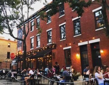
Second Street between Girard and Spring Garden has become a vibrant mixed-use commercial corridor, and the new zoning maps, which were developed as part of the Philadelphia2035 district planning process, reflect that. Zoning classifications for neighborhood commercial areas will line the strip.
A huge swath of land that hosts, among other things, a Superfresh grocery store and the Piazza at Schmidt’s is currently zoned for auto-oriented commercial use. The new maps designate the area CMX-3, a commercial mixed-use district with a broad range of permitted uses. Pockets of leftover industrial zoning will be slated for residential and commercial development.
It’s a modernization of the maps that the Planning Commission is working to complete in every neighborhood, the type of update that’s welcomed by both developers and civic groups. When the zoning maps are an accurate reflection of the type of development that’s most likely to occur in a given area, the construction process is streamlined.
“The new mapping will do what the zoning code was supposed to do, which is zone the neighborhood in keeping with contemporary uses, and in keeping with what we’d like to see happen where,” said Matt Ruben, president of the Northern Liberties Neighborhood Association.
Ruben pointed out that accurate zoning reduces the need for developers to go to the zoning board for exceptions, which in turn reduces the number of points at which community groups can weigh in on what’s being built.
At the same time, it also should decrease the ability for developers to exploit the aspects of inaccurate mapping that work for them. (You’re not allowed to build a house on an industrial parcel, for example, but if you get an exception, congratulations: you can build twice as tall.)
“If people are building residential, [NLNA] may have less input if they can get it by right,” Ruben said. “But at the same time, we’re not going to be getting people trying to build 50-foot high rowhouses because they’re in an industrial zone.”
The new maps, in combination with the recently updated zoning code, will put “well thought-out limits” on development in the neighborhood, which Ruben said has been welcoming to tall and dense development, and will cut down on abuse of the variance system.
At its core, the new plan is a recognition that the neighborhood’s industrial days are over.
“I’m all for Philadelphia industry,” Ruben said. “But the center of Northern Liberties is not where it’s happening now, and it hasn’t been for decades.”
So far, the City Planning Commission has completed five district plans, for the Lower Northeast, West Park, University/Southwest, and Lower South districts, as well as the Central district, which includes Northern Liberties. It is currently working on plans for the Central Northeast and Lower North districts. The remapping of Northern Liberties is one of Philadelphia2035’s first major plans to be introduced into City Council.
WHYY is your source for fact-based, in-depth journalism and information. As a nonprofit organization, we rely on financial support from readers like you. Please give today.


